
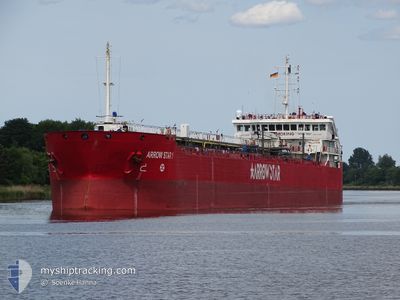
ARROW STAR 1
Oil Products Tanker
Current Trip
| Time Travelled | 1 day |
|---|---|
| Remaining Time | 14 h, 54 mins |
| Distance Travelled | 178.12 nm |
| Remaining Distance | 217.21 nm |
| AVG Speed | 8 Knots |
| MAX Speed | 13.8 Knots |
| AVG Wind | 9.9 knots |
| MAX Wind | 21.3 knots |
| MIN Temp | 12.9°C / 55.22°F |
| MAX Temp | 18.5°C / 65.3°F |
| Draught | 6.1 m |
| Position Received | 2 h, 3 m ago |
Current Position
| Longitude | 8.68101° |
|---|---|
| Latitude | 53.91646° |
| Status | Under way using engine |
| Speed | 13.5 Knots |
| Course | 333° |
| Area | North Sea |
| Station | T-AIS |
| Position Received | 2 h, 3 m ago |
Info
Information
The current position of ARROW STAR 1 is in North Sea with coordinates 53.91646° / 8.68101° as reported on 2024-05-23 18:33 by AIS to our vessel tracker app. The vessel's current speed is 13.5 Knots and is heading at the port of AMSTERDAM. The estimated time of arrival as calculated by vessel tracking app is 2024-05-24 11:31 LT
The vessel ARROW STAR 1 (IMO: 9435313, MMSI: 256791000) is a Oil Products Tanker that was built in 2007 ( 17 years old ). It's sailing under the flag of [MT] Malta.
In this page you can find informations about the vessels current position, last detected port calls, and current voyage information. If the vessels is not in coverage by AIS you will find the latest position.
The current position of ARROW STAR 1 is detected by our AIS receivers and we are not responsible for the reliability of the data. The last position was recorded while the vessel was in Coverage by the Ais receivers of our vessel tracking app.
The current draught of ARROW STAR 1 as reported by AIS is 6.1 meters
Weather
| Temperature | 14.3°C / 57.74°F |
|---|---|
| Wind Speed | 6 knots |
| Direction | 282° WNW |
| Pressure | 1016.5 hPa |
| Humidity | 86.7 % |
| Cloud Coverage | --- |
Featured Company
Last Port Calls
| Port | Arrival | Departure | Time In Port |
|---|---|---|---|
| 2024-05-21 10:36 | 2024-05-22 18:34 | 1 d | |
| 2024-05-16 00:57 | 2024-05-17 02:21 | 1 d | |
| 2024-05-11 23:26 | 2024-05-12 15:53 | 16 h | |
| 2024-05-11 04:49 | 2024-05-11 18:53 | 14 h | |
| 2024-05-09 22:13 | 2024-05-10 12:25 | 14 h | |
| 2024-05-07 09:29 | 2024-05-09 06:08 | 1 d | |
| 2024-05-07 00:36 | 2024-05-07 01:13 | 36 m | |
| 2024-05-05 11:33 | 2024-05-06 00:23 | 12 h | |
| 2024-05-04 04:32 | 2024-05-04 20:14 | 15 h | |
| 2024-04-29 11:20 | 2024-05-01 21:37 | 2 d |
Last Trips
| Origin | Departure | Destination | Arrival | Distance | |
|---|---|---|---|---|---|
| 2024-05-17 03:21 | 2024-05-21 12:36 | 801.32 nm | |||
| 2024-05-12 17:53 | 2024-05-16 01:57 | 808.81 nm | |||
| 2024-05-11 20:53 | 2024-05-12 01:26 | 45.27 nm | |||
| 2024-05-10 14:25 | 2024-05-11 06:49 | 156.21 nm | |||
| 2024-05-09 08:08 | 2024-05-10 00:13 | 131.93 nm | |||
| 2024-05-07 03:13 | 2024-05-07 11:29 | 50.36 nm | |||
| 2024-05-06 02:23 | 2024-05-07 02:36 | 133.01 nm | |||
| 2024-05-04 22:14 | 2024-05-05 13:33 | 147.89 nm | |||
| 2024-05-01 23:37 | 2024-05-04 06:32 | 482.94 nm | |||
| 2024-04-28 04:46 | 2024-04-29 13:20 | 290.89 nm |
Events
| Time | Event | Details | Position / Dest | Info |
|---|---|---|---|---|
| 2024-05-23 18:38 | Status Changed | Default Under way using engine |
53.93068 / 8.66758
DK KAL > NL AMS
|
Speed: 13.5 kn Course: 333° |
| 2024-05-23 18:33 | OUT of Coverage |
53.91646 / 8.68101
North Sea
DK KAL > NL AMS
|
Speed: 13.5 kn Course: 333° |
|
| 2024-05-23 18:06 | Status Changed | Under way using engine Default |
53.84271 / 8.79372
DK KAL > NL AMS
|
Speed: 13.8 kn Course: 272° |
| 2024-05-23 18:00 | Status Changed | Default Under way using engine |
53.84093 / 8.82742
DK KAL > NL AMS
|
Speed: 13.6 kn Course: 258.8° |
| 2024-05-23 17:02 | START Moving | 0.85 nm, South West of BRUNSBUETTEL |
53.89278 / 9.14352
DK KAL > NL AMS
|
Speed: 3.3 kn Course: 225° |
| 2024-05-23 17:01 | Detected in Sea | German part of the North Sea |
53.89340 / 9.14465
North Sea
DK KAL > NL AMS
|
Speed: 2.2 kn Course: 227.5° |
| 2024-05-23 16:31 | STOP Moving | 0.72 nm, South West of BRUNSBUETTEL |
53.89417 / 9.14612
DK KAL > NL AMS
|
Speed: 0.1 kn Course: 229° |
| 2024-05-23 15:05 | Status Changed | Under way using engine Default |
53.99106 / 9.28729
DK KAL > NL AMS
|
Speed: 6.5 kn Course: 188° |
| 2024-05-23 14:51 | IN Coverage |
53.99106 / 9.28729
Baltic Sea
DK KAL > NL AMS
|
Speed: 6.6 kn Course: 203.5° |
|
| 2024-05-23 12:50 | OUT of Coverage |
54.18286 / 9.48517
Baltic Sea
DK KAL > NL AMS
|
Speed: 6.7 kn Course: 249.9° |