
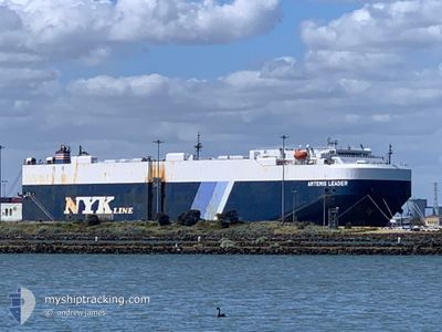
ARTEMIS LEADER
Vehicles Carrier
Current Trip
| Time Travelled | 14 h, 52 mins |
|---|---|
| Remaining Time | 4 days |
| Distance Travelled | 102.28 nm |
| Remaining Distance | 1750.89 nm |
| AVG Speed | 16.6 Knots |
| MAX Speed | 18.7 Knots |
| AVG Wind | 7.7 knots |
| MAX Wind | 10.4 knots |
| MIN Temp | 23.2°C / 73.76°F |
| MAX Temp | 24.7°C / 76.46°F |
| Draught | 8.4 m |
| Position Received | 10 h, 10 m ago |
Current Position
| Longitude | 122.16064° |
|---|---|
| Latitude | 25.13005° |
| Status | Under way using engine |
| Speed | 17.4 Knots |
| Course | 118.8° |
| Area | Eastern China Sea |
| Station | T-AIS |
| Position Received | 10 h, 10 m ago |
Info
Information
The current position of ARTEMIS LEADER is in Eastern China Sea with coordinates 25.13005° / 122.16064° as reported on 2024-05-23 10:26 by AIS to our vessel tracker app. The vessel's current speed is 17.4 Knots and is heading at the port of SINGAPORE. The estimated time of arrival as calculated by vessel tracking app is 2024-05-28 00:40 LT
The vessel ARTEMIS LEADER (IMO: 9355202, MMSI: 431534000) is a Vehicles Carrier that was built in 2008 ( 16 years old ). It's sailing under the flag of [JP] Japan.
In this page you can find informations about the vessels current position, last detected port calls, and current voyage information. If the vessels is not in coverage by AIS you will find the latest position.
The current position of ARTEMIS LEADER is detected by our AIS receivers and we are not responsible for the reliability of the data. The last position was recorded while the vessel was in Coverage by the Ais receivers of our vessel tracking app.
The current draught of ARTEMIS LEADER as reported by AIS is 8.4 meters
Weather
| Temperature | 27.7°C / 81.86°F |
|---|---|
| Wind Speed | 8 knots |
| Direction | 168° SSE |
| Pressure | 1009.5 hPa |
| Humidity | 86.6 % |
| Cloud Coverage | 100 % |
Featured Company
Last Port Calls
| Port | Arrival | Departure | Time In Port |
|---|---|---|---|
| 2024-05-21 22:25 | 2024-05-23 05:44 | 1 d | |
| 2024-05-16 21:56 | 2024-05-17 07:56 | 10 h | |
| 2024-05-13 20:51 | 2024-05-15 04:22 | 1 d | |
| 2024-05-10 21:48 | 2024-05-11 08:26 | 10 h | |
| 2024-05-09 21:07 | 2024-05-10 07:56 | 10 h | |
| 2024-05-06 19:56 | 2024-05-08 09:16 | 1 d | |
| 2024-04-24 19:35 | 2024-04-27 13:39 | 2 d | |
| 2024-04-13 21:37 | 2024-04-15 15:12 | 1 d | |
| 2024-04-05 03:34 | 2024-04-08 17:18 | 3 d | |
| 2024-03-29 08:24 | 2024-03-30 23:20 | 1 d |
Most Visited Ports (Last year)
| Port | Arrivals | |
|---|---|---|
| 7 | ||
| 7 | ||
| 5 | ||
| 5 | ||
| 4 | ||
| 3 |
Last Trips
| Origin | Departure | Destination | Arrival | Distance | |
|---|---|---|---|---|---|
| 2024-05-17 16:56 | 2024-05-22 06:25 | 1014.79 nm | |||
| 2024-05-15 13:22 | 2024-05-17 06:56 | 422.84 nm | |||
| 2024-05-11 17:26 | 2024-05-14 05:51 | 267.45 nm | |||
| 2024-05-10 16:56 | 2024-05-11 06:48 | 113.68 nm | |||
| 2024-05-08 18:16 | 2024-05-10 06:07 | 354.70 nm | |||
| 2024-04-27 20:39 | 2024-05-07 04:56 | 3043.77 nm | |||
| 2024-04-15 23:12 | 2024-04-25 02:35 | 1869.61 nm | |||
| 2024-04-09 03:18 | 2024-04-14 05:37 | 1702.14 nm | |||
| 2024-03-31 10:20 | 2024-04-05 14:34 | 763.39 nm | |||
| 2024-03-27 16:43 | 2024-03-29 19:24 | 582.58 nm |
Events
| Time | Event | Details | Position / Dest | Info |
|---|---|---|---|---|
| 2024-05-23 10:36 | Status Changed | Default Under way using engine |
25.10586 / 122.20804
TWTPE>SGSIN
|
Speed: 17.4 kn Course: 118.8° |
| 2024-05-23 10:26 | OUT of Coverage |
25.13005 / 122.16064
Eastern China Sea
TWTPE>SGSIN
|
Speed: 17.4 kn Course: 118.8° |
|
| 2024-05-23 08:09 | Status Changed | Under way using engine Default |
25.38667 / 121.49359
TWTPE>SGSIN
|
Speed: 18.4 kn Course: 79° |
| 2024-05-23 07:52 | Status Changed | Default Under way using engine |
25.35606 / 121.40543
TWTPE>SGSIN
|
Speed: 18.6 kn Course: 59.5° |
| 2024-05-23 07:45 | Status Changed | Under way using engine Default |
25.33814 / 121.37046
TWTPE>SGSIN
|
Speed: 18.6 kn Course: 58° |
| 2024-05-23 07:37 | Status Changed | Default Under way using engine |
25.31438 / 121.32867
TWTPE>SGSIN
|
Speed: 18.6 kn Course: 58.2° |
| 2024-05-23 07:33 | Change Sea Area | Taiwanese part of the Eastern China Sea Taiwanese part of the South China Sea |
25.30494 / 121.31193
Eastern China Sea
TWTPE>SGSIN
|
Speed: 18.6 kn Course: 58.2° |
| 2024-05-23 07:23 | ETA Changed | 2024/05/28 02:00 2024/05/27 17:00 |
25.27546 / 121.26082
TWTPE>SGSIN
|
Speed: 18 kn Course: 56.1° |
| 2024-05-23 07:12 | Status Changed | Under way using engine Default |
25.24565 / 121.21003
TWTPE>SGSIN
|
Speed: 18.3 kn Course: 57° |
| 2024-05-23 06:36 | Status Changed | Default Under way using engine |
25.20625 / 121.19479
TWTPE>SGSIN
|
Speed: 15 kn Course: 245.3° |