
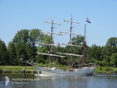
ARTEMIS
Passengers Ship
Current Trip
| Time Travelled | 2 days |
|---|---|
| Remaining Time | --- |
| Distance Travelled | 170.95 nm |
| Remaining Distance | --- |
| AVG Speed | 7.1 Knots |
| MAX Speed | 9.4 Knots |
| AVG Wind | 16.2 knots |
| MAX Wind | 21.9 knots |
| MIN Temp | 13°C / 55.4°F |
| MAX Temp | 16.1°C / 60.98°F |
| Draught | 3.4 m |
| Position Received | 1 m ago |
Current Position
| Longitude | 10.15140° |
|---|---|
| Latitude | 54.36892° |
| Status | Moored |
| Speed | |
| Course | --- |
| Area | Baltic Sea |
| Station | T-AIS |
| Position Received | 1 m ago |
Info
Information
The current position of ARTEMIS is in Baltic Sea with coordinates 54.36892° / 10.15140° as reported on 2024-06-16 11:19 by AIS to our vessel tracker app. The vessel's current speed is 0 Knots
The vessel ARTEMIS (IMO: 5209699, MMSI: 244875000) is a Passengers Ship that was built in 1926 ( 98 years old ). It's sailing under the flag of [NL] Netherlands.
In this page you can find informations about the vessels current position, last detected port calls, and current voyage information. If the vessels is not in coverage by AIS you will find the latest position.
The current position of ARTEMIS is detected by our AIS receivers and we are not responsible for the reliability of the data. The last position was recorded while the vessel was in Coverage by the Ais receivers of our vessel tracking app.
The current draught of ARTEMIS as reported by AIS is 3.4 meters
Weather
| Temperature | 17.6°C / 63.68°F |
|---|---|
| Wind Speed | 11 knots |
| Direction | 195° SSW |
| Pressure | 1007 hPa |
| Humidity | 75.7 % |
| Cloud Coverage | 55 % |
Featured Company
Last Port Calls
| Port | Arrival | Departure | Time In Port |
|---|---|---|---|
| 2024-06-13 09:53 | 2024-06-14 10:23 | 1 d | |
| 2024-06-12 00:44 | 2024-06-12 16:29 | 15 h | |
| 2024-06-09 12:18 | 2024-06-11 08:12 | 1 d | |
| 2024-06-08 06:03 | 2024-06-09 06:51 | 1 d | |
| 2024-06-06 00:02 | 2024-06-07 06:38 | 1 d | |
| 2024-06-04 06:16 | 2024-06-05 07:26 | 1 d | |
| 2024-05-31 16:05 | 2024-05-31 21:55 | 5 h | |
| 2024-05-31 09:01 | 2024-05-31 13:48 | 4 h | |
| 2024-05-27 21:11 | 2024-05-28 16:19 | 19 h | |
| 2024-05-26 13:19 | 2024-05-26 18:43 | 5 h |
Last Trips
| Origin | Departure | Destination | Arrival | Distance | |
|---|---|---|---|---|---|
| 2024-06-12 18:29 | 2024-06-13 11:53 | 93.28 nm | |||
| 2024-06-11 10:12 | 2024-06-12 02:44 | 97.43 nm | |||
| 2024-06-09 08:51 | 2024-06-09 14:18 | 39.90 nm | |||
| 2024-06-07 08:38 | 2024-06-08 08:03 | 127.01 nm | |||
| 2024-06-05 09:26 | 2024-06-06 02:02 | 104.57 nm | |||
| 2024-05-31 23:55 | 2024-06-04 08:16 | 152.82 nm | |||
| 2024-05-31 15:48 | 2024-05-31 18:05 | 9.31 nm | |||
| 2024-05-28 18:19 | 2024-05-31 11:01 | 236.50 nm | |||
| 2024-05-26 20:43 | 2024-05-27 23:11 | 171.72 nm | |||
| 2024-05-26 14:10 | 2024-05-26 15:19 | 3.53 nm |
Events
| Time | Event | Details | Position / Dest | Info |
|---|---|---|---|---|
| 2024-06-15 10:13 | Status Changed | Moored Under way using engine |
54.36890 / 10.15139
DEKEL
|
Speed: Course: 511° |
| 2024-06-15 10:05 | STOP Moving | 1.03 nm, South West of STICKENHΟRN SPORT |
54.36880 / 10.15135
DEKEL
|
Speed: 0.2 kn Course: 511° |
| 2024-06-15 08:40 | Status Changed | Under way using engine Under way sailing |
54.46215 / 10.38683
DEKEL
|
Speed: 6.5 kn Course: 252.3° |
| 2024-06-15 04:11 | Detected in Sea | German part of the Baltic Sea |
54.54182 / 11.36880
Baltic Sea
DEKEL
|
Speed: 7.6 kn Course: 281.4° |
| 2024-06-15 00:43 | ETA Changed | 2024/06/15 10:00 2024/06/15 14:00 |
54.49738 / 12.02823
DEKEL
|
Speed: 7.2 kn Course: 264.2° |
| 2024-06-14 23:41 | Change Sea Area | Danish part of the Baltic Sea German part of the Baltic Sea |
54.53285 / 12.24751
Baltic Sea
DEKEL
|
Speed: 7.6 kn Course: 255.3° |
| 2024-06-14 14:37 | Detected in Sea | German part of the Baltic Sea |
54.95952 / 13.99350
Baltic Sea
DEKEL
|
Speed: 7.3 kn Course: 246.4° |
| 2024-06-14 11:15 | Status Changed | Under way sailing Under way using engine |
55.13983 / 14.55614
DEKEL
|
Speed: 6.1 kn Course: 235.8° |
| 2024-06-14 10:23 | PORT DEPARTURE |
|
55.18847 / 14.69499
DEKEL
|
Speed: 4 kn Course: 234.4° |
| 2024-06-14 10:19 | START Moving |
55.18838 / 14.70023
[DK] HASLE
|
Speed: 3.2 kn Course: 309.7° |