
AS ANITA
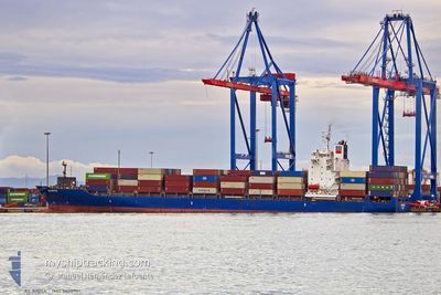
Container Ship
Current Trip
| Time Travelled | 1 day |
|---|---|
| Remaining Time | 19 h, 13 mins |
| Distance Travelled | 358.39 nm |
| Remaining Distance | 225.13 nm |
| AVG Speed | 11.8 Knots |
| MAX Speed | 14.1 Knots |
| AVG Wind | 15.8 knots |
| MAX Wind | 23 knots |
| MIN Temp | 19.6°C / 67.28°F |
| MAX Temp | 25.6°C / 78.08°F |
| Draught | 10.9 m |
| Position Received | 1 m ago |
Current Position
| Longitude | -4.65055° |
|---|---|
| Latitude | 36.10206° |
| Status | Under way using engine |
| Speed | 11.6 Knots |
| Course | 259.2° |
| Area | Alboran Sea |
| Station | T-AIS |
| Position Received | 1 m ago |
Info
Information
The current position of AS ANITA is in Alboran Sea with coordinates 36.10206° / -4.65055° as reported on 2024-06-10 15:38 by AIS to our vessel tracker app. The vessel's current speed is 11.6 Knots and is heading at the port of CASABLANCA. The estimated time of arrival as calculated by vessel tracking app is 2024-06-11 10:52 LT
The vessel AS ANITA (IMO: 9470961, MMSI: 636093268) is a Container Ship that was built in 2010 ( 14 years old ). It's sailing under the flag of [LR] Liberia.
In this page you can find informations about the vessels current position, last detected port calls, and current voyage information. If the vessels is not in coverage by AIS you will find the latest position.
The current position of AS ANITA is detected by our AIS receivers and we are not responsible for the reliability of the data. The last position was recorded while the vessel was in Coverage by the Ais receivers of our vessel tracking app.
The current draught of AS ANITA as reported by AIS is 10.9 meters
Weather
| Temperature | 20.2°C / 68.36°F |
|---|---|
| Wind Speed | 22 knots |
| Direction | 273° W |
| Pressure | 1011.6 hPa |
| Humidity | 81 % |
| Cloud Coverage | --- |
Featured Company
Last Port Calls
| Port | Arrival | Departure | Time In Port |
|---|---|---|---|
| 2024-06-08 09:24 | 2024-06-09 08:48 | 23 h | |
| 2024-06-02 18:35 | 2024-06-03 12:11 | 17 h | |
| 2024-06-01 13:12 | 2024-06-02 01:47 | 12 h | |
| 2024-05-31 00:31 | 2024-05-31 12:48 | 12 h | |
| 2024-05-30 00:39 | 2024-05-30 14:31 | 13 h | |
| 2024-05-28 19:49 | 2024-05-29 07:38 | 11 h | |
| 2024-05-26 12:53 | 2024-05-27 10:59 | 22 h | |
| 2024-05-26 12:41 | |||
| 2024-05-21 17:56 | 2024-05-22 03:56 | 10 h | |
| 2024-05-14 21:00 | 2024-05-16 05:04 | 1 d |
Last Trips
| Origin | Departure | Destination | Arrival | Distance | |
|---|---|---|---|---|---|
| 2024-06-03 15:11 | 2024-06-08 11:24 | 1261.29 nm | |||
| 2024-06-02 04:47 | 2024-06-02 21:35 | 193.47 nm | |||
| 2024-05-31 15:48 | 2024-06-01 16:12 | 306.88 nm | |||
| 2024-05-30 17:31 | 2024-05-31 03:31 | 65.51 nm | |||
| 2024-05-29 10:38 | 2024-05-30 03:39 | 48.95 nm | |||
| 2024-05-27 13:59 | 2024-05-28 22:49 | 370.67 nm | |||
| 2024-05-22 05:56 | 2024-05-26 15:53 | 1518.30 nm | |||
| 2024-05-22 05:56 | 2024-05-26 15:41 | 1518.19 nm | |||
| 2024-05-16 06:04 | 2024-05-21 19:56 | 521.27 nm | |||
| 2024-05-12 09:38 | 2024-05-14 22:00 | 609.20 nm |
Events
| Time | Event | Details | Position / Dest | Info |
|---|---|---|---|---|
| 2024-06-10 10:45 | IN Coverage |
36.24012 / -3.52373
Alboran Sea
MACAS
|
Speed: 11.7 kn Course: 259.6° |
|
| 2024-06-10 09:25 | OUT of Coverage |
36.28542 / -3.20154
Alboran Sea
MACAS
|
Speed: 11.7 kn Course: 258.7° |
|
| 2024-06-10 09:25 | Detected in Sea | Spanish part of the Alboran Sea |
36.28542 / -3.20154
Alboran Sea
MACAS
|
Speed: 11.7 kn Course: 258.7° |
| 2024-06-10 09:25 | IN Coverage |
36.28542 / -3.20154
Alboran Sea
MACAS
|
Speed: 11.7 kn Course: 258.7° |
|
| 2024-06-10 01:17 | OUT of Coverage |
36.95113 / -1.45843
Mediterranean Sea - Western Basin
MACAS
|
Speed: 11.3 kn Course: 228.2° |
|
| 2024-06-10 00:43 | IN Coverage |
37.02115 / -1.36104
Mediterranean Sea - Western Basin
MACAS
|
Speed: 11.3 kn Course: 227.9° |
|
| 2024-06-09 23:09 | OUT of Coverage |
37.21751 / -1.07851
Mediterranean Sea - Western Basin
MACAS
|
Speed: 11.8 kn Course: 229.3° |
|
| 2024-06-09 20:54 | Draught Changed | 10.9 10 |
37.51064 / -.65917
MACAS
|
Speed: 11.9 kn Course: 228° |
| 2024-06-09 20:54 | ETA Changed | 2024/06/11 11:00 |
37.51064 / -.65917
MACAS
|
Speed: 11.9 kn Course: 228° |
| 2024-06-09 18:48 | Draught Changed | 10 10.9 |
37.83570 / -.35213
MACAS
|
Speed: 10.9 kn Course: 208° |