
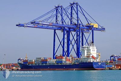
AS FATIMA
Container Ship
Current Trip
| Time Travelled | 14 h, 17 mins |
|---|---|
| Remaining Time | 3 days |
| Distance Travelled | 226.14 nm |
| Remaining Distance | 974.43 nm |
| AVG Speed | 16.1 Knots |
| MAX Speed | 20.2 Knots |
| AVG Wind | 6.8 knots |
| MAX Wind | 14 knots |
| MIN Temp | 18.1°C / 64.58°F |
| MAX Temp | 24.1°C / 75.38°F |
| Draught | 7.6 m |
| Position Received | 1 h, 34 m ago |
Current Position
| Longitude | 16.21266° |
|---|---|
| Latitude | 37.64584° |
| Status | Under way using engine |
| Speed | 12.8 Knots |
| Course | 113.9° |
| Area | Ionian Sea |
| Station | T-AIS |
| Position Received | 1 h, 34 m ago |
Info
Information
The current position of AS FATIMA is in Ionian Sea with coordinates 37.64584° / 16.21266° as reported on 2024-05-18 23:34 by AIS to our vessel tracker app. The vessel's current speed is 12.8 Knots and is heading at the port of ASHDOD. The estimated time of arrival as calculated by vessel tracking app is 2024-05-22 06:57 LT
The vessel AS FATIMA (IMO: 9437191, MMSI: 255806067) is a Container Ship that was built in 2008 ( 16 years old ). It's sailing under the flag of [PT] Portugal.
In this page you can find informations about the vessels current position, last detected port calls, and current voyage information. If the vessels is not in coverage by AIS you will find the latest position.
The current position of AS FATIMA is detected by our AIS receivers and we are not responsible for the reliability of the data. The last position was recorded while the vessel was in Coverage by the Ais receivers of our vessel tracking app.
The current draught of AS FATIMA as reported by AIS is 7.6 meters
Weather
| Temperature | 20.2°C / 68.36°F |
|---|---|
| Wind Speed | 9 knots |
| Direction | 51° NE |
| Pressure | 1011.7 hPa |
| Humidity | 90.1 % |
| Cloud Coverage | 11 % |
Featured Company
Last Port Calls
| Port | Arrival | Departure | Time In Port |
|---|---|---|---|
| 2024-05-18 04:25 | 2024-05-18 10:52 | 6 h | |
| 2024-05-16 12:08 | 2024-05-16 23:08 | 10 h | |
| 2024-05-15 02:28 | 2024-05-15 14:40 | 12 h | |
| 2024-05-08 18:03 | 2024-05-09 03:38 | 9 h | |
| 2024-05-05 04:41 | 2024-05-05 10:58 | 6 h | |
| 2024-05-03 09:24 | 2024-05-03 20:57 | 11 h | |
| 2024-05-01 06:28 | 2024-05-02 16:44 | 1 d | |
| 2024-04-24 12:33 | 2024-04-25 18:50 | 1 d | |
| 2024-04-20 14:05 | 2024-04-21 13:27 | 23 h | |
| 2024-04-17 13:59 | 2024-04-17 23:42 | 9 h |
Last Trips
| Origin | Departure | Destination | Arrival | Distance | |
|---|---|---|---|---|---|
| 2024-05-17 01:08 | 2024-05-18 06:25 | 378.66 nm | |||
| 2024-05-15 16:40 | 2024-05-16 14:08 | 233.88 nm | |||
| 2024-05-09 06:38 | 2024-05-15 04:28 | 1882.90 nm | |||
| 2024-05-05 12:58 | 2024-05-08 21:03 | 1191.28 nm | |||
| 2024-05-03 22:57 | 2024-05-05 06:41 | 378.14 nm | |||
| 2024-05-02 18:44 | 2024-05-03 11:24 | 228.56 nm | |||
| 2024-04-25 21:50 | 2024-05-01 08:28 | 1867.43 nm | |||
| 2024-04-21 16:27 | 2024-04-24 15:33 | 687.22 nm | |||
| 2024-04-18 02:42 | 2024-04-20 17:05 | 717.05 nm | |||
| 2024-04-16 12:55 | 2024-04-17 16:59 | 403.30 nm |
Events
| Time | Event | Details | Position / Dest | Info |
|---|---|---|---|---|
| 2024-05-18 23:37 | Status Changed | Default Under way using engine |
37.64167 / 16.22500
ILASH
|
Speed: 12.8 kn Course: 113.9° |
| 2024-05-18 23:34 | OUT of Coverage |
37.64584 / 16.21266
Ionian Sea
ILASH
|
Speed: 12.8 kn Course: 113.9° |
|
| 2024-05-18 23:19 | Status Changed | Under way using engine Default |
37.66871 / 16.14938
ILASH
|
Speed: 12.3 kn Course: 115° |
| 2024-05-18 22:58 | Status Changed | Default Under way using engine |
37.69833 / 16.06833
ILASH
|
Speed: 12.1 kn Course: 116.2° |
| 2024-05-18 19:19 | Change Sea Area | Italian part of the Ionian Sea Italian part of the Tyrrhenian Sea |
38.25394 / 15.63893
Ionian Sea
ILASH
|
Speed: 19.2 kn Course: 246.6° |
| 2024-05-18 15:08 | Draught Changed | 7.6 7.2 |
39.40803 / 15.13290
ILASH
|
Speed: 18.6 kn Course: 160.1° |
| 2024-05-18 15:08 | Destination Changed | ILASH ITSAL |
39.40803 / 15.13290
ILASH
|
Speed: 18.6 kn Course: 160.1° |
| 2024-05-18 15:08 | ETA Changed | 2024/05/22 07:00 2024/05/18 03:00 |
39.40803 / 15.13290
ILASH
|
Speed: 18.6 kn Course: 160.1° |
| 2024-05-18 14:47 | Status Changed | Under way using engine Default |
39.51024 / 15.08426
ITSAL
|
Speed: 19 kn Course: 159° |
| 2024-05-18 14:42 | Status Changed | Default Under way using engine |
39.53333 / 15.07333
ITSAL
|
Speed: 18.7 kn Course: 160° |