
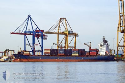
AS PAOLA
Container Ship
Current Trip
| Time Travelled | 4 days |
|---|---|
| Remaining Time | --- |
| Distance Travelled | 1106.02 nm |
| Remaining Distance | --- |
| AVG Speed | 11.9 Knots |
| MAX Speed | 17 Knots |
| AVG Wind | 8.5 knots |
| MAX Wind | 13 knots |
| MIN Temp | 24.4°C / 75.92°F |
| MAX Temp | 28.5°C / 83.3°F |
| Draught | 9.3 m |
| Position Received | 1 h, 35 m ago |
Current Position
| Longitude | -77.81441° |
|---|---|
| Latitude | 25.92847° |
| Status | Under way using engine |
| Speed | 11.4 Knots |
| Course | 106.5° |
| Area | North Atlantic Ocean |
| Station | T-AIS |
| Position Received | 1 h, 35 m ago |
Info
Information
The current position of AS PAOLA is in North Atlantic Ocean with coordinates 25.92847° / -77.81441° as reported on 2024-05-23 11:26 by AIS to our vessel tracker app. The vessel's current speed is 11.4 Knots and is heading at the port of VALENCIA. The estimated time of arrival as calculated by vessel tracking app is 2024-06-09 04:30 LT
The vessel AS PAOLA (IMO: 9312418, MMSI: 636092860) is a Container Ship that was built in 2005 ( 19 years old ). It's sailing under the flag of [LR] Liberia.
In this page you can find informations about the vessels current position, last detected port calls, and current voyage information. If the vessels is not in coverage by AIS you will find the latest position.
The current position of AS PAOLA is detected by our AIS receivers and we are not responsible for the reliability of the data. The last position was recorded while the vessel was in Coverage by the Ais receivers of our vessel tracking app.
The current draught of AS PAOLA as reported by AIS is 9.3 meters
Weather
| Temperature | --- |
|---|---|
| Wind Speed | --- |
| Direction | --- |
| Pressure | --- |
| Humidity | --- |
| Cloud Coverage | --- |
Featured Company
Last Port Calls
| Port | Arrival | Departure | Time In Port |
|---|---|---|---|
| 2024-05-18 08:19 | 2024-05-19 09:45 | 1 d | |
| 2024-05-16 14:21 | 2024-05-17 02:31 | 12 h | |
| 2024-05-14 19:32 | 2024-05-15 22:41 | 1 d | |
| 2024-05-11 14:30 | 2024-05-11 22:22 | 7 h | |
| 2024-04-30 00:09 | 2024-04-30 19:12 | 19 h | |
| 2024-04-28 01:25 | 2024-04-28 18:17 | 16 h | |
| 2024-04-25 03:23 | 2024-04-26 04:12 | 1 d | |
| 2024-04-24 04:46 | 2024-04-24 18:00 | 13 h | |
| 2024-04-19 09:51 | 2024-04-20 08:22 | 22 h | |
| 2024-03-27 01:23 | 2024-03-28 11:36 | 1 d |
Last Trips
| Origin | Departure | Destination | Arrival | Distance | |
|---|---|---|---|---|---|
| 2024-05-16 21:31 | 2024-05-18 03:19 | 497.28 nm | |||
| 2024-05-15 17:41 | 2024-05-16 09:21 | 240.86 nm | |||
| 2024-05-11 18:22 | 2024-05-14 14:32 | 1064.15 nm | |||
| 2024-04-30 21:12 | 2024-05-11 10:30 | 4281.24 nm | |||
| 2024-04-28 20:17 | 2024-04-30 02:09 | 188.43 nm | |||
| 2024-04-26 06:12 | 2024-04-28 03:25 | 387.85 nm | |||
| 2024-04-24 20:00 | 2024-04-25 05:23 | 83.99 nm | |||
| 2024-04-20 10:22 | 2024-04-24 06:46 | 564.91 nm | |||
| 2024-03-28 06:36 | 2024-04-19 11:51 | 5412.93 nm | |||
| 2024-03-22 16:24 | 2024-03-26 20:23 | 503.62 nm |
Events
| Time | Event | Details | Position / Dest | Info |
|---|---|---|---|---|
| 2024-05-23 11:32 | Status Changed | Default Under way using engine |
25.92297 / -77.79269
ESVLC
|
Speed: 11.4 kn Course: 106.5° |
| 2024-05-23 11:26 | OUT of Coverage |
25.92847 / -77.81441
North Atlantic Ocean
ESVLC
|
Speed: 11.4 kn Course: 106.5° |
|
| 2024-05-23 08:56 | Detected in Sea | Bahamas part of the North Atlantic Ocean |
26.05013 / -78.32274
North Atlantic Ocean
ESVLC
|
Speed: 11.4 kn Course: 104.6° |
| 2024-05-23 08:56 | Status Changed | Under way using engine Default |
26.05013 / -78.32274
ESVLC
|
Speed: 11.2 kn Course: 106° |
| 2024-05-23 08:37 | IN Coverage |
26.05013 / -78.32274
North Atlantic Ocean
ESVLC
|
Speed: 11.4 kn Course: 104.6° |
|
| 2024-05-20 01:50 | Status Changed | Default Under way using engine |
27.74403 / -92.32205
ESVLC
|
Speed: 10 kn Course: 117.2° |
| 2024-05-20 01:45 | OUT of Coverage |
27.75058 / -92.33610
Gulf of Mexico
ESVLC
|
Speed: 10 kn Course: 117.2° |
|
| 2024-05-20 01:23 | Status Changed | Under way using engine Default |
27.77980 / -92.39886
ESVLC
|
Speed: 10.3 kn Course: 117° |
| 2024-05-20 01:10 | Status Changed | Default Under way using engine |
27.79718 / -92.43584
ESVLC
|
Speed: 10.5 kn Course: 118.4° |
| 2024-05-20 00:39 | Status Changed | Under way using engine Default |
27.83949 / -92.52458
ESVLC
|
Speed: 10.5 kn Course: 118° |