
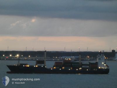
AS SELINA
Container Ship
Current Trip
| Time Travelled | 14 days |
|---|---|
| Remaining Time | --- |
| Distance Travelled | 2783.29 nm |
| Remaining Distance | --- |
| AVG Speed | 11.7 Knots |
| MAX Speed | 17.8 Knots |
| AVG Wind | 13.7 knots |
| MAX Wind | 28.8 knots |
| MIN Temp | 14.8°C / 58.64°F |
| MAX Temp | 22.7°C / 72.86°F |
| Draught | 11.2 m |
| Position Received | 3 d ago |
Current Position
| Longitude | -16.76894° |
|---|---|
| Latitude | 18.94278° |
| Status | Under way using engine |
| Speed | 15 Knots |
| Course | 143.7° |
| Area | North Atlantic Ocean |
| Station | T-AIS |
| Position Received | 3 d ago |
Info
Information
The current position of AS SELINA is in North Atlantic Ocean with coordinates 18.94278° / -16.76894° as reported on 2024-06-23 06:23 by AIS to our vessel tracker app. The vessel's current speed is 15 Knots
The vessel AS SELINA (IMO: 9516789, MMSI: 255709000) is a Container Ship that was built in 2012 ( 12 years old ). It's sailing under the flag of [PT] Portugal.
In this page you can find informations about the vessels current position, last detected port calls, and current voyage information. If the vessels is not in coverage by AIS you will find the latest position.
The current position of AS SELINA is detected by our AIS receivers and we are not responsible for the reliability of the data. The last position was recorded while the vessel was in Coverage by the Ais receivers of our vessel tracking app.
The current draught of AS SELINA as reported by AIS is 11.2 meters
Weather
| Temperature | 22.1°C / 71.78°F |
|---|---|
| Wind Speed | 14 knots |
| Direction | 319° NW |
| Pressure | 1011.8 hPa |
| Humidity | 85.8 % |
| Cloud Coverage | 6 % |
Featured Company
Last Port Calls
| Port | Arrival | Departure | Time In Port |
|---|---|---|---|
| 2024-06-11 10:50 | 2024-06-11 21:41 | 10 h | |
| 2024-06-09 13:48 | |||
| 2024-05-30 10:02 | 2024-05-31 10:25 | 1 d | |
| 2024-05-12 10:54 | 2024-05-13 17:50 | 1 d | |
| 2024-05-04 12:42 | 2024-05-07 11:54 | 2 d | |
| 2024-05-02 13:42 | 2024-05-03 15:34 | 1 d | |
| 2024-04-15 14:28 | 2024-04-16 18:05 | 1 d | |
| 2024-04-09 14:47 | 2024-04-12 14:20 | 2 d | |
| 2024-04-06 18:20 | 2024-04-08 07:55 | 1 d |
Most Visited Ports (Last year)
| Port | Arrivals | |
|---|---|---|
| 20 | ||
| 10 | ||
| 8 | ||
| 3 | ||
| 2 | ||
| 1 |
Last Trips
| Origin | Departure | Destination | Arrival | Distance | |
|---|---|---|---|---|---|
| 2024-06-09 13:48 | 2024-06-11 10:50 | 206.07 nm | |||
| 2024-05-13 17:50 | 2024-05-30 10:02 | 2881.78 nm | |||
| 2024-05-07 11:54 | 2024-05-12 10:54 | 215.17 nm | |||
| 2024-05-03 15:34 | 2024-05-04 12:42 | 208.08 nm | |||
| 2024-04-16 18:05 | 2024-05-02 13:42 | 2995.34 nm | |||
| 2024-04-12 14:20 | 2024-04-15 14:28 | 221.69 nm | |||
| 2024-04-08 07:55 | 2024-04-09 14:47 | 206.29 nm | |||
| 2024-03-24 13:55 | 2024-04-06 18:20 | 3033.83 nm |
Events
| Time | Event | Details | Position / Dest | Info |
|---|---|---|---|---|
| 2024-06-23 11:40 | STOP Moving | 6.27 nm, West of NOUAKCHOTT |
18.01349 / -16.13651
MAPTM>MRNKC
|
Speed: Course: 338° |
| 2024-06-23 06:25 | Status Changed | Default Under way using engine |
18.93533 / -16.76317
MAPTM>MRNKC
|
Speed: 15 kn Course: 143.7° |
| 2024-06-23 06:23 | OUT of Coverage |
18.94278 / -16.76894
North Atlantic Ocean
MAPTM>MRNKC
|
Speed: 15 kn Course: 143.7° |
|
| 2024-06-23 06:15 | Status Changed | Under way using engine Default |
18.97058 / -16.79029
MAPTM>MRNKC
|
Speed: 14.7 kn Course: 141° |
| 2024-06-23 06:15 | IN Coverage |
18.96656 / -16.78720
North Atlantic Ocean
MAPTM>MRNKC
|
Speed: 15 kn Course: 145.1° |
|
| 2024-06-23 02:58 | Status Changed | Default Under way using engine |
19.68537 / -17.21817
MAPTM>MRNKC
|
Speed: 14.9 kn Course: 150.9° |
| 2024-06-23 02:53 | Change Sea Area | Mauritanian part of the North Atlantic Ocean Moroccan part of the North Atlantic Ocean |
19.70412 / -17.22995
North Atlantic Ocean
MAPTM>MRNKC
|
Speed: 14.9 kn Course: 150.9° |
| 2024-06-23 02:53 | OUT of Coverage |
19.70412 / -17.22995
North Atlantic Ocean
MAPTM>MRNKC
|
Speed: 14.9 kn Course: 150.9° |
|
| 2024-06-23 02:52 | Status Changed | Under way using engine Default |
19.70734 / -17.23199
MAPTM>MRNKC
|
Speed: 14.7 kn Course: 150° |
| 2024-06-23 02:50 | IN Coverage |
19.70412 / -17.22995
North Atlantic Ocean
MAPTM>MRNKC
|
Speed: 14.9 kn Course: 150.9° |