
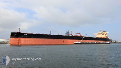
ASCONA
Tanker
Current Trip
| Time Travelled | 22 days |
|---|---|
| Remaining Time | --- |
| Distance Travelled | 6370.05 nm |
| Remaining Distance | --- |
| AVG Speed | 12.5 Knots |
| MAX Speed | 16 Knots |
| AVG Wind | 10.5 knots |
| MAX Wind | 24.8 knots |
| MIN Temp | 20.1°C / 68.18°F |
| MAX Temp | 33.2°C / 91.76°F |
| Draught | 20.7 m |
| Position Received | 9 d ago |
Current Position
| Longitude | 104.42311° |
|---|---|
| Latitude | 1.36705° |
| Status | Constrained by her draught |
| Speed | 11.8 Knots |
| Course | 48.8° |
| Area | South China Sea |
| Station | T-AIS |
| Position Received | 9 d ago |
Info
Information
The current position of ASCONA is in South China Sea with coordinates 1.36705° / 104.42311° as reported on 2024-06-01 23:51 by AIS to our vessel tracker app. The vessel's current speed is 11.8 Knots and is heading at the port of YEOSU. The estimated time of arrival as calculated by vessel tracking app is 2024-06-09 21:00 LT
The vessel ASCONA (IMO: 9828338, MMSI: 241622000) is a Tanker It's sailing under the flag of [GR] Greece.
In this page you can find informations about the vessels current position, last detected port calls, and current voyage information. If the vessels is not in coverage by AIS you will find the latest position.
The current position of ASCONA is detected by our AIS receivers and we are not responsible for the reliability of the data. The last position was recorded while the vessel was in Coverage by the Ais receivers of our vessel tracking app.
The current draught of ASCONA as reported by AIS is 20.7 meters
Weather
| Temperature | 20.3°C / 68.54°F |
|---|---|
| Wind Speed | 6 knots |
| Direction | 223° SW |
| Pressure | 1007 hPa |
| Humidity | 81.2 % |
| Cloud Coverage | 100 % |
Featured Company
Last Port Calls
| Port | Arrival | Departure | Time In Port |
|---|---|---|---|
| 2024-05-18 14:57 | 2024-05-20 09:06 | 1 d | |
| 2024-04-25 11:31 | 2024-04-27 06:00 | 1 d |
Most Visited Ports (Last year)
| Port | Arrivals | |
|---|---|---|
| 1 | ||
| 1 | ||
| 1 | ||
| 1 | ||
| 1 |
Last Trips
| Origin | Departure | Destination | Arrival | Distance | |
|---|---|---|---|---|---|
| 2024-04-27 12:00 | 2024-05-18 17:57 | 5340.63 nm | |||
| 2024-03-07 15:37 | 2024-04-25 17:31 | 12205.19 nm |
Events
| Time | Event | Details | Position / Dest | Info |
|---|---|---|---|---|
| 2024-06-10 01:45 | STOP Moving | 4.84 nm, South East of GWANGYANG |
34.85578 / 127.77900
KRYOS
|
Speed: Course: 336° |
| 2024-06-01 23:54 | Status Changed | Default Constrained by her draught |
1.37422 / 104.43148
KRYOS
|
Speed: 11.8 kn Course: 48.8° |
| 2024-06-01 23:51 | OUT of Coverage |
1.36705 / 104.42311
South China Sea
KRYOS
|
Speed: 11.8 kn Course: 48.8° |
|
| 2024-06-01 23:32 | Status Changed | Constrained by her draught Default |
1.32693 / 104.37677
KRYOS
|
Speed: 11.8 kn Course: 49° |
| 2024-06-01 23:30 | Status Changed | Default Constrained by her draught |
1.32190 / 104.37101
KRYOS
|
Speed: 11.6 kn Course: 48.7° |
| 2024-06-01 23:27 | Change Sea Area | Malaysian part of the South China Sea Malaysian part of the Singapore Strait |
1.31459 / 104.36278
South China Sea
KRYOS
|
Speed: 11.6 kn Course: 48.7° |
| 2024-06-01 23:08 | Status Changed | Constrained by her draught Default |
1.28246 / 104.31317
KRYOS
|
Speed: 11.9 kn Course: 81° |
| 2024-06-01 23:06 | Status Changed | Default Constrained by her draught |
1.28110 / 104.30492
KRYOS
|
Speed: 11.8 kn Course: 81.4° |
| 2024-06-01 22:17 | Change Sea Area | Malaysian part of the Singapore Strait Indonesian part of the Singapore Strait |
1.25943 / 104.14880
Singapore Strait
KRYOS
|
Speed: 11.4 kn Course: 83.1° |
| 2024-06-01 20:44 | Change Sea Area | Indonesian part of the Singapore Strait Singaporean part of the Singapore Strait |
1.19614 / 103.86071
Singapore Strait
KRYOS
|
Speed: 11 kn Course: 66.8° |