
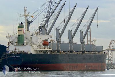
ASIAN PEARL
Bulk Carrier
Current Trip
| Trip Time | 9 days |
|---|---|
| Trip Distance | 1559.46 nm |
| AVG Speed | 12 Knots |
| MAX Speed | 16.3 Knots |
| Draught | 7 m |
| AVG Wind | 13.6 knots |
| MAX Wind | 26.8 knots |
| MIN Temp | 14°C / 57.2°F |
| MAX Temp | 33.7°C / 92.66°F |
| Position Received | 8 d ago |
Current Position
| Longitude | 17.72727° |
|---|---|
| Latitude | -33.89285° |
| Status | Under way using engine |
| Speed | 10.4 Knots |
| Course | 333° |
| Area | South Atlantic Ocean |
| Station | T-AIS |
| Position Received | 8 d ago |
Info
Information
The current position of ASIAN PEARL is in South Atlantic Ocean with coordinates -33.89285° / 17.72727° as reported on 2024-05-10 03:07 by AIS to our vessel tracker app. The vessel's current speed is 10.4 Knots and is currently inside the port of WALVIS BAY.
The vessel ASIAN PEARL (IMO: 9266176, MMSI: 351888000) is a Bulk Carrier that was built in 2003 ( 21 years old ). It's sailing under the flag of [PA] Panama.
In this page you can find informations about the vessels current position, last detected port calls, and current voyage information. If the vessels is not in coverage by AIS you will find the latest position.
The current position of ASIAN PEARL is detected by our AIS receivers and we are not responsible for the reliability of the data. The last position was recorded while the vessel was in Coverage by the Ais receivers of our vessel tracking app.
The current draught of ASIAN PEARL as reported by AIS is 7 meters
Weather
| Temperature | 30.8°C / 87.44°F |
|---|---|
| Wind Speed | 7 knots |
| Direction | 308° NW |
| Pressure | 1014.1 hPa |
| Humidity | 17.6 % |
| Cloud Coverage | --- |
Featured Company
Last Port Calls
| Port | Arrival | Departure | Time In Port |
|---|---|---|---|
| 2024-05-16 10:31 | |||
| 2024-04-21 07:47 | 2024-05-07 06:39 | 15 d | |
| 2024-03-23 16:59 |
Most Visited Ports (Last year)
| Port | Arrivals | |
|---|---|---|
| 2 | ||
| 2 | ||
| 1 | ||
| 1 | ||
| 1 | ||
| 1 |
Last Trips
| Origin | Departure | Destination | Arrival | Distance | |
|---|---|---|---|---|---|
| 2024-05-07 08:39 | 2024-05-16 12:31 | 1559.46 nm | |||
| 2024-03-24 00:59 | 2024-04-21 09:47 | 7762.07 nm |
Events
| Time | Event | Details | Position / Dest | Info |
|---|---|---|---|---|
| 2024-05-16 10:49 | STOP Moving |
-22.94962 / 14.49775
[NA] WALVIS BAY
|
Speed: 0.2 kn Course: 229° |
|
| 2024-05-16 10:31 | PORT ARRIVAL |
|
-22.93655 / 14.49708
[NA] WALVIS BAY
|
Speed: 5.8 kn Course: 182° |
| 2024-05-16 09:19 | START Moving | 6.2 nm, North of WALVIS BAY |
-22.83607 / 14.50442
WALVIS BAY
|
Speed: 4.1 kn Course: 251° |
| 2024-05-12 12:38 | STOP Moving | 6.47 nm, North of WALVIS BAY |
-22.83193 / 14.51277
WALVIS BAY
|
Speed: 0.3 kn Course: 240° |
| 2024-05-10 03:18 | Status Changed | Default Under way using engine |
-33.86462 / 17.70967
WALVIS BAY
|
Speed: 10.4 kn Course: 333° |
| 2024-05-10 03:07 | OUT of Coverage |
-33.89285 / 17.72727
South Atlantic Ocean
WALVIS BAY
|
Speed: 10.4 kn Course: 333° |
|
| 2024-05-10 02:45 | Status Changed | Under way using engine Default |
-33.94800 / 17.76252
WALVIS BAY
|
Speed: 10.4 kn Course: 332° |
| 2024-05-10 02:34 | IN Coverage |
-33.94587 / 17.76112
South Atlantic Ocean
WALVIS BAY
|
Speed: 10.3 kn Course: 328° |
|
| 2024-05-10 01:31 | Status Changed | Default Under way using engine |
-34.14407 / 17.88142
WALVIS BAY
|
Speed: 11 kn Course: 337° |
| 2024-05-10 01:27 | OUT of Coverage |
-34.15633 / 17.88875
South Atlantic Ocean
WALVIS BAY
|
Speed: 11 kn Course: 337° |