
ASIS V
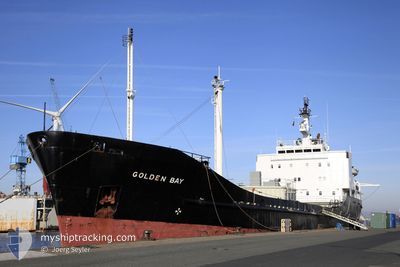
Cement Carrier
Current Trip
| Time Travelled | 5 days |
|---|---|
| Remaining Time | --- |
| Distance Travelled | 1287.53 nm |
| Remaining Distance | --- |
| AVG Speed | 9.8 Knots |
| MAX Speed | 11.6 Knots |
| AVG Wind | 10.8 knots |
| MAX Wind | 24 knots |
| MIN Temp | 25.7°C / 78.26°F |
| MAX Temp | 29.5°C / 85.1°F |
| Draught | 4.3 m |
| Position Received | Now |
Current Position
| Longitude | -97.74474° |
|---|---|
| Latitude | 22.24426° |
| Status | Under way using engine |
| Speed | 0.3 Knots |
| Course | 132° |
| Area | Gulf of Mexico |
| Station | T-AIS |
| Position Received | Now |
Info
Information
The current position of ASIS V is in Gulf of Mexico with coordinates 22.24426° / -97.74474° as reported on 2024-05-29 09:37 by AIS to our vessel tracker app. The vessel's current speed is 0.3 Knots
The vessel ASIS V (IMO: 7720257, MMSI: 304483000) is a Cement Carrier that was built in 1979 ( 45 years old ). It's sailing under the flag of [AG] Antigua Barbuda.
In this page you can find informations about the vessels current position, last detected port calls, and current voyage information. If the vessels is not in coverage by AIS you will find the latest position.
The current position of ASIS V is detected by our AIS receivers and we are not responsible for the reliability of the data. The last position was recorded while the vessel was in Coverage by the Ais receivers of our vessel tracking app.
The current draught of ASIS V as reported by AIS is 4.3 meters
Weather
| Temperature | 28.1°C / 82.58°F |
|---|---|
| Wind Speed | 5 knots |
| Direction | 92° E |
| Pressure | 1012.7 hPa |
| Humidity | 88.8 % |
| Cloud Coverage | 2 % |
Featured Company
Last Port Calls
| Port | Arrival | Departure | Time In Port |
|---|---|---|---|
| 2024-05-22 06:48 | 2024-05-23 12:44 | 1 d | |
| 2024-05-13 23:29 | 2024-05-14 00:27 | 57 m | |
| 2024-05-06 12:17 | 2024-05-08 02:30 | 1 d | |
| 2024-05-04 23:06 | 2024-05-05 23:27 | 1 d | |
| 2024-04-26 11:48 | 2024-04-29 19:18 | 3 d | |
| 2024-04-15 11:40 | 2024-04-17 16:26 | 2 d | |
| 2024-04-13 14:09 | 2024-04-14 15:56 | 1 d | |
| 2024-04-05 23:15 | 2024-04-06 00:12 | 56 m | |
| 2024-03-28 23:09 | 2024-03-29 19:18 | 20 h | |
| 2024-03-14 21:23 | 2024-03-14 22:10 | 47 m |
Most Visited Ports (Last year)
| Port | Arrivals | |
|---|---|---|
| 10 | ||
| 7 | ||
| 7 | ||
| 5 | ||
| 4 | ||
| 1 |
Last Trips
| Origin | Departure | Destination | Arrival | Distance | |
|---|---|---|---|---|---|
| 2024-05-13 19:27 | 2024-05-22 02:48 | 1280.99 nm | |||
| 2024-05-07 22:30 | 2024-05-13 18:29 | 1173.35 nm | |||
| 2024-05-05 19:27 | 2024-05-06 08:17 | 121.50 nm | |||
| 2024-04-29 14:18 | 2024-05-04 19:06 | 1162.57 nm | |||
| 2024-04-17 12:26 | 2024-04-26 06:48 | 1277.98 nm | |||
| 2024-04-14 11:56 | 2024-04-15 07:40 | 121.53 nm | |||
| 2024-04-05 18:12 | 2024-04-13 10:09 | 1251.83 nm | |||
| 2024-03-29 15:18 | 2024-04-05 17:15 | 1281.64 nm | |||
| 2024-03-14 16:10 | 2024-03-28 19:09 | 1355.60 nm | |||
| 2024-03-08 18:55 | 2024-03-14 15:23 | 1305.44 nm |
Events
| Time | Event | Details | Position / Dest | Info |
|---|---|---|---|---|
| 2024-05-29 02:57 | STOP Moving | 5.94 nm, East of TAMPICO |
22.24437 / -97.74474
TAMPICO MX
|
Speed: 0.3 kn Course: 132° |
| 2024-05-29 01:44 | Draught Changed | 4.3 5.7 |
22.28051 / -97.61295
TAMPICO MX
|
Speed: 10.1 kn Course: 250.2° |
| 2024-05-29 01:44 | Destination Changed | TAMPICO MX NASSAU |
22.28051 / -97.61295
TAMPICO MX
|
Speed: 10.1 kn Course: 250.2° |
| 2024-05-29 01:44 | ETA Changed | 2024/05/29 07:00 2024/05/20 18:00 |
22.28051 / -97.61295
TAMPICO MX
|
Speed: 10.1 kn Course: 250.2° |
| 2024-05-29 00:41 | Status Changed | Under way using engine Default |
22.30310 / -97.42945
NASSAU
|
Speed: 10 kn Course: 275° |
| 2024-05-29 00:17 | Status Changed | Default Under way using engine |
22.29670 / -97.35604
NASSAU
|
Speed: 9.9 kn Course: 275.9° |
| 2024-05-29 00:15 | Status Changed | Under way using engine Default |
22.29613 / -97.35013
NASSAU
|
Speed: 9.7 kn Course: 278° |
| 2024-05-29 00:01 | Status Changed | Default Under way using engine |
22.29134 / -97.31001
NASSAU
|
Speed: 9.7 kn Course: 278.6° |
| 2024-05-28 23:50 | Status Changed | Under way using engine Default |
22.28680 / -97.27913
NASSAU
|
Speed: 9.8 kn Course: 278° |
| 2024-05-28 23:35 | Status Changed | Default Under way using engine |
22.28039 / -97.23288
NASSAU
|
Speed: 9.8 kn Course: 273.7° |