
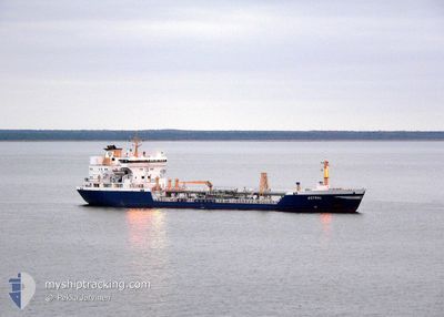
ASTRAL
Oil/Chemical Tanker
Current Trip
| Time Travelled | 14 h, 24 mins |
|---|---|
| Remaining Time | 3 days |
| Distance Travelled | 170.84 nm |
| Remaining Distance | 1112.10 nm |
| AVG Speed | 11.5 Knots |
| MAX Speed | 13.2 Knots |
| AVG Wind | 17.7 knots |
| MAX Wind | 20 knots |
| MIN Temp | 8.1°C / 46.58°F |
| MAX Temp | 9.5°C / 49.1°F |
| Draught | 5.5 m |
| Position Received | 13 h, 34 m ago |
Current Position
| Longitude | -22.31293° |
|---|---|
| Latitude | 64.16106° |
| Status | Under way using engine |
| Speed | 11.9 Knots |
| Course | 257.3° |
| Area | North Atlantic Ocean |
| Station | T-AIS |
| Position Received | 13 h, 34 m ago |
Info
Information
The current position of ASTRAL is in North Atlantic Ocean with coordinates 64.16106° / -22.31293° as reported on 2024-05-31 23:37 by AIS to our vessel tracker app. The vessel's current speed is 11.9 Knots and is heading at the port of GOTEBORG. The estimated time of arrival as calculated by vessel tracking app is 2024-06-05 03:26 LT
The vessel ASTRAL (IMO: 9371878, MMSI: 266266000) is a Oil/Chemical Tanker that was built in 2006 ( 18 years old ). It's sailing under the flag of [SE] Sweden.
In this page you can find informations about the vessels current position, last detected port calls, and current voyage information. If the vessels is not in coverage by AIS you will find the latest position.
The current position of ASTRAL is detected by our AIS receivers and we are not responsible for the reliability of the data. The last position was recorded while the vessel was in Coverage by the Ais receivers of our vessel tracking app.
The current draught of ASTRAL as reported by AIS is 5.5 meters
Weather
| Temperature | 9.5°C / 49.1°F |
|---|---|
| Wind Speed | 20 knots |
| Direction | 233° SW |
| Pressure | 1015.2 hPa |
| Humidity | 91.4 % |
| Cloud Coverage | 100 % |
Featured Company
Last Port Calls
| Port | Arrival | Departure | Time In Port |
|---|---|---|---|
| 2024-05-31 08:26 | 2024-05-31 22:47 | 14 h | |
| 2024-05-24 13:07 | 2024-05-26 12:21 | 1 d | |
| 2024-05-21 12:13 | 2024-05-22 16:39 | 1 d | |
| 2024-05-17 17:54 | 2024-05-18 18:01 | 1 d | |
| 2024-05-14 15:05 | 2024-05-16 00:10 | 1 d | |
| 2024-05-12 18:58 | 2024-05-12 20:12 | 1 h | |
| 2024-05-10 16:33 | 2024-05-12 10:11 | 1 d | |
| 2024-05-06 09:48 | 2024-05-07 06:04 | 20 h | |
| 2024-05-01 12:57 | 2024-05-02 08:08 | 19 h | |
| 2024-04-30 08:53 | 2024-05-01 07:12 | 22 h |
Most Visited Ports (Last year)
| Port | Arrivals | |
|---|---|---|
| 17 | ||
| 15 | ||
| 10 | ||
| 8 | ||
| 8 | ||
| 7 |
Last Trips
| Origin | Departure | Destination | Arrival | Distance | |
|---|---|---|---|---|---|
| 2024-05-26 14:21 | 2024-05-31 08:26 | 1261.09 nm | |||
| 2024-05-22 18:39 | 2024-05-24 15:07 | 111.55 nm | |||
| 2024-05-18 20:01 | 2024-05-21 14:13 | 569.44 nm | |||
| 2024-05-16 02:10 | 2024-05-17 19:54 | 560.25 nm | |||
| 2024-05-12 22:12 | 2024-05-14 17:05 | 420.47 nm | |||
| 2024-05-12 12:11 | 2024-05-12 20:58 | 106.30 nm | |||
| 2024-05-07 08:04 | 2024-05-10 18:33 | 931.50 nm | |||
| 2024-05-02 10:08 | 2024-05-06 11:48 | 1128.50 nm | |||
| 2024-05-01 09:12 | 2024-05-01 14:57 | 57.42 nm | |||
| 2024-04-29 21:37 | 2024-04-30 10:53 | 138.63 nm |
Events
| Time | Event | Details | Position / Dest | Info |
|---|---|---|---|---|
| 2024-05-31 23:40 | Status Changed | Default Under way using engine |
64.15943 / -22.33386
SE GOT
|
Speed: 11.9 kn Course: 257.3° |
| 2024-05-31 23:37 | Status Changed | Under way using engine Default |
64.16106 / -22.31293
SE GOT
|
Speed: 12 kn Course: 256° |
| 2024-05-31 23:37 | OUT of Coverage |
64.16106 / -22.31293
North Atlantic Ocean
SE GOT
|
Speed: 11.9 kn Course: 257.3° |
|
| 2024-05-31 23:23 | IN Coverage |
64.16106 / -22.31293
North Atlantic Ocean
SE GOT
|
Speed: 11.9 kn Course: 257.3° |
|
| 2024-05-31 22:47 | PORT DEPARTURE |
|
64.18333 / -21.94167
SE GOT
|
Speed: 7 kn Course: -1° |
| 2024-05-31 22:38 | Status Changed | Default Under way using engine |
64.16167 / -21.92500
[IS] REYKJAVIK
|
Speed: 5 kn Course: 35° |
| 2024-05-31 22:35 | OUT of Coverage |
64.15907 / -21.92675
North Atlantic Ocean
SE GOT
|
Speed: 5 kn Course: 75.2° |
|
| 2024-05-31 22:35 | START Moving |
64.15903 / -21.92722
[IS] REYKJAVIK
|
Speed: 5 kn Course: 44° |
|
| 2024-05-31 22:14 | Draught Changed | 5.5 6.7 |
64.15969 / -21.93219
[IS] REYKJAVIK
|
Speed: Course: 100° |
| 2024-05-31 22:14 | ETA Changed | 2024/06/05 10:00 2024/05/31 08:00 |
64.15969 / -21.93219
[IS] REYKJAVIK
|
Speed: Course: 100° |