
ATAIR
Other Type
Current Trip
WRECKSEARCH
| Time Travelled | 2 days |
|---|---|
| Remaining Time | --- |
| Distance Travelled | 84.68 nm |
| Remaining Distance | --- |
| AVG Speed | 5.3 Knots |
| MAX Speed | 12.2 Knots |
| AVG Wind | 9.1 knots |
| MAX Wind | 17 knots |
| MIN Temp | 16.6°C / 61.88°F |
| MAX Temp | 24.3°C / 75.74°F |
| Draught | 5 m |
| Position Received | Now |
Current Position
| Longitude | 7.23857° |
|---|---|
| Latitude | 53.90770° |
| Status | At anchor |
| Speed | 0.1 Knots |
| Course | 211° |
| Area | North Sea |
| Station | T-AIS |
| Position Received | Now |
Info
Information
The current position of ATAIR is in North Sea with coordinates 53.90770° / 7.23857° as reported on 2024-06-28 05:15 by AIS to our vessel tracker app. The vessel's current speed is 0.1 Knots
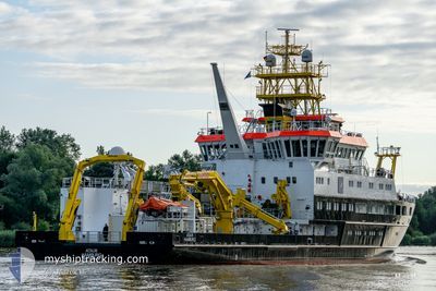
The vessel ATAIR (IMO: 9835496, MMSI: 211297130) is a Other Type It's sailing under the flag of [DE] Germany.
In this page you can find informations about the vessels current position, last detected port calls, and current voyage information. If the vessels is not in coverage by AIS you will find the latest position.
The current position of ATAIR is detected by our AIS receivers and we are not responsible for the reliability of the data. The last position was recorded while the vessel was in Coverage by the Ais receivers of our vessel tracking app.
The current draught of ATAIR as reported by AIS is 5 meters
Weather
| Temperature | 17.5°C / 63.5°F |
|---|---|
| Wind Speed | 16 knots |
| Direction | 245° WSW |
| Pressure | 1007.9 hPa |
| Humidity | 86.7 % |
| Cloud Coverage | 67 % |
Featured Company
Last Port Calls
| Port | Arrival | Departure | Time In Port |
|---|---|---|---|
| 2024-06-20 08:10 | 2024-06-25 14:25 | 5 d | |
| 2024-06-02 06:58 | 2024-06-11 14:53 | 9 d | |
| 2024-05-14 13:37 | 2024-05-28 15:26 | 14 d | |
| 2024-05-13 15:41 | 2024-05-14 06:00 | 14 h | |
| 2024-05-09 13:30 | 2024-05-13 09:33 | 3 d | |
| 2024-05-08 21:13 | 2024-05-09 11:00 | 13 h | |
| 2024-05-02 05:40 | 2024-05-08 11:50 | 6 d | |
| 2024-05-01 19:18 | |||
| 2024-05-01 18:24 | 2024-05-01 19:13 | 49 m | |
| 2024-04-18 05:03 | 2024-04-22 15:01 | 4 d |
Most Visited Ports (Last year)
| Port | Arrivals | |
|---|---|---|
| 20 | ||
| 2 | ||
| 1 | ||
| 1 | ||
| 1 | ||
| 1 |
Last Trips
| Origin | Departure | Destination | Arrival | Distance | |
|---|---|---|---|---|---|
| 2024-06-11 16:53 | 2024-06-20 10:10 | 317.77 nm | |||
| 2024-05-28 17:26 | 2024-06-02 08:58 | 85.07 nm | |||
| 2024-05-14 08:00 | 2024-05-14 15:37 | 47.28 nm | |||
| 2024-05-13 11:33 | 2024-05-13 17:41 | 49.93 nm | |||
| 2024-05-09 13:00 | 2024-05-09 15:30 | 12.67 nm | |||
| 2024-05-08 13:50 | 2024-05-08 23:13 | 96.49 nm | |||
| 2024-05-01 21:13 | 2024-05-02 07:40 | 1.23 nm | |||
| 2024-05-01 21:13 | 2024-05-01 21:18 | 0.14 nm | |||
| 2024-04-22 17:01 | 2024-05-01 20:24 | 808.53 nm | |||
| 2024-04-08 17:35 | 2024-04-18 07:03 | 366.22 nm |
Events
| Time | Event | Details | Position / Dest | Info |
|---|---|---|---|---|
| 2024-06-27 13:58 | STOP Moving | 12 nm, North of BALTRUM |
53.90730 / 7.23727
WRECKSEARCH
|
Speed: 0.3 kn Course: 272° |
| 2024-06-27 13:55 | Status Changed | At anchor Restricted manoeuverability |
53.90836 / 7.23684
WRECKSEARCH
|
Speed: 4.1 kn Course: 170° |
| 2024-06-27 11:30 | START Moving | 12.3 nm, North of NORDERNEY |
53.90320 / 7.18088
WRECKSEARCH
|
Speed: 4.1 kn Course: 248° |
| 2024-06-27 10:31 | STOP Moving | 12.38 nm, North of NORDERNEY |
53.90429 / 7.18399
WRECKSEARCH
|
Speed: 0.2 kn Course: 254° |
| 2024-06-27 10:25 | START Moving | 12.26 nm, North of NORDERNEY |
53.90254 / 7.17957
WRECKSEARCH
|
Speed: 3.2 kn Course: 63° |
| 2024-06-27 08:01 | STOP Moving | 12.09 nm, North of NORDERNEY |
53.89981 / 7.16534
WRECKSEARCH
|
Speed: Course: 100° |
| 2024-06-27 06:10 | IN Coverage |
53.89892 / 7.16607
North Sea
|
Speed: 5.3 kn Course: 264.5° |
|
| 2024-06-27 02:45 | OUT of Coverage |
53.89673 / 7.12373
North Sea
|
Speed: 0.1 kn Course: 284.2° |
|
| 2024-06-27 00:36 | IN Coverage |
53.89641 / 7.12409
North Sea
|
Speed: 0.1 kn Course: 189.2° |
|
| 2024-06-26 23:33 | OUT of Coverage |
53.89646 / 7.12423
North Sea
|
Speed: 0.1 kn Course: 214.8° |