
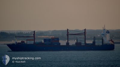
ATLANTIC IBIS
Container Ship
Current Trip
| Time Travelled | 2 days |
|---|---|
| Remaining Time | 2 h, 57 mins |
| Distance Travelled | 686.58 nm |
| Remaining Distance | 497.61 nm |
| AVG Speed | 10.8 Knots |
| MAX Speed | 13.9 Knots |
| AVG Wind | 8.8 knots |
| MAX Wind | 25 knots |
| MIN Temp | 28.6°C / 83.48°F |
| MAX Temp | 35.6°C / 96.08°F |
| Draught | 10.3 m |
| Position Received | 1 d ago |
Current Position
| Longitude | 57.14908° |
|---|---|
| Latitude | 25.65204° |
| Status | Under way using engine |
| Speed | 12 Knots |
| Course | 139.6° |
| Area | Gulf of Oman |
| Station | T-AIS |
| Position Received | 1 d ago |
Info
Information
The current position of ATLANTIC IBIS is in Gulf of Oman with coordinates 25.65204° / 57.14908° as reported on 2024-05-26 19:25 by AIS to our vessel tracker app. The vessel's current speed is 12 Knots and is heading at the port of PORT QASIM. The estimated time of arrival as calculated by vessel tracking app is 2024-05-28 21:30 LT
The vessel ATLANTIC IBIS (IMO: 9339856, MMSI: 538009897) is a Container Ship that was built in 2008 ( 16 years old ). It's sailing under the flag of [MH] Marshall Is.
In this page you can find informations about the vessels current position, last detected port calls, and current voyage information. If the vessels is not in coverage by AIS you will find the latest position.
The current position of ATLANTIC IBIS is detected by our AIS receivers and we are not responsible for the reliability of the data. The last position was recorded while the vessel was in Coverage by the Ais receivers of our vessel tracking app.
The current draught of ATLANTIC IBIS as reported by AIS is 10.3 meters
Weather
| Temperature | 28.4°C / 83.12°F |
|---|---|
| Wind Speed | 23 knots |
| Direction | 260° W |
| Pressure | 999.6 hPa |
| Humidity | 88.1 % |
| Cloud Coverage | --- |
Featured Company
Last Port Calls
| Port | Arrival | Departure | Time In Port |
|---|---|---|---|
| 2024-05-25 02:56 | 2024-05-26 01:06 | 22 h | |
| 2024-05-22 10:52 | 2024-05-23 06:45 | 19 h | |
| 2024-05-20 06:47 | 2024-05-22 03:11 | 1 d | |
| 2024-05-18 07:28 | 2024-05-19 21:09 | 1 d | |
| 2024-05-09 19:42 | 2024-05-11 06:49 | 1 d | |
| 2024-05-09 03:22 | 2024-05-09 11:03 | 7 h | |
| 2024-05-05 14:03 | 2024-05-06 07:32 | 17 h | |
| 2024-05-03 12:09 | 2024-05-05 07:25 | 1 d | |
| 2024-04-28 05:53 | 2024-04-28 10:01 | 4 h | |
| 2024-04-25 18:30 | 2024-04-27 06:51 | 1 d |
Last Trips
| Origin | Departure | Destination | Arrival | Distance | |
|---|---|---|---|---|---|
| 2024-05-23 10:45 | 2024-05-25 06:56 | 44.69 nm | |||
| 2024-05-22 07:11 | 2024-05-22 14:52 | 70.27 nm | |||
| 2024-05-20 01:09 | 2024-05-20 10:47 | 55.61 nm | |||
| 2024-05-11 11:49 | 2024-05-18 11:28 | 771.32 nm | |||
| 2024-05-09 16:03 | 2024-05-10 00:42 | 57.05 nm | |||
| 2024-05-06 11:32 | 2024-05-09 08:22 | 792.59 nm | |||
| 2024-05-05 11:25 | 2024-05-05 18:03 | 42.76 nm | |||
| 2024-04-28 15:01 | 2024-05-03 16:09 | 538.47 nm | |||
| 2024-04-27 11:51 | 2024-04-28 10:53 | 259.45 nm | |||
| 2024-04-25 09:39 | 2024-04-25 23:30 | 62.11 nm |
Events
| Time | Event | Details | Position / Dest | Info |
|---|---|---|---|---|
| 2024-05-27 06:23 | START Moving |
25.07025 / 59.32558
PORT QASIM
|
Speed: 8.1 kn Course: 98° |
|
| 2024-05-27 06:16 | STOP Moving |
25.07167 / 59.31667
PORT QASIM
|
Speed: Course: -1° |
|
| 2024-05-26 19:28 | Status Changed | Default Under way using engine |
25.64333 / 57.15500
PORT QASIM
|
Speed: 12 kn Course: 139.6° |
| 2024-05-26 19:25 | OUT of Coverage |
25.65204 / 57.14908
Gulf of Oman
PORT QASIM
|
Speed: 12 kn Course: 139.6° |
|
| 2024-05-26 18:10 | Change Sea Area | Iranian part of the Gulf of Oman Iranian part of the Persian Gulf |
25.85581 / 57.01011
Gulf of Oman
PORT QASIM
|
Speed: 11.5 kn Course: 150.6° |
| 2024-05-26 18:07 | Status Changed | Under way using engine Default |
25.86429 / 57.00498
PORT QASIM
|
Speed: 11.3 kn Course: 151° |
| 2024-05-26 17:40 | Status Changed | Default Under way using engine |
25.93726 / 56.95780
PORT QASIM
|
Speed: 10.8 kn Course: 148.7° |
| 2024-05-26 17:36 | Change Sea Area | Iranian part of the Persian Gulf Omani part of the Persian Gulf |
25.94672 / 56.95149
Persian Gulf
PORT QASIM
|
Speed: 10.8 kn Course: 148.7° |
| 2024-05-26 17:35 | Status Changed | Under way using engine Default |
25.94929 / 56.94976
PORT QASIM
|
Speed: 10.7 kn Course: 149° |
| 2024-05-26 17:29 | IN Coverage |
25.94672 / 56.95149
Persian Gulf
PORT QASIM
|
Speed: 10.8 kn Course: 148.7° |