
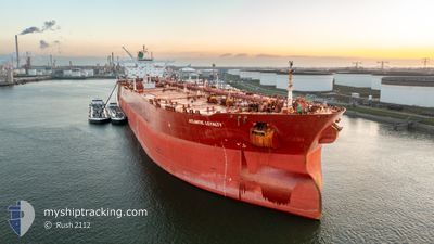
ATLANTIC LOYALTY
Crude Oil Tanker
Current Trip
| Time Travelled | 44 days |
|---|---|
| Remaining Time | 2 days |
| Distance Travelled | 3477.13 nm |
| Remaining Distance | 786.86 nm |
| AVG Speed | 9.9 Knots |
| MAX Speed | 15.9 Knots |
| AVG Wind | 5.8 knots |
| MAX Wind | 18 knots |
| MIN Temp | 25.3°C / 77.54°F |
| MAX Temp | 31.1°C / 87.98°F |
| Draught | 12 m |
| Position Received | 5 d ago |
Current Position
| Longitude | 76.66915° |
|---|---|
| Latitude | 7.78892° |
| Status | Under way using engine |
| Speed | 6.6 Knots |
| Course | 311.2° |
| Area | Laccadive Sea |
| Station | T-AIS |
| Position Received | 5 d ago |
Info
Information
The current position of ATLANTIC LOYALTY is in Laccadive Sea with coordinates 7.78892° / 76.66915° as reported on 2024-05-13 13:42 by AIS to our vessel tracker app. The vessel's current speed is 6.6 Knots and is heading at the port of RAS TANURA. The estimated time of arrival as calculated by vessel tracking app is 2024-05-21 21:10 LT
The vessel ATLANTIC LOYALTY (IMO: 9312509, MMSI: 538010100) is a Crude Oil Tanker that was built in 2007 ( 17 years old ). It's sailing under the flag of [MH] Marshall Is.
In this page you can find informations about the vessels current position, last detected port calls, and current voyage information. If the vessels is not in coverage by AIS you will find the latest position.
The current position of ATLANTIC LOYALTY is detected by our AIS receivers and we are not responsible for the reliability of the data. The last position was recorded while the vessel was in Coverage by the Ais receivers of our vessel tracking app.
The current draught of ATLANTIC LOYALTY as reported by AIS is 12 meters
Weather
| Temperature | 29.4°C / 84.92°F |
|---|---|
| Wind Speed | 16 knots |
| Direction | 219° SW |
| Pressure | 1005.2 hPa |
| Humidity | 80.4 % |
| Cloud Coverage | --- |
Featured Company
Last Port Calls
| Port | Arrival | Departure | Time In Port |
|---|---|---|---|
| 2024-04-02 03:00 | 2024-04-04 02:48 | 1 d |
Most Visited Ports (Last year)
| Port | Arrivals | |
|---|---|---|
| 1 | ||
| 1 | ||
| 1 | ||
| 1 | ||
| 1 | ||
| 1 |
Last Trips
| Origin | Departure | Destination | Arrival | Distance | |
|---|---|---|---|---|---|
| 2024-03-01 05:08 | 2024-04-02 11:00 | 1708.64 nm |
Events
| Time | Event | Details | Position / Dest | Info |
|---|---|---|---|---|
| 2024-05-13 13:50 | Status Changed | Default Under way using engine |
7.79667 / 76.65667
RAS TANURAH
|
Speed: 6.6 kn Course: 311.2° |
| 2024-05-13 13:42 | Status Changed | Under way using engine Default |
7.78892 / 76.66915
RAS TANURAH
|
Speed: 6.6 kn Course: 318° |
| 2024-05-13 13:42 | OUT of Coverage |
7.78892 / 76.66915
Laccadive Sea
RAS TANURAH
|
Speed: 6.6 kn Course: 311.2° |
|
| 2024-05-13 13:05 | Status Changed | Default Under way using engine |
7.73333 / 76.70667
RAS TANURAH
|
Speed: 6.7 kn Course: 314.6° |
| 2024-05-13 12:58 | Status Changed | Under way using engine Default |
7.72711 / 76.71820
RAS TANURAH
|
Speed: 6 kn Course: 320° |
| 2024-05-13 12:41 | IN Coverage |
7.72802 / 76.71728
Laccadive Sea
RAS TANURAH
|
Speed: 6.7 kn Course: 314.6° |
|
| 2024-05-13 11:53 | Status Changed | Default Under way using engine |
7.63500 / 76.79667
RAS TANURAH
|
Speed: 6.4 kn Course: 302.9° |
| 2024-05-13 11:46 | OUT of Coverage |
7.62923 / 76.80713
Laccadive Sea
RAS TANURAH
|
Speed: 6.4 kn Course: 302.9° |
|
| 2024-05-13 11:45 | Status Changed | Under way using engine Default |
7.62810 / 76.80881
RAS TANURAH
|
Speed: 6.2 kn Course: 303° |
| 2024-05-13 11:27 | Status Changed | Default Under way using engine |
7.61023 / 76.83588
RAS TANURAH
|
Speed: 6.3 kn Course: 291.6° |