
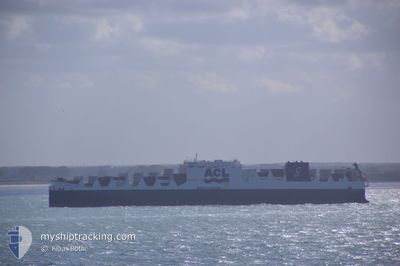
ATLANTIC SKY
Cargo
Current Trip
| Trip Time | 6 days |
|---|---|
| Trip Distance | 2467.28 nm |
| AVG Speed | 13.4 Knots |
| MAX Speed | 18.9 Knots |
| Draught | 9 m |
| AVG Wind | 9.4 knots |
| MAX Wind | 16 knots |
| MIN Temp | 6.2°C / 43.16°F |
| MAX Temp | 14.7°C / 58.46°F |
| Position Received | 1 m ago |
Current Position
| Longitude | -3.01966° |
|---|---|
| Latitude | 53.46115° |
| Status | Moored |
| Speed | |
| Course | 268° |
| Area | Irish Sea and St. George's Channel |
| Station | T-AIS |
| Position Received | 1 m ago |
Info
Information
The current position of ATLANTIC SKY is in Irish Sea and St. George's Channel with coordinates 53.46115° / -3.01966° as reported on 2024-06-13 05:14 by AIS to our vessel tracker app. The vessel's current speed is 0 Knots and is currently inside the port of LIVERPOOL.
The vessel ATLANTIC SKY (IMO: 9670602, MMSI: 215804000) is a Cargo It's sailing under the flag of [MT] Malta.
In this page you can find informations about the vessels current position, last detected port calls, and current voyage information. If the vessels is not in coverage by AIS you will find the latest position.
The current position of ATLANTIC SKY is detected by our AIS receivers and we are not responsible for the reliability of the data. The last position was recorded while the vessel was in Coverage by the Ais receivers of our vessel tracking app.
The current draught of ATLANTIC SKY as reported by AIS is 9 meters
Weather
| Temperature | 8°C / 46.4°F |
|---|---|
| Wind Speed | 8 knots |
| Direction | 148° SSE |
| Pressure | 1012.9 hPa |
| Humidity | 82.9 % |
| Cloud Coverage | 100 % |
Featured Company
Last Port Calls
| Port | Arrival | Departure | Time In Port |
|---|---|---|---|
| 2024-06-13 02:26 | |||
| 2024-06-05 19:33 | 2024-06-06 05:27 | 9 h | |
| 2024-06-03 07:54 | 2024-06-03 19:42 | 11 h | |
| 2024-06-01 21:45 | 2024-06-02 21:24 | 23 h | |
| 2024-06-01 02:21 | 2024-06-01 21:15 | 18 h | |
| 2024-05-29 08:59 | 2024-05-30 19:33 | 1 d | |
| 2024-05-27 08:20 | 2024-05-27 19:46 | 11 h | |
| 2024-05-18 18:39 | 2024-05-20 08:37 | 1 d | |
| 2024-05-15 03:13 | 2024-05-16 22:48 | 1 d | |
| 2024-05-12 20:00 | 2024-05-13 23:18 | 1 d |
Last Trips
| Origin | Departure | Destination | Arrival | Distance | |
|---|---|---|---|---|---|
| 2024-06-06 02:27 | 2024-06-13 03:26 | 2467.28 nm | |||
| 2024-06-03 15:42 | 2024-06-05 16:33 | 781.22 nm | |||
| 2024-06-02 17:24 | 2024-06-03 03:54 | 162.20 nm | |||
| 2024-06-01 17:15 | 2024-06-01 17:45 | 0.81 nm | |||
| 2024-05-30 15:33 | 2024-05-31 22:21 | 420.51 nm | |||
| 2024-05-27 16:46 | 2024-05-29 04:59 | 588.28 nm | |||
| 2024-05-20 09:37 | 2024-05-27 05:20 | 2560.30 nm | |||
| 2024-05-17 00:48 | 2024-05-18 19:39 | 704.70 nm | |||
| 2024-05-14 01:18 | 2024-05-15 05:13 | 402.96 nm | |||
| 2024-05-04 12:50 | 2024-05-12 22:00 | 3052.77 nm |
Events
| Time | Event | Details | Position / Dest | Info |
|---|---|---|---|---|
| 2024-06-13 04:11 | Status Changed | Moored Under way using engine |
53.46115 / -3.01970
[GB] LIVERPOOL
|
Speed: Course: 268° |
| 2024-06-13 02:26 | PORT ARRIVAL |
|
53.44715 / -3.02195
[GB] LIVERPOOL
|
Speed: 0.3 kn Course: 348° |
| 2024-06-13 02:19 | STOP Moving | 1.45 nm, North of LIVERPOOL |
53.44734 / -3.02308
CAHAL>GBLIV
|
Speed: 0.3 kn Course: 348° |
| 2024-06-12 20:08 | Draught Changed | 9 9.1 |
53.62726 / -4.00095
CAHAL>GBLIV
|
Speed: 6.7 kn Course: 120.5° |
| 2024-06-12 20:01 | Status Changed | Under way using engine Default |
53.63336 / -4.01750
CAHAL>GBLIV
|
Speed: 6.7 kn Course: 123° |
| 2024-06-12 19:59 | Status Changed | Default Under way using engine |
53.63548 / -4.02331
CAHAL>GBLIV
|
Speed: 6.6 kn Course: 121° |
| 2024-06-12 19:47 | Status Changed | Under way using engine Default |
53.64733 / -4.05545
CAHAL>GBLIV
|
Speed: 6.5 kn Course: 121° |
| 2024-06-12 19:31 | IN Coverage |
53.64733 / -4.05545
Irish Sea and St. George's Channel
CAHAL>GBLIV
|
Speed: 6.6 kn Course: 123.4° |
|
| 2024-06-12 16:47 | Status Changed | Default Under way using engine |
53.83003 / -4.51322
CAHAL>GBLIV
|
Speed: 7.1 kn Course: 131° |
| 2024-06-12 16:40 | OUT of Coverage |
53.83927 / -4.53011
Irish Sea and St. George's Channel
CAHAL>GBLIV
|
Speed: 7.1 kn Course: 131° |