
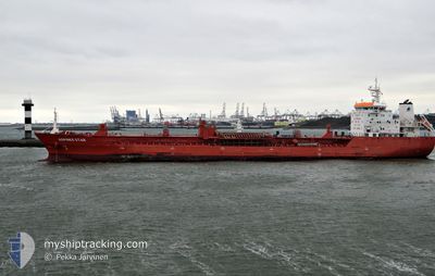
ATLANTIC SPIRIT
Oil/Chemical Tanker
Current Trip
CAMIS
| Time Travelled | 1 day |
|---|---|
| Remaining Time | --- |
| Distance Travelled | 306.56 nm |
| Remaining Distance | --- |
| AVG Speed | 9.4 Knots |
| MAX Speed | 13.4 Knots |
| AVG Wind | 7.7 knots |
| MAX Wind | 17 knots |
| MIN Temp | 13.8°C / 56.84°F |
| MAX Temp | 28.8°C / 83.84°F |
| Draught | 7.5 m |
| Position Received | 1 m ago |
Current Position
| Longitude | -79.60311° |
|---|---|
| Latitude | 43.49395° |
| Status | Moored |
| Speed | |
| Course | 158° |
| Area | Gulf of St-Lawrence |
| Station | T-AIS |
| Position Received | 1 m ago |
Info
Information
The current position of ATLANTIC SPIRIT is in Gulf of St-Lawrence with coordinates 43.49395° / -79.60311° as reported on 2024-05-24 03:46 by AIS to our vessel tracker app. The vessel's current speed is 0 Knots
The vessel ATLANTIC SPIRIT (IMO: 9580974, MMSI: 538008872) is a Oil/Chemical Tanker that was built in 2011 ( 13 years old ). It's sailing under the flag of [MH] Marshall Is.
In this page you can find informations about the vessels current position, last detected port calls, and current voyage information. If the vessels is not in coverage by AIS you will find the latest position.
The current position of ATLANTIC SPIRIT is detected by our AIS receivers and we are not responsible for the reliability of the data. The last position was recorded while the vessel was in Coverage by the Ais receivers of our vessel tracking app.
The current draught of ATLANTIC SPIRIT as reported by AIS is 7.5 meters
Weather
| Temperature | 17.6°C / 63.68°F |
|---|---|
| Wind Speed | 7 knots |
| Direction | 236° SW |
| Pressure | 1011.9 hPa |
| Humidity | 67.5 % |
| Cloud Coverage | 14 % |
Featured Company
Last Port Calls
| Port | Arrival | Departure | Time In Port |
|---|---|---|---|
| 2024-05-21 11:01 | 2024-05-22 03:58 | 16 h | |
| 2024-05-08 22:32 | 2024-05-10 02:20 | 1 d | |
| 2024-05-03 22:22 | 2024-05-07 09:31 | 3 d | |
| 2024-04-21 13:20 | 2024-04-22 02:32 | 13 h | |
| 2024-04-17 15:04 | 2024-04-17 17:38 | 2 h | |
| 2024-04-02 01:53 | 2024-04-04 07:52 | 2 d | |
| 2024-03-04 11:20 | 2024-03-06 11:59 | 2 d |
Most Visited Ports (Last year)
| Port | Arrivals | |
|---|---|---|
| 17 | ||
| 9 | ||
| 6 | ||
| 4 |
Last Trips
| Origin | Departure | Destination | Arrival | Distance | |
|---|---|---|---|---|---|
| 2024-05-10 04:20 | 2024-05-21 07:01 | 3354.43 nm | |||
| 2024-05-07 11:31 | 2024-05-09 00:32 | 368.52 nm | |||
| 2024-04-21 22:32 | 2024-05-04 00:22 | 3611.97 nm | |||
| 2024-04-17 13:38 | 2024-04-21 09:20 | 616.53 nm | |||
| 2024-04-04 09:52 | 2024-04-17 11:04 | 3665.26 nm | |||
| 2024-03-06 06:59 | 2024-04-02 03:53 | 3694.20 nm | |||
| 2024-02-15 16:06 | 2024-03-04 06:20 | 3940.28 nm |
Events
| Time | Event | Details | Position / Dest | Info |
|---|---|---|---|---|
| 2024-05-23 11:52 | Status Changed | Moored Under way using engine |
43.49392 / -79.60318
CAMIS
|
Speed: Course: 158° |
| 2024-05-23 11:31 | STOP Moving | 3.53 nm, South of PORT CREDIT |
43.49029 / -79.60083
CAMIS
|
Speed: 0.3 kn Course: 122° |
| 2024-05-23 07:53 | Status Changed | Under way using engine Default |
43.61054 / -78.61247
CAMIS
|
Speed: 13 kn Course: 260° |
| 2024-05-23 07:47 | Status Changed | Default Under way using engine |
43.61451 / -78.58205
CAMIS
|
Speed: 13 kn Course: 261.5° |
| 2024-05-23 07:00 | Status Changed | Under way using engine Default |
43.64337 / -78.35219
CAMIS
|
Speed: 12 kn Course: 261° |
| 2024-05-23 06:55 | Status Changed | Default Under way using engine |
43.64500 / -78.32500
CAMIS
|
Speed: 12.6 kn Course: 261.3° |
| 2024-05-23 06:41 | Status Changed | Under way using engine Default |
43.65360 / -78.26081
CAMIS
|
Speed: 12 kn Course: 262° |
| 2024-05-23 06:37 | Status Changed | Default Under way using engine |
43.65500 / -78.23834
CAMIS
|
Speed: 13 kn Course: 262.9° |
| 2024-05-23 06:33 | Status Changed | Under way using engine Default |
43.65741 / -78.21835
CAMIS
|
Speed: 12 kn Course: 262° |
| 2024-05-23 06:22 | IN Coverage |
43.65710 / -78.22157
Gulf of St-Lawrence
CAMIS
|
Speed: 13 kn Course: 262.9° |