
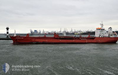
ATLANTIC SPIRIT
Oil/Chemical Tanker
Current Trip
| Time Travelled | 8 days |
|---|---|
| Remaining Time | 1 day |
| Distance Travelled | 2749.21 nm |
| Remaining Distance | 657.65 nm |
| AVG Speed | 13.4 Knots |
| MAX Speed | 18.2 Knots |
| AVG Wind | 13.8 knots |
| MAX Wind | 34.8 knots |
| MIN Temp | 6.9°C / 44.42°F |
| MAX Temp | 15.5°C / 59.9°F |
| Draught | 6.5 m |
| Position Received | 7 d ago |
Current Position
| Longitude | -70.65443° |
|---|---|
| Latitude | 47.16075° |
| Status | Under way using engine |
| Speed | 13.2 Knots |
| Course | 46.4° |
| Area | Gulf of St-Lawrence |
| Station | T-AIS |
| Position Received | 7 d ago |
Info
Information
The current position of ATLANTIC SPIRIT is in Gulf of St-Lawrence with coordinates 47.16075° / -70.65443° as reported on 2024-05-27 13:25 by AIS to our vessel tracker app. The vessel's current speed is 13.2 Knots and is heading at the port of AMSTERDAM. The estimated time of arrival as calculated by vessel tracking app is 2024-06-06 09:25 LT
The vessel ATLANTIC SPIRIT (IMO: 9580974, MMSI: 538008872) is a Oil/Chemical Tanker that was built in 2011 ( 13 years old ). It's sailing under the flag of [MH] Marshall Is.
In this page you can find informations about the vessels current position, last detected port calls, and current voyage information. If the vessels is not in coverage by AIS you will find the latest position.
The current position of ATLANTIC SPIRIT is detected by our AIS receivers and we are not responsible for the reliability of the data. The last position was recorded while the vessel was in Coverage by the Ais receivers of our vessel tracking app.
The current draught of ATLANTIC SPIRIT as reported by AIS is 6.5 meters
Weather
| Temperature | 13.5°C / 56.3°F |
|---|---|
| Wind Speed | 15 knots |
| Direction | 295° WNW |
| Pressure | 1018.1 hPa |
| Humidity | 79.7 % |
| Cloud Coverage | 100 % |
Featured Company
Last Port Calls
| Port | Arrival | Departure | Time In Port |
|---|---|---|---|
| 2024-05-26 07:32 | 2024-05-27 01:20 | 17 h | |
| 2024-05-21 11:01 | 2024-05-22 03:58 | 16 h | |
| 2024-05-08 22:32 | 2024-05-10 02:20 | 1 d | |
| 2024-05-03 22:22 | 2024-05-07 09:31 | 3 d | |
| 2024-04-21 13:20 | 2024-04-22 02:32 | 13 h | |
| 2024-04-17 15:04 | 2024-04-17 17:38 | 2 h | |
| 2024-04-02 01:53 | 2024-04-04 07:52 | 2 d |
Most Visited Ports (Last year)
| Port | Arrivals | |
|---|---|---|
| 18 | ||
| 8 | ||
| 5 | ||
| 4 |
Last Trips
| Origin | Departure | Destination | Arrival | Distance | |
|---|---|---|---|---|---|
| 2024-05-21 23:58 | 2024-05-26 03:32 | 614.97 nm | |||
| 2024-05-10 04:20 | 2024-05-21 07:01 | 3354.43 nm | |||
| 2024-05-07 11:31 | 2024-05-09 00:32 | 368.52 nm | |||
| 2024-04-21 22:32 | 2024-05-04 00:22 | 3611.97 nm | |||
| 2024-04-17 13:38 | 2024-04-21 09:20 | 616.53 nm | |||
| 2024-04-04 09:52 | 2024-04-17 11:04 | 3665.26 nm | |||
| 2024-03-06 06:59 | 2024-04-02 03:53 | 3694.20 nm |
Events
| Time | Event | Details | Position / Dest | Info |
|---|---|---|---|---|
| 2024-05-27 13:28 | Status Changed | Default Under way using engine |
47.16667 / -70.64333
NLAMS
|
Speed: 13.2 kn Course: 46.4° |
| 2024-05-27 13:25 | OUT of Coverage |
47.16075 / -70.65443
Gulf of St-Lawrence
NLAMS
|
Speed: 13.2 kn Course: 46.4° |
|
| 2024-05-27 13:24 | Status Changed | Under way using engine Default |
47.15693 / -70.66025
NLAMS
|
Speed: 12 kn Course: 34° |
| 2024-05-27 13:07 | Status Changed | Default Under way using engine |
47.10500 / -70.70667
NLAMS
|
Speed: 12.7 kn Course: 25.9° |
| 2024-05-27 12:09 | Status Changed | Under way using engine Default |
46.94313 / -70.85136
NLAMS
|
Speed: 10 kn Course: 45° |
| 2024-05-27 11:52 | Status Changed | Default Under way using engine |
46.90167 / -70.89333
NLAMS
|
Speed: 10.4 kn Course: 46.4° |
| 2024-05-27 11:48 | Status Changed | Under way using engine Default |
46.89567 / -70.90534
NLAMS
|
Speed: 10.4 kn Course: 49° |
| 2024-05-27 11:45 | Status Changed | Default Under way using engine |
46.88832 / -70.91679
NLAMS
|
Speed: 10.5 kn Course: 55° |
| 2024-05-27 11:39 | Status Changed | Under way using engine Default |
46.87853 / -70.93462
NLAMS
|
Speed: 10.5 kn Course: 58° |
| 2024-05-27 11:34 | Status Changed | Default Under way using engine |
46.87046 / -70.95232
NLAMS
|
Speed: 10.5 kn Course: 60.2° |