
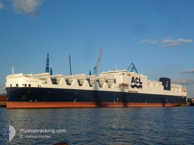
ATLANTIC STAR
Cargo B
Current Trip
| Time Travelled | 19 h, 31 mins |
|---|---|
| Remaining Time | 7 h, 34 mins |
| Distance Travelled | 296.77 nm |
| Remaining Distance | 119.61 nm |
| AVG Speed | 14.5 Knots |
| MAX Speed | 18 Knots |
| AVG Wind | 6.6 knots |
| MAX Wind | 11 knots |
| MIN Temp | 15.4°C / 59.72°F |
| MAX Temp | 25.2°C / 77.36°F |
| Draught | 9.4 m |
| Position Received | 3 m ago |
Current Position
| Longitude | -76.08894° |
|---|---|
| Latitude | 37.32731° |
| Status | Under way using engine |
| Speed | 15.9 Knots |
| Course | 26.1° |
| Area | North Atlantic Ocean |
| Station | T-AIS |
| Position Received | 3 m ago |
Info
Information
The current position of ATLANTIC STAR is in North Atlantic Ocean with coordinates 37.32731° / -76.08894° as reported on 2024-05-25 19:25 by AIS to our vessel tracker app. The vessel's current speed is 15.9 Knots and is heading at the port of BALTIMORE. The estimated time of arrival as calculated by vessel tracking app is 2024-05-26 03:02 LT
The vessel ATLANTIC STAR (IMO: 9670573, MMSI: 215797000) is a Cargo B It's sailing under the flag of [MT] Malta.
In this page you can find informations about the vessels current position, last detected port calls, and current voyage information. If the vessels is not in coverage by AIS you will find the latest position.
The current position of ATLANTIC STAR is detected by our AIS receivers and we are not responsible for the reliability of the data. The last position was recorded while the vessel was in Coverage by the Ais receivers of our vessel tracking app.
The current draught of ATLANTIC STAR as reported by AIS is 9.4 meters
Weather
| Temperature | 25.2°C / 77.36°F |
|---|---|
| Wind Speed | 6 knots |
| Direction | 127° SE |
| Pressure | 1010.7 hPa |
| Humidity | 67.1 % |
| Cloud Coverage | 17 % |
Featured Company
Last Port Calls
| Port | Arrival | Departure | Time In Port |
|---|---|---|---|
| 2024-05-23 09:09 | 2024-05-24 23:57 | 1 d | |
| 2024-05-21 09:04 | 2024-05-21 20:11 | 11 h | |
| 2024-05-12 12:40 | 2024-05-14 02:54 | 1 d | |
| 2024-05-09 07:02 | 2024-05-10 12:40 | 1 d | |
| 2024-05-06 23:52 | 2024-05-08 02:54 | 1 d | |
| 2024-04-28 08:35 | 2024-04-28 23:15 | 14 h | |
| 2024-04-25 06:57 | 2024-04-26 03:52 | 20 h | |
| 2024-04-20 09:50 | 2024-04-23 04:34 | 2 d | |
| 2024-04-18 08:33 | 2024-04-18 20:25 | 11 h | |
| 2024-04-09 22:28 | 2024-04-11 12:27 | 1 d |
Last Trips
| Origin | Departure | Destination | Arrival | Distance | |
|---|---|---|---|---|---|
| 2024-05-21 17:11 | 2024-05-23 05:09 | 591.29 nm | |||
| 2024-05-14 03:54 | 2024-05-21 06:04 | 2473.38 nm | |||
| 2024-05-10 14:40 | 2024-05-12 13:40 | 716.58 nm | |||
| 2024-05-08 04:54 | 2024-05-09 09:02 | 404.12 nm | |||
| 2024-04-28 20:15 | 2024-05-07 01:52 | 3072.68 nm | |||
| 2024-04-25 23:52 | 2024-04-28 05:35 | 784.41 nm | |||
| 2024-04-23 00:34 | 2024-04-25 02:57 | 344.31 nm | |||
| 2024-04-18 17:25 | 2024-04-20 05:50 | 592.64 nm | |||
| 2024-04-11 13:27 | 2024-04-18 05:33 | 2519.95 nm | |||
| 2024-04-07 04:59 | 2024-04-09 23:28 | 816.36 nm |
Events
| Time | Event | Details | Position / Dest | Info |
|---|---|---|---|---|
| 2024-05-25 19:25 | Status Changed | Under way using engine Default |
37.32731 / -76.08894
US NYC>US BAL
|
Speed: 16.1 kn Course: 30° |
| 2024-05-25 19:15 | Status Changed | Default Under way using engine |
37.28775 / -76.11533
US NYC>US BAL
|
Speed: 15.8 kn Course: 17° |
| 2024-05-25 18:20 | Status Changed | Under way using engine Default |
37.06428 / -76.09113
US NYC>US BAL
|
Speed: 15.4 kn Course: 322° |
| 2024-05-25 18:18 | Status Changed | Default Under way using engine |
37.06021 / -76.08714
US NYC>US BAL
|
Speed: 15.3 kn Course: 322.2° |
| 2024-05-25 18:14 | Status Changed | Under way using engine Default |
37.04380 / -76.07156
US NYC>US BAL
|
Speed: 15.7 kn Course: 324° |
| 2024-05-25 18:11 | Status Changed | Default Under way using engine |
37.03292 / -76.06143
US NYC>US BAL
|
Speed: 15.6 kn Course: 323.9° |
| 2024-05-25 17:55 | Status Changed | Under way using engine Default |
36.98727 / -76.00663
US NYC>US BAL
|
Speed: 14.4 kn Course: 325° |
| 2024-05-25 17:55 | Status Changed | Default Under way using engine |
36.98547 / -76.00457
US NYC>US BAL
|
Speed: 13.8 kn Course: 326.1° |
| 2024-05-25 17:42 | Status Changed | Under way using engine Default |
36.94383 / -75.97063
US NYC>US BAL
|
Speed: 12.7 kn Course: 290° |
| 2024-05-25 17:30 | IN Coverage |
36.94383 / -75.97063
North Atlantic Ocean
US NYC>US BAL
|
Speed: 13.3 kn Course: 293.1° |