
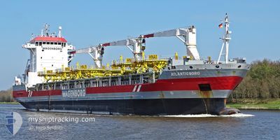
ATLANTICBORG
General Cargo
Current Trip
| Time Travelled | 16 h, 21 mins |
|---|---|
| Remaining Time | --- |
| Distance Travelled | 203.08 nm |
| Remaining Distance | --- |
| AVG Speed | 13 Knots |
| MAX Speed | 14.7 Knots |
| AVG Wind | 14.1 knots |
| MAX Wind | 18.6 knots |
| MIN Temp | 21.3°C / 70.34°F |
| MAX Temp | 23.8°C / 74.84°F |
| Draught | 6.4 m |
| Position Received | 3 h, 2 m ago |
Current Position
| Longitude | -75.39502° |
|---|---|
| Latitude | 37.06367° |
| Status | Under way using engine |
| Speed | 11.9 Knots |
| Course | 61° |
| Area | North Atlantic Ocean |
| Station | T-AIS |
| Position Received | 3 h, 2 m ago |
Info
Information
The current position of ATLANTICBORG is in North Atlantic Ocean with coordinates 37.06367° / -75.39502° as reported on 2024-06-28 17:42 by AIS to our vessel tracker app. The vessel's current speed is 11.9 Knots and is heading at the port of BAIE COMEAU. The estimated time of arrival as calculated by vessel tracking app is 2024-07-03 12:00 LT
The vessel ATLANTICBORG (IMO: 9466350, MMSI: 245299000) is a General Cargo that was built in 2012 ( 12 years old ). It's sailing under the flag of [NL] Netherlands.
In this page you can find informations about the vessels current position, last detected port calls, and current voyage information. If the vessels is not in coverage by AIS you will find the latest position.
The current position of ATLANTICBORG is detected by our AIS receivers and we are not responsible for the reliability of the data. The last position was recorded while the vessel was in Coverage by the Ais receivers of our vessel tracking app.
The current draught of ATLANTICBORG as reported by AIS is 6.4 meters
Weather
| Temperature | 23.7°C / 74.66°F |
|---|---|
| Wind Speed | 14 knots |
| Direction | 85° E |
| Pressure | 1019.7 hPa |
| Humidity | 83.4 % |
| Cloud Coverage | 11 % |
Featured Company
Last Port Calls
| Port | Arrival | Departure | Time In Port |
|---|---|---|---|
| 2024-06-23 11:42 | 2024-06-28 04:23 | 4 d | |
| 2024-06-11 00:06 | 2024-06-18 00:27 | 7 d | |
| 2024-06-05 13:01 | 2024-06-09 17:54 | 4 d | |
| 2024-06-02 20:18 | 2024-06-04 23:41 | 2 d | |
| 2024-05-12 21:03 | 2024-05-13 01:26 | 4 h | |
| 2024-05-09 18:14 | 2024-05-11 23:18 | 2 d | |
| 2024-04-30 04:02 | 2024-05-03 04:30 | 3 d | |
| 2024-04-13 14:41 |
Most Visited Ports (Last year)
| Port | Arrivals | |
|---|---|---|
| 3 | ||
| 2 | ||
| 2 | ||
| 2 | ||
| 1 | ||
| 1 |
Last Trips
| Origin | Departure | Destination | Arrival | Distance | |
|---|---|---|---|---|---|
| 2024-06-17 20:27 | 2024-06-23 07:42 | 1548.71 nm | |||
| 2024-06-09 13:54 | 2024-06-10 20:06 | 4.54 nm | |||
| 2024-06-04 19:41 | 2024-06-05 09:01 | 167.57 nm | |||
| 2024-05-12 20:26 | 2024-06-02 16:18 | 3157.43 nm | |||
| 2024-05-11 18:18 | 2024-05-12 16:03 | 245.03 nm | |||
| 2024-05-03 00:30 | 2024-05-09 13:14 | 1964.12 nm | |||
| 2024-04-13 17:41 | 2024-04-30 00:02 | 4473.64 nm |
Events
| Time | Event | Details | Position / Dest | Info |
|---|---|---|---|---|
| 2024-06-28 17:52 | Status Changed | Default Under way using engine |
37.07976 / -75.35927
CABCO
|
Speed: 11.9 kn Course: 61° |
| 2024-06-28 17:42 | OUT of Coverage |
37.06367 / -75.39502
North Atlantic Ocean
CABCO
|
Speed: 11.9 kn Course: 61° |
|
| 2024-06-28 17:39 | Status Changed | Under way using engine Default |
37.05886 / -75.40579
CABCO
|
Speed: 11.9 kn Course: 61° |
| 2024-06-28 17:34 | Status Changed | Default Under way using engine |
37.05057 / -75.42447
CABCO
|
Speed: 12 kn Course: 61° |
| 2024-06-28 16:40 | Status Changed | Under way using engine Default |
36.98646 / -75.63093
CABCO
|
Speed: 11.8 kn Course: 74° |
| 2024-06-28 16:36 | Status Changed | Default Under way using engine |
36.98262 / -75.64875
CABCO
|
Speed: 11.8 kn Course: 75° |
| 2024-06-28 14:25 | Draught Changed | 6.4 6 |
37.08688 / -76.10788
CABCO
|
Speed: 14 kn Course: 150.2° |
| 2024-06-28 14:25 | ETA Changed | 2024/07/03 12:00 |
37.08688 / -76.10788
CABCO
|
Speed: 14 kn Course: 150.2° |
| 2024-06-28 12:46 | Status Changed | Under way using engine Default |
37.46606 / -76.11588
CABCO
|
Speed: 13.9 kn Course: 171° |
| 2024-06-28 12:13 | Status Changed | Default Under way using engine |
37.59143 / -76.14274
CABCO
|
Speed: 13.6 kn Course: 169.8° |