
ATOUT
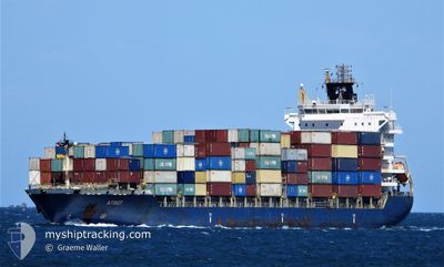
Container Ship
Current Trip
| Time Travelled | 14 h, 17 mins |
|---|---|
| Remaining Time | 4 h, 24 mins |
| Distance Travelled | 163.78 nm |
| Remaining Distance | 55.28 nm |
| AVG Speed | 11.6 Knots |
| MAX Speed | 12.1 Knots |
| AVG Wind | 13.5 knots |
| MAX Wind | 17.8 knots |
| MIN Temp | 21.4°C / 70.52°F |
| MAX Temp | 27.5°C / 81.5°F |
| Draught | 7.2 m |
| Position Received | 1 m ago |
Current Position
| Longitude | 14.75550° |
|---|---|
| Latitude | 35.07408° |
| Status | Under way using engine |
| Speed | 11.7 Knots |
| Course | 349.2° |
| Area | Mediterranean Sea - Eastern Basin |
| Station | T-AIS |
| Position Received | 1 m ago |
Info
Information
The current position of ATOUT is in Mediterranean Sea - Eastern Basin with coordinates 35.07408° / 14.75550° as reported on 2024-06-01 03:07 by AIS to our vessel tracker app. The vessel's current speed is 11.7 Knots and is heading at the port of VALLETTA. The estimated time of arrival as calculated by vessel tracking app is 2024-06-01 07:32 LT
The vessel ATOUT (IMO: 9354648, MMSI: 636014890) is a Container Ship that was built in 2010 ( 14 years old ). It's sailing under the flag of [LR] Liberia.
In this page you can find informations about the vessels current position, last detected port calls, and current voyage information. If the vessels is not in coverage by AIS you will find the latest position.
The current position of ATOUT is detected by our AIS receivers and we are not responsible for the reliability of the data. The last position was recorded while the vessel was in Coverage by the Ais receivers of our vessel tracking app.
The current draught of ATOUT as reported by AIS is 7.2 meters
Weather
| Temperature | 21.4°C / 70.52°F |
|---|---|
| Wind Speed | 12 knots |
| Direction | 126° SE |
| Pressure | 1013.2 hPa |
| Humidity | 85.3 % |
| Cloud Coverage | 2 % |
Featured Company
Last Port Calls
| Port | Arrival | Departure | Time In Port |
|---|---|---|---|
| 2024-05-30 02:04 | 2024-05-31 12:51 | 1 d | |
| 2024-05-28 05:58 | 2024-05-29 06:04 | 1 d | |
| 2024-05-22 13:35 | |||
| 2024-05-17 03:07 | 2024-05-17 12:22 | 9 h | |
| 2024-05-16 02:11 | |||
| 2024-05-13 11:19 | 2024-05-14 04:02 | 16 h | |
| 2024-05-11 02:30 | 2024-05-12 11:05 | 1 d | |
| 2024-04-30 20:47 | 2024-05-02 22:28 | 2 d | |
| 2024-04-27 16:19 | 2024-04-28 05:18 | 12 h | |
| 2024-04-16 20:57 | 2024-04-24 03:48 | 7 d |
Most Visited Ports (Last year)
| Port | Arrivals | |
|---|---|---|
| 7 | ||
| 6 | ||
| 6 | ||
| 6 | ||
| 5 | ||
| 4 |
Last Trips
| Origin | Departure | Destination | Arrival | Distance | |
|---|---|---|---|---|---|
| 2024-05-29 08:04 | 2024-05-30 04:04 | 210.60 nm | |||
| 2024-05-22 16:35 | 2024-05-28 07:58 | 1190.93 nm | |||
| 2024-05-14 07:02 | 2024-05-16 05:11 | 561.17 nm | |||
| 2024-05-12 14:05 | 2024-05-13 14:19 | 279.99 nm | |||
| 2024-05-03 00:28 | 2024-05-11 05:30 | 775.91 nm | |||
| 2024-04-28 07:18 | 2024-04-30 22:47 | 119.82 nm | |||
| 2024-04-24 04:48 | 2024-04-27 18:19 | 524.17 nm | |||
| 2024-04-07 13:18 | 2024-04-16 21:57 | 530.20 nm | |||
| 2024-04-05 12:48 | 2024-04-07 07:07 | 325.53 nm | |||
| 2024-03-22 15:10 | 2024-04-04 00:54 | 1069.02 nm |
Events
| Time | Event | Details | Position / Dest | Info |
|---|---|---|---|---|
| 2024-06-01 00:19 | Change Sea Area | Maltese part of the Mediterranean Sea - Eastern Basin Libyan part of the Mediterranean Sea - Eastern Basin |
34.52414 / 14.87537
Mediterranean Sea - Eastern Basin
MTMLA
|
Speed: 11.7 kn Course: 350° |
| 2024-05-31 22:56 | Status Changed | Under way using engine Default |
34.26123 / 14.93487
MTMLA
|
Speed: 11.4 kn Course: 348° |
| 2024-05-31 22:48 | Status Changed | Default Under way using engine |
34.23615 / 14.94082
MTMLA
|
Speed: 11.4 kn Course: 349.7° |
| 2024-05-31 21:15 | Status Changed | Under way using engine Default |
33.94044 / 15.00718
MTMLA
|
Speed: 11.7 kn Course: 350° |
| 2024-05-31 21:02 | IN Coverage |
33.94418 / 15.00644
Mediterranean Sea - Eastern Basin
MTMLA
|
Speed: 11.9 kn Course: 350.4° |
|
| 2024-05-31 20:11 | Status Changed | Default Under way using engine |
33.73405 / 15.05351
MTMLA
|
Speed: 11.7 kn Course: 349.2° |
| 2024-05-31 20:09 | OUT of Coverage |
33.72975 / 15.05450
Mediterranean Sea - Eastern Basin
MTMLA
|
Speed: 11.7 kn Course: 349.2° |
|
| 2024-05-31 20:05 | Status Changed | Under way using engine Default |
33.71418 / 15.05805
MTMLA
|
Speed: 11.7 kn Course: 349° |
| 2024-05-31 20:02 | Status Changed | Default Under way using engine |
33.70509 / 15.06010
MTMLA
|
Speed: 11.7 kn Course: 349° |
| 2024-05-31 19:58 | Status Changed | Under way using engine Default |
33.69280 / 15.06290
MTMLA
|
Speed: 11.7 kn Course: 348° |