
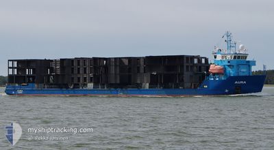
AURA
Cable Layer
Current Trip
| Time Travelled | 8 h, 36 mins |
|---|---|
| Remaining Time | --- |
| Distance Travelled | 85.47 nm |
| Remaining Distance | --- |
| AVG Speed | 10 Knots |
| MAX Speed | 10.3 Knots |
| AVG Wind | 12.7 knots |
| MAX Wind | 14 knots |
| MIN Temp | 13°C / 55.4°F |
| MAX Temp | 16.4°C / 61.52°F |
| Draught | 4 m |
| Position Received | 1 m ago |
Current Position
| Longitude | 15.64716° |
|---|---|
| Latitude | 55.09357° |
| Status | Under way using engine |
| Speed | 10 Knots |
| Course | 36° |
| Area | Kattegat |
| Station | T-AIS |
| Position Received | 1 m ago |
Info
Information
The current position of AURA is in Kattegat with coordinates 55.09357° / 15.64716° as reported on 2024-06-04 02:26 by AIS to our vessel tracker app. The vessel's current speed is 10 Knots and is heading at the port of HARNOSAND. The estimated time of arrival as calculated by vessel tracking app is 2024-06-06 08:00 LT
The vessel AURA (IMO: 9395276, MMSI: 230601000) is a Cable Layer that was built in 2008 ( 16 years old ). It's sailing under the flag of [FI] Finland.
In this page you can find informations about the vessels current position, last detected port calls, and current voyage information. If the vessels is not in coverage by AIS you will find the latest position.
The current position of AURA is detected by our AIS receivers and we are not responsible for the reliability of the data. The last position was recorded while the vessel was in Coverage by the Ais receivers of our vessel tracking app.
The current draught of AURA as reported by AIS is 4 meters
Weather
| Temperature | 13.2°C / 55.76°F |
|---|---|
| Wind Speed | 13 knots |
| Direction | 296° WNW |
| Pressure | 1012.2 hPa |
| Humidity | 84.6 % |
| Cloud Coverage | 100 % |
Featured Company
Last Port Calls
| Port | Arrival | Departure | Time In Port |
|---|---|---|---|
| 2024-06-01 17:40 | 2024-06-03 17:51 | 2 d | |
| 2024-05-30 09:20 | 2024-05-30 19:23 | 10 h | |
| 2024-05-29 02:59 | 2024-05-29 20:30 | 17 h | |
| 2024-05-19 23:13 | 2024-05-21 12:37 | 1 d | |
| 2024-05-06 09:24 | 2024-05-08 23:08 | 2 d | |
| 2024-05-02 21:16 | 2024-05-03 14:10 | 16 h | |
| 2024-04-30 06:14 | 2024-04-30 21:04 | 14 h | |
| 2024-04-27 19:40 | 2024-04-29 17:56 | 1 d | |
| 2024-04-27 17:05 | 2024-04-27 17:09 | 3 m | |
| 2024-04-24 20:40 | 2024-04-25 15:28 | 18 h |
Last Trips
| Origin | Departure | Destination | Arrival | Distance | |
|---|---|---|---|---|---|
| 2024-05-30 22:23 | 2024-06-01 19:40 | 270.06 nm | |||
| 2024-05-29 22:30 | 2024-05-30 12:20 | 151.26 nm | |||
| 2024-05-21 14:37 | 2024-05-29 04:59 | 1770.48 nm | |||
| 2024-05-09 02:08 | 2024-05-20 01:13 | 2026.11 nm | |||
| 2024-05-03 16:10 | 2024-05-06 12:24 | 716.38 nm | |||
| 2024-04-30 23:04 | 2024-05-02 23:16 | 462.35 nm | |||
| 2024-04-29 19:56 | 2024-04-30 08:14 | 93.83 nm | |||
| 2024-04-27 19:09 | 2024-04-27 21:40 | 11.48 nm | |||
| 2024-04-25 17:28 | 2024-04-27 19:05 | 457.50 nm | |||
| 2024-04-20 13:43 | 2024-04-24 22:40 | 835.28 nm |
Events
| Time | Event | Details | Position / Dest | Info |
|---|---|---|---|---|
| 2024-06-04 00:44 | Detected in Sea | Danish part of the Kattegat |
54.85575 / 15.36003
Kattegat
SEHND
|
Speed: 10 kn Course: 35° |
| 2024-06-03 20:01 | Destination Changed | SEHND SWINOUJSCIE |
54.20894 / 14.59000
SEHND
|
Speed: 9.9 kn Course: 32.5° |
| 2024-06-03 20:01 | ETA Changed | 2024/06/06 08:00 2025/05/31 21:00 |
54.20894 / 14.59000
SEHND
|
Speed: 9.9 kn Course: 32.5° |
| 2024-06-03 19:50 | Status Changed | Under way using engine Default |
54.18292 / 14.56186
SWINOUJSCIE
|
Speed: 10 kn Course: 32° |
| 2024-06-03 19:50 | IN Coverage |
54.18292 / 14.56186
Baltic Sea
|
Speed: 10 kn Course: 32.1° |
|
| 2024-06-03 17:51 | PORT DEPARTURE |
|
53.92834 / 14.27899
SWINOUJSCIE
|
Speed: 9.3 kn Course: 36° |
| 2024-06-01 17:40 | START Moving |
53.92417 / 14.28157
[PL] SWINOUJSCIE
|
Speed: 7.5 kn Course: 163° |
|
| 2024-06-01 17:40 | PORT ARRIVAL |
|
53.92417 / 14.28157
[PL] SWINOUJSCIE
|
Speed: 0.3 kn Course: 350° |
| 2024-06-01 16:42 | Status Changed | Default At anchor |
53.95316 / 14.24051
SWINOUJSCIE
|
Speed: Course: 36° |
| 2024-06-01 16:15 | OUT of Coverage |
53.95314 / 14.24043
Baltic Sea
|
Speed: Course: 230.2° |