
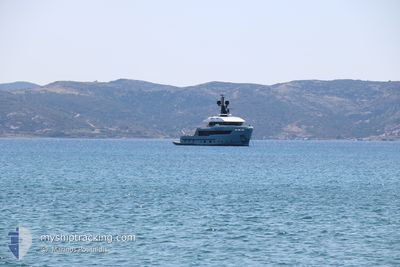
AURELIA
Pleasure Craft
Current Trip
EGADI
| Time Travelled | 12 days |
|---|---|
| Remaining Time | --- |
| Distance Travelled | 196.04 nm |
| Remaining Distance | --- |
| AVG Speed | 9.7 Knots |
| MAX Speed | 14 Knots |
| AVG Wind | 10.1 knots |
| MAX Wind | 16 knots |
| MIN Temp | 20.8°C / 69.44°F |
| MAX Temp | 28.6°C / 83.48°F |
| Draught | 2.8 m |
| Position Received | 41 m ago |
Current Position
| Longitude | 12.21040° |
|---|---|
| Latitude | 37.49218° |
| Status | Under way using engine |
| Speed | 13 Knots |
| Course | 175.3° |
| Area | Mediterranean Sea - Eastern Basin |
| Station | T-AIS |
| Position Received | 41 m ago |
Info
Information
The current position of AURELIA is in Mediterranean Sea - Eastern Basin with coordinates 37.49218° / 12.21040° as reported on 2024-06-27 06:33 by AIS to our vessel tracker app. The vessel's current speed is 13 Knots
The vessel AURELIA (IMO: 9920241, MMSI: 319195800) is a Pleasure Craft It's sailing under the flag of [KY] Cayman Is.
In this page you can find informations about the vessels current position, last detected port calls, and current voyage information. If the vessels is not in coverage by AIS you will find the latest position.
The current position of AURELIA is detected by our AIS receivers and we are not responsible for the reliability of the data. The last position was recorded while the vessel was in Coverage by the Ais receivers of our vessel tracking app.
The current draught of AURELIA as reported by AIS is 2.8 meters
Weather
| Temperature | 22.5°C / 72.5°F |
|---|---|
| Wind Speed | 8 knots |
| Direction | 15° NNE |
| Pressure | 1013 hPa |
| Humidity | 74.9 % |
| Cloud Coverage | --- |
Featured Company
Events
| Time | Event | Details | Position / Dest | Info |
|---|---|---|---|---|
| 2024-06-27 05:32 | Change Sea Area | Italian part of the Mediterranean Sea - Eastern Basin Italian part of the Mediterranean Sea - Western Basin |
37.71185 / 12.25755
Mediterranean Sea - Eastern Basin
EGADI
|
Speed: 13.1 kn Course: 196.7° |
| 2024-06-27 04:55 | Change Sea Area | Italian part of the Mediterranean Sea - Western Basin Italian part of the Tyrrhenian Sea |
37.83728 / 12.30674
Mediterranean Sea - Western Basin
EGADI
|
Speed: 12.4 kn Course: 198.7° |
| 2024-06-27 04:41 | ETA Changed | 2024/06/27 21:40 2024/06/22 21:40 |
37.88567 / 12.32616
EGADI
|
Speed: 12.7 kn Course: 192.8° |
| 2024-06-27 04:41 | Status Changed | Under way using engine At anchor |
37.88567 / 12.32616
EGADI
|
Speed: 12.6 kn Course: 192.9° |
| 2024-06-27 04:31 | START Moving | 1.21 nm, South of FAVIGNANA |
37.91356 / 12.32714
EGADI
|
Speed: 4.8 kn Course: 152° |
| 2024-06-22 11:45 | ETA Changed | 2024/06/22 21:40 2024/06/19 21:40 |
37.91499 / 12.32596
EGADI
|
Speed: 0.1 kn Course: 0° |
| 2024-06-22 06:18 | STOP Moving | 1.1 nm, South of FAVIGNANA |
37.91535 / 12.32653
EGADI
|
Speed: 0.2 kn Course: 5° |
| 2024-06-22 05:58 | START Moving | 2.69 nm, South East of FAVIGNANA |
37.90748 / 12.36955
EGADI
|
Speed: 7.9 kn Course: 203.6° |
| 2024-06-21 12:54 | STOP Moving | 2.68 nm, South East of FAVIGNANA |
37.90933 / 12.37070
EGADI
|
Speed: 0.3 kn Course: 317° |
| 2024-06-21 12:40 | START Moving | 1.94 nm, East of FAVIGNANA |
37.92951 / 12.36385
EGADI
|
Speed: 8.4 kn Course: 19.3° |