
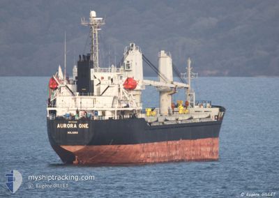
AURORA ONE
Bulk Carrier
Current Trip
| Time Travelled | 1 day |
|---|---|
| Remaining Time | --- |
| Distance Travelled | 254.11 nm |
| Remaining Distance | --- |
| AVG Speed | 10.1 Knots |
| MAX Speed | 11.4 Knots |
| AVG Wind | 8.6 knots |
| MAX Wind | 16.8 knots |
| MIN Temp | 19.1°C / 66.38°F |
| MAX Temp | 20.9°C / 69.62°F |
| Draught | 4.1 m |
| Position Received | 3 m ago |
Current Position
| Longitude | 20.20204° |
|---|---|
| Latitude | 38.05828° |
| Status | Under way using engine |
| Speed | 9.9 Knots |
| Course | 152.3° |
| Area | Ionian Sea |
| Station | T-AIS |
| Position Received | 3 m ago |
Info
Information
The current position of AURORA ONE is in Ionian Sea with coordinates 38.05828° / 20.20204° as reported on 2024-05-23 19:52 by AIS to our vessel tracker app. The vessel's current speed is 9.9 Knots and is heading at the port of ISTANBUL. The estimated time of arrival as calculated by vessel tracking app is 2024-05-26 12:00 LT
The vessel AURORA ONE (IMO: 9343819, MMSI: 538005792) is a Bulk Carrier that was built in 2007 ( 17 years old ). It's sailing under the flag of [MH] Marshall Is.
In this page you can find informations about the vessels current position, last detected port calls, and current voyage information. If the vessels is not in coverage by AIS you will find the latest position.
The current position of AURORA ONE is detected by our AIS receivers and we are not responsible for the reliability of the data. The last position was recorded while the vessel was in Coverage by the Ais receivers of our vessel tracking app.
The current draught of AURORA ONE as reported by AIS is 4.1 meters
Weather
| Temperature | 20.2°C / 68.36°F |
|---|---|
| Wind Speed | 13 knots |
| Direction | 313° NW |
| Pressure | 1016.7 hPa |
| Humidity | 77.8 % |
| Cloud Coverage | 46 % |
Featured Company
Last Trips
| Origin | Departure | Destination | Arrival | Distance | |
|---|---|---|---|---|---|
| 2024-04-28 06:40 | 2024-05-17 10:07 | 3939.20 nm | |||
| 2024-04-23 19:32 | 2024-04-26 00:56 | 77.95 nm | |||
| 2024-04-01 02:26 | 2024-04-20 16:21 | 4260.59 nm | |||
| 2024-03-04 09:09 | 2024-03-24 17:49 | 592.21 nm |
Events
| Time | Event | Details | Position / Dest | Info |
|---|---|---|---|---|
| 2024-05-23 19:44 | Status Changed | Under way using engine Default |
38.07805 / 20.18952
ISTANBUL
|
Speed: 9.7 kn Course: 154° |
| 2024-05-23 19:40 | Status Changed | Default Under way using engine |
38.08572 / 20.18449
ISTANBUL
|
Speed: 9.8 kn Course: 154.4° |
| 2024-05-23 19:33 | Status Changed | Under way using engine Default |
38.10477 / 20.17216
ISTANBUL
|
Speed: 9.7 kn Course: 152° |
| 2024-05-23 19:12 | Status Changed | Default Under way using engine |
38.15372 / 20.14145
ISTANBUL
|
Speed: 9.7 kn Course: 153.9° |
| 2024-05-23 11:04 | Status Changed | Under way using engine Default |
39.29564 / 19.39275
ISTANBUL
|
Speed: 10 kn Course: 151° |
| 2024-05-23 10:38 | Status Changed | Default Under way using engine |
39.35860 / 19.35016
ISTANBUL
|
Speed: 9.9 kn Course: 150.3° |
| 2024-05-23 08:25 | Detected in Sea | Greek part of the Ionian Sea |
39.68516 / 19.13443
Ionian Sea
ISTANBUL
|
Speed: 9.8 kn Course: 153° |
| 2024-05-23 08:25 | Status Changed | Under way using engine Default |
39.68516 / 19.13443
ISTANBUL
|
Speed: 9.7 kn Course: 154° |
| 2024-05-23 08:25 | IN Coverage |
39.68516 / 19.13443
Ionian Sea
ISTANBUL
|
Speed: 9.8 kn Course: 153° |
|
| 2024-05-23 05:24 | OUT of Coverage |
40.14030 / 18.82980
Adriatic Sea
ISTANBUL
|
Speed: 10.5 kn Course: 152.2° |