
AUTOSUN
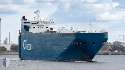
Vehicles Carrier
Current Trip
| Time Travelled | 1 day |
|---|---|
| Remaining Time | --- |
| Distance Travelled | 342.90 nm |
| Remaining Distance | 310.45 nm |
| AVG Speed | 14.5 Knots |
| MAX Speed | 17.2 Knots |
| AVG Wind | 10.4 knots |
| MAX Wind | 16.9 knots |
| MIN Temp | 9.9°C / 49.82°F |
| MAX Temp | 14.6°C / 58.28°F |
| Draught | 7 m |
| Position Received | 14 h, 35 m ago |
Current Position
| Longitude | -6.01185° |
|---|---|
| Latitude | 50.31355° |
| Status | Under way using engine |
| Speed | 15.8 Knots |
| Course | 197.4° |
| Area | Celtic Sea |
| Station | T-AIS |
| Position Received | 14 h, 35 m ago |
Info
Information
The current position of AUTOSUN is in Celtic Sea with coordinates 50.31355° / -6.01185° as reported on 2024-05-16 06:12 by AIS to our vessel tracker app. The vessel's current speed is 15.8 Knots and is heading at the port of SANTANDER. The estimated time of arrival as calculated by vessel tracking app is 2024-05-17 10:30 LT
The vessel AUTOSUN (IMO: 9227053, MMSI: 255801490) is a Vehicles Carrier that was built in 2000 ( 24 years old ). It's sailing under the flag of [PT] Portugal.
In this page you can find informations about the vessels current position, last detected port calls, and current voyage information. If the vessels is not in coverage by AIS you will find the latest position.
The current position of AUTOSUN is detected by our AIS receivers and we are not responsible for the reliability of the data. The last position was recorded while the vessel was in Coverage by the Ais receivers of our vessel tracking app.
The current draught of AUTOSUN as reported by AIS is 7 meters
Weather
| Temperature | 14.4°C / 57.92°F |
|---|---|
| Wind Speed | 5 knots |
| Direction | 348° NNW |
| Pressure | 1002.2 hPa |
| Humidity | 83.4 % |
| Cloud Coverage | 51 % |
Featured Company
Last Port Calls
| Port | Arrival | Departure | Time In Port |
|---|---|---|---|
| 2024-05-14 23:37 | 2024-05-15 20:45 | 21 h | |
| 2024-05-12 13:08 | 2024-05-12 13:26 | 18 m | |
| 2024-05-11 22:02 | |||
| 2024-05-11 10:44 | 2024-05-11 17:07 | 6 h | |
| 2024-05-08 04:07 | 2024-05-08 21:58 | 17 h | |
| 2024-05-05 10:30 | 2024-05-05 10:52 | 21 m | |
| 2024-05-05 04:02 | |||
| 2024-05-04 09:09 | 2024-05-04 17:55 | 8 h | |
| 2024-04-30 01:16 | 2024-05-01 01:33 | 1 d | |
| 2024-04-27 11:44 | 2024-04-27 12:06 | 22 m |
Last Trips
| Origin | Departure | Destination | Arrival | Distance | |
|---|---|---|---|---|---|
| 2024-05-12 15:26 | 2024-05-15 00:37 | 615.67 nm | |||
| 2024-05-11 19:07 | 2024-05-12 15:08 | 87.55 nm | |||
| 2024-05-11 19:07 | 2024-05-12 00:02 | 85.62 nm | |||
| 2024-05-08 22:58 | 2024-05-11 12:44 | 580.49 nm | |||
| 2024-05-05 12:52 | 2024-05-08 05:07 | 615.49 nm | |||
| 2024-05-04 19:55 | 2024-05-05 12:30 | 85.08 nm | |||
| 2024-05-04 19:55 | 2024-05-05 06:02 | 84.81 nm | |||
| 2024-05-01 02:33 | 2024-05-04 11:09 | 579.51 nm | |||
| 2024-04-27 14:06 | 2024-04-30 02:16 | 612.09 nm | |||
| 2024-04-26 20:20 | 2024-04-27 13:44 | 85.29 nm |
Events
| Time | Event | Details | Position / Dest | Info |
|---|---|---|---|---|
| 2024-05-16 06:18 | Status Changed | Default Under way using engine |
50.28579 / -6.01990
ES SDR
|
Speed: 15.8 kn Course: 197.4° |
| 2024-05-16 06:12 | OUT of Coverage |
50.31355 / -6.01185
Celtic Sea
ES SDR
|
Speed: 15.8 kn Course: 197.4° |
|
| 2024-05-16 06:10 | Status Changed | Under way using engine Default |
50.32111 / -6.00829
ES SDR
|
Speed: 15.7 kn Course: 203° |
| 2024-05-16 06:07 | Status Changed | Default Under way using engine |
50.33624 / -5.99947
ES SDR
|
Speed: 15.8 kn Course: 231.5° |
| 2024-05-16 01:43 | Change Sea Area | United Kingdom part of the Celtic Sea United Kingdom part of the Bristol Channel |
51.07762 / -4.57751
Celtic Sea
ES SDR
|
Speed: 16.1 kn Course: 230.8° |
| 2024-05-16 00:29 | Status Changed | Under way using engine Default |
51.26835 / -4.15794
ES SDR
|
Speed: 16.1 kn Course: 260° |
| 2024-05-16 00:18 | Status Changed | Default Under way using engine |
51.27702 / -4.08021
ES SDR
|
Speed: 16.1 kn Course: 259.3° |
| 2024-05-16 00:00 | Status Changed | Under way using engine Default |
51.29156 / -3.94875
ES SDR
|
Speed: 15 kn Course: 259° |
| 2024-05-16 00:00 | IN Coverage |
51.29156 / -3.94875
Bristol Channel
ES SDR
|
Speed: 16 kn Course: 260° |
|
| 2024-05-15 22:24 | OUT of Coverage |
51.34623 / -3.29850
Bristol Channel
ES SDR
|
Speed: 13.9 kn Course: 270.6° |