
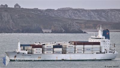
AUTUMN STREAM
Reefer
Current Trip
| Trip Time | 2 days |
|---|---|
| Trip Distance | 407.68 nm |
| AVG Speed | 14.8 Knots |
| MAX Speed | 20.5 Knots |
| Draught | 8 m |
| AVG Wind | 16.7 knots |
| MAX Wind | 26.2 knots |
| MIN Temp | 13.2°C / 55.76°F |
| MAX Temp | 23.9°C / 75.02°F |
| Position Received | 8 d ago |
Current Position
| Longitude | 25.67383° |
|---|---|
| Latitude | -33.88880° |
| Status | At anchor |
| Speed | 0.2 Knots |
| Course | 268° |
| Area | Indian Ocean |
| Station | T-AIS |
| Position Received | 8 d ago |
Info
Information
The current position of AUTUMN STREAM is in Indian Ocean with coordinates -33.88880° / 25.67383° as reported on 2024-06-18 21:30 by AIS to our vessel tracker app. The vessel's current speed is 0.2 Knots and is currently inside the port of COEGA.
The vessel AUTUMN STREAM (IMO: 9038323, MMSI: 308315000) is a Reefer that was built in 1993 ( 31 years old ). It's sailing under the flag of [BS] Bahamas.
In this page you can find informations about the vessels current position, last detected port calls, and current voyage information. If the vessels is not in coverage by AIS you will find the latest position.
The current position of AUTUMN STREAM is detected by our AIS receivers and we are not responsible for the reliability of the data. The last position was recorded while the vessel was in Coverage by the Ais receivers of our vessel tracking app.
The current draught of AUTUMN STREAM as reported by AIS is 8 meters
Weather
| Temperature | 14.4°C / 57.92°F |
|---|---|
| Wind Speed | 3 knots |
| Direction | 347° NNW |
| Pressure | 1030.9 hPa |
| Humidity | 75.8 % |
| Cloud Coverage | --- |
Featured Company
Last Port Calls
| Port | Arrival | Departure | Time In Port |
|---|---|---|---|
| 2024-06-20 08:12 | |||
| 2024-06-14 00:25 | 2024-06-17 13:54 | 3 d | |
| 2024-06-08 09:20 | 2024-06-09 21:52 | 1 d | |
| 2024-06-06 14:03 | 2024-06-07 03:12 | 13 h | |
| 2024-05-20 04:16 | 2024-05-21 15:42 | 1 d | |
| 2024-05-18 11:31 | 2024-05-18 13:26 | 1 h | |
| 2024-04-30 07:23 | 2024-04-30 15:54 | 8 h | |
| 2024-04-14 01:04 | 2024-04-18 14:54 | 4 d | |
| 2024-04-06 18:55 | 2024-04-10 21:27 | 4 d |
Most Visited Ports (Last year)
| Port | Arrivals | |
|---|---|---|
| 4 | ||
| 4 | ||
| 3 | ||
| 2 | ||
| 1 | ||
| 1 |
Last Trips
| Origin | Departure | Destination | Arrival | Distance | |
|---|---|---|---|---|---|
| 2024-06-17 15:54 | 2024-06-20 10:12 | 407.68 nm | |||
| 2024-06-09 23:52 | 2024-06-14 02:25 | 473.71 nm | |||
| 2024-06-07 05:12 | 2024-06-08 11:20 | 460.42 nm | |||
| 2024-05-21 17:42 | 2024-06-06 16:03 | 6225.86 nm | |||
| 2024-05-18 15:26 | 2024-05-20 06:16 | 569.30 nm | |||
| 2024-04-30 16:54 | 2024-05-18 13:31 | 3990.30 nm | |||
| 2024-04-18 16:54 | 2024-04-30 08:23 | 4249.92 nm | |||
| 2024-04-10 23:27 | 2024-04-14 03:04 | 834.69 nm | |||
| 2024-03-26 12:23 | 2024-04-06 20:55 | 2874.54 nm |
Events
| Time | Event | Details | Position / Dest | Info |
|---|---|---|---|---|
| 2024-06-20 08:36 | STOP Moving |
-33.79874 / 25.68901
[ZA] COEGA
|
Speed: 0.3 kn Course: 149° |
|
| 2024-06-20 08:12 | PORT ARRIVAL |
|
-33.81247 / 25.69225
[ZA] COEGA
|
Speed: 4.8 kn Course: 5° |
| 2024-06-20 06:44 | START Moving | 4.46 nm, North East of PORT ELIZABETH |
-33.88646 / 25.67701
ZA PLZ
|
Speed: 4.1 kn Course: 68° |
| 2024-06-18 21:36 | Status Changed | Default At anchor |
-33.88853 / 25.67384
ZA PLZ
|
Speed: 0.2 kn Course: 268° |
| 2024-06-18 21:30 | OUT of Coverage |
-33.88880 / 25.67383
Indian Ocean
|
Speed: 0.2 kn Course: 29.5° |
|
| 2024-06-18 21:19 | Status Changed | At anchor Default |
-33.88930 / 25.67374
ZA PLZ
|
Speed: Course: 295° |
| 2024-06-18 21:10 | Status Changed | Default At anchor |
-33.88948 / 25.67365
ZA PLZ
|
Speed: 0.1 kn Course: 307° |
| 2024-06-18 20:55 | Status Changed | At anchor Default |
-33.88971 / 25.67332
ZA PLZ
|
Speed: 0.2 kn Course: 311° |
| 2024-06-18 20:52 | Status Changed | Default At anchor |
-33.88974 / 25.67336
ZA PLZ
|
Speed: 0.1 kn Course: 309° |
| 2024-06-18 20:46 | Status Changed | At anchor Default |
-33.88974 / 25.67350
ZA PLZ
|
Speed: 0.1 kn Course: 306° |