
AVILA
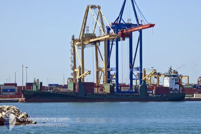
Container Ship
Current Trip
| Time Travelled | 14 h, 36 mins |
|---|---|
| Remaining Time | 1 day |
| Distance Travelled | 214.64 nm |
| Remaining Distance | 721.34 nm |
| AVG Speed | 14.8 Knots |
| MAX Speed | 15.8 Knots |
| AVG Wind | 9.6 knots |
| MAX Wind | 18 knots |
| MIN Temp | 15.8°C / 60.44°F |
| MAX Temp | 18.9°C / 66.02°F |
| Draught | 9 m |
| Position Received | 1 m ago |
Current Position
| Longitude | -7.97706° |
|---|---|
| Latitude | 43.82581° |
| Status | Under way using engine |
| Speed | 15 Knots |
| Course | 262.3° |
| Area | North Atlantic Ocean |
| Station | T-AIS |
| Position Received | 1 m ago |
Info
Information
The current position of AVILA is in North Atlantic Ocean with coordinates 43.82581° / -7.97706° as reported on 2024-06-18 12:34 by AIS to our vessel tracker app. The vessel's current speed is 15 Knots and is heading at the port of ALGECIRAS. The estimated time of arrival as calculated by vessel tracking app is 2024-06-20 12:00 LT
The vessel AVILA (IMO: 9295529, MMSI: 255806143) is a Container Ship that was built in 2007 ( 17 years old ). It's sailing under the flag of [PT] Portugal.
In this page you can find informations about the vessels current position, last detected port calls, and current voyage information. If the vessels is not in coverage by AIS you will find the latest position.
The current position of AVILA is detected by our AIS receivers and we are not responsible for the reliability of the data. The last position was recorded while the vessel was in Coverage by the Ais receivers of our vessel tracking app.
The current draught of AVILA as reported by AIS is 9 meters
Weather
| Temperature | 15.8°C / 60.44°F |
|---|---|
| Wind Speed | 9 knots |
| Direction | 258° WSW |
| Pressure | 1012.1 hPa |
| Humidity | 88.5 % |
| Cloud Coverage | 5 % |
Featured Company
Last Port Calls
| Port | Arrival | Departure | Time In Port |
|---|---|---|---|
| 2024-06-16 12:07 | 2024-06-17 21:59 | 1 d | |
| 2024-06-15 12:54 | 2024-06-16 00:54 | 11 h | |
| 2024-06-12 22:12 | 2024-06-13 08:57 | 10 h | |
| 2024-06-11 21:08 | 2024-06-12 05:25 | 8 h | |
| 2024-06-10 02:30 | 2024-06-10 20:12 | 17 h | |
| 2024-06-07 06:01 | 2024-06-08 04:44 | 22 h | |
| 2024-06-04 15:46 | 2024-06-05 13:05 | 21 h | |
| 2024-06-04 05:46 | 2024-06-04 10:12 | 4 h | |
| 2024-05-31 08:56 | 2024-06-02 02:12 | 1 d | |
| 2024-05-30 23:42 | 2024-05-31 08:50 | 9 h |
Most Visited Ports (Last year)
| Port | Arrivals | |
|---|---|---|
| 64 | ||
| 17 | ||
| 17 | ||
| 16 | ||
| 15 | ||
| 15 |
Last Trips
| Origin | Departure | Destination | Arrival | Distance | |
|---|---|---|---|---|---|
| 2024-06-16 02:54 | 2024-06-16 14:07 | 117.45 nm | |||
| 2024-06-13 09:57 | 2024-06-15 14:54 | 780.70 nm | |||
| 2024-06-12 07:25 | 2024-06-12 23:12 | 124.26 nm | |||
| 2024-06-10 22:12 | 2024-06-11 23:08 | 3.90 nm | |||
| 2024-06-08 05:44 | 2024-06-10 04:30 | 462.44 nm | |||
| 2024-06-05 14:05 | 2024-06-07 07:01 | 349.62 nm | |||
| 2024-06-04 11:12 | 2024-06-04 16:46 | 54.52 nm | |||
| 2024-06-02 04:12 | 2024-06-04 06:46 | 725.47 nm | |||
| 2024-05-31 10:50 | 2024-05-31 10:56 | 0.92 nm | |||
| 2024-05-27 14:01 | 2024-05-31 01:42 | 990.31 nm |
Events
| Time | Event | Details | Position / Dest | Info |
|---|---|---|---|---|
| 2024-06-18 12:02 | Change Sea Area | Spanish part of the North Atlantic Ocean Spanish part of the Bay of Biscay |
43.84074 / -7.79385
North Atlantic Ocean
ESALG
|
Speed: 15 kn Course: 263.5° |
| 2024-06-18 10:27 | ETA Changed | 2024/06/20 18:00 2024/06/20 14:00 |
43.82817 / -7.23715
ESALG
|
Speed: 15.2 kn Course: 272.3° |
| 2024-06-18 10:04 | Status Changed | Under way using engine Default |
43.82166 / -7.10308
ESALG
|
Speed: 14 kn Course: 274° |
| 2024-06-18 10:04 | IN Coverage |
43.82179 / -7.10901
Bay of Biscay
ESALG
|
Speed: 15.4 kn Course: 273.6° |
|
| 2024-06-18 07:36 | Status Changed | Default Under way using engine |
43.79181 / -6.26382
ESALG
|
Speed: 14.4 kn Course: 273.4° |
| 2024-06-18 07:28 | Status Changed | Under way using engine Default |
43.79008 / -6.22302
ESALG
|
Speed: 14.4 kn Course: 274° |
| 2024-06-18 07:28 | OUT of Coverage |
43.79008 / -6.22302
Bay of Biscay
ESALG
|
Speed: 14.4 kn Course: 273.4° |
|
| 2024-06-18 07:27 | Status Changed | Default Under way using engine |
43.78984 / -6.21694
ESALG
|
Speed: 14.6 kn Course: 274° |
| 2024-06-18 07:20 | Status Changed | Under way using engine Default |
43.78767 / -6.17520
ESALG
|
Speed: 14.7 kn Course: 274° |
| 2024-06-18 06:35 | Status Changed | Default Under way using engine |
43.77319 / -5.92296
ESALG
|
Speed: 15.1 kn Course: 275.1° |