
AVONDSTER
Wing in ground
Current Trip
ZEEBRUGGE
| Time Travelled | 1 day |
|---|---|
| Remaining Time | --- |
| Distance Travelled | 32.92 nm |
| Remaining Distance | --- |
| AVG Speed | 5.2 Knots |
| MAX Speed | 6.5 Knots |
| AVG Wind | 14.5 knots |
| MAX Wind | 16 knots |
| MIN Temp | 13.6°C / 56.48°F |
| MAX Temp | 18.4°C / 65.12°F |
| Draught | 0 m |
| Position Received | 1 m ago |
Current Position
| Longitude | 3.29866° |
|---|---|
| Latitude | 50.91082° |
| Status | Under way using engine |
| Speed | 5.1 Knots |
| Course | 283° |
| Area | North Sea |
| Station | T-AIS |
| Position Received | 1 m ago |
Info
Information
The current position of AVONDSTER is in North Sea with coordinates 50.91082° / 3.29866° as reported on 2024-05-29 13:58 by AIS to our vessel tracker app. The vessel's current speed is 5.1 Knots
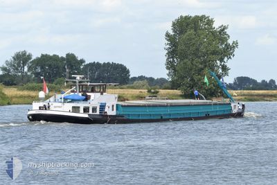
The vessel AVONDSTER (MMSI: 244010949) is a Wing in ground It's sailing under the flag of [NL] Netherlands.
In this page you can find informations about the vessels current position, last detected port calls, and current voyage information. If the vessels is not in coverage by AIS you will find the latest position.
The current position of AVONDSTER is detected by our AIS receivers and we are not responsible for the reliability of the data. The last position was recorded while the vessel was in Coverage by the Ais receivers of our vessel tracking app.
Weather
| Temperature | 17.9°C / 64.22°F |
|---|---|
| Wind Speed | 12 knots |
| Direction | 263° W |
| Pressure | 1009 hPa |
| Humidity | 62.7 % |
| Cloud Coverage | 100 % |
Featured Company
Last Port Calls
| Port | Arrival | Departure | Time In Port |
|---|---|---|---|
| 2024-05-28 10:18 | 2024-05-28 11:38 | 1 h | |
| 2024-05-27 18:34 | 2024-05-28 09:46 | 15 h | |
| 2024-05-27 17:00 | 2024-05-27 17:51 | 51 m | |
| 2024-05-25 14:48 | 2024-05-27 09:27 | 1 d | |
| 2024-05-24 11:58 | 2024-05-24 13:01 | 1 h | |
| 2024-05-23 11:14 | 2024-05-24 11:26 | 1 d | |
| 2024-05-23 09:53 | 2024-05-23 10:31 | 38 m | |
| 2024-05-22 09:36 | 2024-05-23 02:57 | 17 h | |
| 2024-05-21 07:31 | 2024-05-21 08:39 | 1 h | |
| 2024-05-20 09:52 | 2024-05-21 07:01 | 21 h |
Last Trips
| Origin | Departure | Destination | Arrival | Distance | |
|---|---|---|---|---|---|
| 2024-05-28 11:46 | 2024-05-28 12:18 | 0.94 nm | |||
| 2024-05-27 19:51 | 2024-05-27 20:34 | 5.08 nm | |||
| 2024-05-27 11:27 | 2024-05-27 19:00 | 38.18 nm | |||
| 2024-05-24 15:01 | 2024-05-25 16:48 | 40.61 nm | |||
| 2024-05-24 13:26 | 2024-05-24 13:58 | 2.04 nm | |||
| 2024-05-23 12:31 | 2024-05-23 13:14 | 5.23 nm | |||
| 2024-05-23 04:57 | 2024-05-23 11:53 | 36.38 nm | |||
| 2024-05-21 10:39 | 2024-05-22 11:36 | 40.10 nm | |||
| 2024-05-21 09:01 | 2024-05-21 09:31 | 3.44 nm | |||
| 2024-05-20 11:06 | 2024-05-20 11:52 | 5.14 nm |
Events
| Time | Event | Details | Position / Dest | Info |
|---|---|---|---|---|
| 2024-05-29 12:45 | START Moving | 6.26 nm, South West of DEINZE |
50.91174 / 3.40919
ZEEBRUGGE
|
Speed: 5 kn Course: 235.9° |
| 2024-05-29 12:44 | Status Changed | Under way using engine Moored |
50.91248 / 3.41084
ZEEBRUGGE
|
Speed: 1.6 kn Course: 511° |
| 2024-05-29 12:43 | Status Changed | Moored Under way using engine |
50.91287 / 3.41171
ZEEBRUGGE
|
Speed: 0.2 kn Course: 511° |
| 2024-05-29 12:27 | STOP Moving | 6.13 nm, South West of DEINZE |
50.91295 / 3.41196
ZEEBRUGGE
|
Speed: 0.2 kn Course: 511° |
| 2024-05-29 06:09 | START Moving | 1.65 nm, South of BRUGGE |
51.19448 / 3.22820
ZEEBRUGGE
|
Speed: 3.3 kn Course: 161.3° |
| 2024-05-29 06:07 | Status Changed | Under way using engine Moored |
51.19617 / 3.22779
ZEEBRUGGE
|
Speed: Course: 511° |
| 2024-05-29 04:48 | IN Coverage |
51.19664 / 3.22811
North Sea
|
Speed: Course: 511° |
|
| 2024-05-29 03:22 | OUT of Coverage |
51.19667 / 3.22812
North Sea
|
Speed: Course: 511° |
|
| 2024-05-29 03:07 | IN Coverage |
51.19664 / 3.22815
North Sea
|
Speed: Course: 511° |
|
| 2024-05-29 00:53 | OUT of Coverage |
51.19665 / 3.22812
North Sea
|
Speed: Course: 511° |