
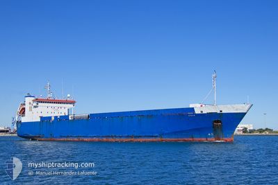
AYA M
Ro-Ro Cargo
Current Trip
| Trip Time | 2 days |
|---|---|
| Trip Distance | 793.95 nm |
| AVG Speed | 11.2 Knots |
| MAX Speed | 12.4 Knots |
| Draught | 5.7 m |
| AVG Wind | 7 knots |
| MAX Wind | 16 knots |
| MIN Temp | 20.4°C / 68.72°F |
| MAX Temp | 32.3°C / 90.14°F |
| Position Received | 5 h, 1 m ago |
Current Position
| Longitude | 15.26625° |
|---|---|
| Latitude | 33.05188° |
| Status | Under way using engine |
| Speed | 10.4 Knots |
| Course | 179.5° |
| Area | Mediterranean Sea - Eastern Basin |
| Station | T-AIS |
| Position Received | 5 h, 1 m ago |
Info
Information
The current position of AYA M is in Mediterranean Sea - Eastern Basin with coordinates 33.05188° / 15.26625° as reported on 2024-06-10 10:14 by AIS to our vessel tracker app. The vessel's current speed is 10.4 Knots and is currently inside the port of MISURATA.
The vessel AYA M (IMO: 9007867, MMSI: 352001122) is a Ro-Ro Cargo that was built in 1995 ( 29 years old ). It's sailing under the flag of [PA] Panama.
In this page you can find informations about the vessels current position, last detected port calls, and current voyage information. If the vessels is not in coverage by AIS you will find the latest position.
The current position of AYA M is detected by our AIS receivers and we are not responsible for the reliability of the data. The last position was recorded while the vessel was in Coverage by the Ais receivers of our vessel tracking app.
The current draught of AYA M as reported by AIS is 5.7 meters
Weather
| Temperature | 32.3°C / 90.14°F |
|---|---|
| Wind Speed | 13 knots |
| Direction | 114° ESE |
| Pressure | 1009.7 hPa |
| Humidity | 30.9 % |
| Cloud Coverage | 6 % |
Featured Company
Last Port Calls
| Port | Arrival | Departure | Time In Port |
|---|---|---|---|
| 2024-06-10 14:11 | |||
| 2024-06-07 04:30 | 2024-06-07 15:51 | 11 h | |
| 2024-06-06 05:46 | 2024-06-06 19:16 | 13 h | |
| 2024-06-02 13:02 | 2024-06-02 22:56 | 9 h | |
| 2024-05-30 14:29 | 2024-05-31 14:16 | 23 h | |
| 2024-05-28 04:22 | 2024-05-28 17:33 | 13 h | |
| 2024-05-24 03:27 | 2024-05-24 17:44 | 14 h | |
| 2024-05-22 06:16 | 2024-05-22 16:14 | 9 h | |
| 2024-05-19 04:43 | 2024-05-19 18:22 | 13 h | |
| 2024-05-14 04:21 | 2024-05-14 16:47 | 12 h |
Last Trips
| Origin | Departure | Destination | Arrival | Distance | |
|---|---|---|---|---|---|
| 2024-06-07 17:51 | 2024-06-10 16:11 | 793.95 nm | |||
| 2024-06-06 21:16 | 2024-06-07 06:30 | 87.93 nm | |||
| 2024-06-03 00:56 | 2024-06-06 07:46 | 864.01 nm | |||
| 2024-05-31 16:16 | 2024-06-02 15:02 | 513.55 nm | |||
| 2024-05-28 19:33 | 2024-05-30 16:29 | 514.85 nm | |||
| 2024-05-24 19:44 | 2024-05-28 06:22 | 901.57 nm | |||
| 2024-05-22 18:14 | 2024-05-24 05:27 | 335.46 nm | |||
| 2024-05-19 20:22 | 2024-05-22 08:16 | 667.01 nm | |||
| 2024-05-14 18:47 | 2024-05-19 06:43 | 852.69 nm | |||
| 2024-05-13 19:54 | 2024-05-14 06:21 | 93.71 nm |
Events
| Time | Event | Details | Position / Dest | Info |
|---|---|---|---|---|
| 2024-06-10 14:22 | STOP Moving |
32.36993 / 15.22063
[LY] MISURATA
|
Speed: 0.2 kn Course: 314° |
|
| 2024-06-10 14:11 | PORT ARRIVAL |
|
32.37167 / 15.22833
[LY] MISURATA
|
Speed: 5 kn Course: 198° |
| 2024-06-10 10:20 | Status Changed | Default Under way using engine |
33.03361 / 15.26627
LYMRA
|
Speed: 10.4 kn Course: 179.5° |
| 2024-06-10 10:14 | OUT of Coverage |
33.05188 / 15.26625
Mediterranean Sea - Eastern Basin
LYMRA
|
Speed: 10.4 kn Course: 179.5° |
|
| 2024-06-10 09:56 | Change Sea Area | Libyan part of the Mediterranean Sea - Eastern Basin Maltese part of the Mediterranean Sea - Eastern Basin |
33.10480 / 15.26565
Mediterranean Sea - Eastern Basin
LYMRA
|
Speed: 10.4 kn Course: 180.1° |
| 2024-06-10 09:55 | IN Coverage |
33.10480 / 15.26565
Mediterranean Sea - Eastern Basin
LYMRA
|
Speed: 10.4 kn Course: 180.1° |
|
| 2024-06-10 09:54 | Status Changed | Under way using engine Default |
33.10821 / 15.26565
LYMRA
|
Speed: 10 kn Course: 181° |
| 2024-06-09 21:32 | Status Changed | Default Under way using engine |
35.34252 / 15.27270
LYMRA
|
Speed: 11 kn Course: 177° |
| 2024-06-09 21:28 | OUT of Coverage |
35.35510 / 15.27191
Mediterranean Sea - Eastern Basin
LYMRA
|
Speed: 11 kn Course: 177° |
|
| 2024-06-09 21:24 | Status Changed | Under way using engine Default |
35.36581 / 15.27125
LYMRA
|
Speed: 10.9 kn Course: 178° |