
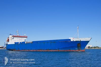
AYA M
Ro-Ro Cargo
Current Trip
MTWTW
| Time Travelled | 10 h, 37 mins |
|---|---|
| Remaining Time | --- |
| Distance Travelled | 119.23 nm |
| Remaining Distance | --- |
| AVG Speed | 11.3 Knots |
| MAX Speed | 12 Knots |
| AVG Wind | 6 knots |
| MAX Wind | 7.9 knots |
| MIN Temp | 20.3°C / 68.54°F |
| MAX Temp | 20.9°C / 69.62°F |
| Draught | 5.6 m |
| Position Received | 2 m ago |
Current Position
| Longitude | 7.44277° |
|---|---|
| Latitude | 42.66934° |
| Status | Under way using engine |
| Speed | 11.9 Knots |
| Course | 111.7° |
| Area | Mediterranean Sea - Western Basin |
| Station | T-AIS |
| Position Received | 2 m ago |
Info
Information
The current position of AYA M is in Mediterranean Sea - Western Basin with coordinates 42.66934° / 7.44277° as reported on 2024-06-26 05:31 by AIS to our vessel tracker app. The vessel's current speed is 11.9 Knots
The vessel AYA M (IMO: 9007867, MMSI: 352001122) is a Ro-Ro Cargo that was built in 1995 ( 29 years old ). It's sailing under the flag of [PA] Panama.
In this page you can find informations about the vessels current position, last detected port calls, and current voyage information. If the vessels is not in coverage by AIS you will find the latest position.
The current position of AYA M is detected by our AIS receivers and we are not responsible for the reliability of the data. The last position was recorded while the vessel was in Coverage by the Ais receivers of our vessel tracking app.
The current draught of AYA M as reported by AIS is 5.6 meters
Weather
| Temperature | 20.9°C / 69.62°F |
|---|---|
| Wind Speed | 6 knots |
| Direction | 259° W |
| Pressure | 1012 hPa |
| Humidity | 84 % |
| Cloud Coverage | 69 % |
Featured Company
Last Port Calls
| Port | Arrival | Departure | Time In Port |
|---|---|---|---|
| 2024-06-25 08:38 | 2024-06-25 18:56 | 10 h | |
| 2024-06-24 05:16 | 2024-06-24 13:17 | 8 h | |
| 2024-06-22 12:30 | 2024-06-23 20:01 | 1 d | |
| 2024-06-21 04:03 | 2024-06-21 07:45 | 3 h | |
| 2024-06-18 16:57 | 2024-06-19 14:10 | 21 h | |
| 2024-06-17 04:21 | 2024-06-17 07:09 | 2 h | |
| 2024-06-15 03:09 | 2024-06-15 13:09 | 9 h | |
| 2024-06-10 14:11 | 2024-06-11 10:27 | 20 h | |
| 2024-06-07 04:30 | 2024-06-07 15:51 | 11 h | |
| 2024-06-06 05:46 | 2024-06-06 19:16 | 13 h |
Last Trips
| Origin | Departure | Destination | Arrival | Distance | |
|---|---|---|---|---|---|
| 2024-06-24 15:17 | 2024-06-25 10:38 | 228.90 nm | |||
| 2024-06-23 22:01 | 2024-06-24 07:16 | 87.56 nm | |||
| 2024-06-21 09:45 | 2024-06-22 14:30 | 174.77 nm | |||
| 2024-06-19 16:10 | 2024-06-21 06:03 | 318.38 nm | |||
| 2024-06-17 09:09 | 2024-06-18 18:57 | 347.14 nm | |||
| 2024-06-15 15:09 | 2024-06-17 06:21 | 335.42 nm | |||
| 2024-06-11 12:27 | 2024-06-15 05:09 | 920.78 nm | |||
| 2024-06-07 17:51 | 2024-06-10 16:11 | 793.95 nm | |||
| 2024-06-06 21:16 | 2024-06-07 06:30 | 87.93 nm | |||
| 2024-06-03 00:56 | 2024-06-06 07:46 | 864.01 nm |
Events
| Time | Event | Details | Position / Dest | Info |
|---|---|---|---|---|
| 2024-06-26 04:24 | Status Changed | Under way using engine Default |
42.74889 / 7.16411
MTWTW
|
Speed: 11.7 kn Course: 110° |
| 2024-06-26 04:05 | Status Changed | Default Under way using engine |
42.77111 / 7.08532
MTWTW
|
Speed: 11.6 kn Course: 110.8° |
| 2024-06-26 03:52 | Status Changed | Under way using engine Default |
42.78695 / 7.02959
MTWTW
|
Speed: 11.6 kn Course: 110° |
| 2024-06-26 03:40 | IN Coverage |
42.78695 / 7.02959
Mediterranean Sea - Western Basin
MTWTW
|
Speed: 11.7 kn Course: 109.2° |
|
| 2024-06-25 20:58 | Status Changed | Default Under way using engine |
43.07130 / 5.32852
MTWTW
|
Speed: 11.8 kn Course: 114.2° |
| 2024-06-25 20:49 | OUT of Coverage |
43.08342 / 5.29238
Mediterranean Sea - Western Basin
MTWTW
|
Speed: 11.8 kn Course: 114.2° |
|
| 2024-06-25 20:36 | Status Changed | Under way using engine Default |
43.10477 / 5.23979
MTWTW
|
Speed: 11.8 kn Course: 155° |
| 2024-06-25 20:26 | Status Changed | Default Under way using engine |
43.13266 / 5.21776
MTWTW
|
Speed: 11.6 kn Course: 153.6° |
| 2024-06-25 20:24 | Status Changed | Under way using engine Default |
43.13894 / 5.21347
MTWTW
|
Speed: 11.5 kn Course: 153° |
| 2024-06-25 20:22 | Status Changed | Default Under way using engine |
43.14555 / 5.20887
MTWTW
|
Speed: 11.3 kn Course: 153° |