
AYADA
General Cargo
Current Trip
| Time Travelled | 8 days |
|---|---|
| Remaining Time | 3 days |
| Distance Travelled | 1716.11 nm |
| Remaining Distance | 752.66 nm |
| AVG Speed | 8.3 Knots |
| MAX Speed | 13.1 Knots |
| AVG Wind | 15.1 knots |
| MAX Wind | 22.3 knots |
| MIN Temp | 10.7°C / 51.26°F |
| MAX Temp | 18.3°C / 64.94°F |
| Draught | 6.3 m |
| Position Received | 2 h, 43 m ago |
Current Position
| Longitude | -0.64667° |
|---|---|
| Latitude | 36.70167° |
| Status | Under way using engine |
| Speed | 9 Knots |
| Course | 74° |
| Area | Mediterranean Sea - Western Basin |
| Station | T-AIS |
| Position Received | 2 h, 43 m ago |
Info
Information
The current position of AYADA is in Mediterranean Sea - Western Basin with coordinates 36.70167° / -0.64667° as reported on 2024-05-16 23:45 by AIS to our vessel tracker app. The vessel's current speed is 9 Knots and is heading at the port of NAPOLI. The estimated time of arrival as calculated by vessel tracking app is 2024-05-20 10:08 LT
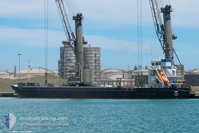
The vessel AYADA (IMO: 9268863, MMSI: 304639000) is a General Cargo that was built in 2005 ( 19 years old ). It's sailing under the flag of [AG] Antigua Barbuda.
In this page you can find informations about the vessels current position, last detected port calls, and current voyage information. If the vessels is not in coverage by AIS you will find the latest position.
The current position of AYADA is detected by our AIS receivers and we are not responsible for the reliability of the data. The last position was recorded while the vessel was in Coverage by the Ais receivers of our vessel tracking app.
The current draught of AYADA as reported by AIS is 6.3 meters
Weather
| Temperature | 18.3°C / 64.94°F |
|---|---|
| Wind Speed | 16 knots |
| Direction | 213° SSW |
| Pressure | 1009.4 hPa |
| Humidity | 82.1 % |
| Cloud Coverage | --- |
Featured Company
Last Port Calls
| Port | Arrival | Departure | Time In Port |
|---|---|---|---|
| 2024-05-07 05:28 | 2024-05-08 22:51 | 1 d | |
| 2024-04-30 13:08 | 2024-05-01 13:56 | 1 d | |
| 2024-04-28 02:48 | 2024-04-28 02:50 | 2 m | |
| 2024-04-22 19:50 | 2024-04-26 10:14 | 3 d | |
| 2024-03-27 15:21 | 2024-04-05 22:41 | 9 d | |
| 2024-03-20 12:44 | 2024-03-27 12:16 | 6 d | |
| 2024-03-20 03:12 |
Last Trips
| Origin | Departure | Destination | Arrival | Distance | |
|---|---|---|---|---|---|
| 2024-05-01 16:56 | 2024-05-07 07:28 | 877.85 nm | |||
| 2024-04-28 04:50 | 2024-04-30 16:08 | 559.83 nm | |||
| 2024-04-26 12:14 | 2024-04-28 04:48 | 347.60 nm | |||
| 2024-04-06 01:41 | 2024-04-22 21:50 | 3479.45 nm | |||
| 2024-03-27 15:16 | 2024-03-27 18:21 | 2.53 nm | |||
| 2024-03-20 06:12 | 2024-03-20 15:44 | 95.66 nm |
Events
| Time | Event | Details | Position / Dest | Info |
|---|---|---|---|---|
| 2024-05-16 23:49 | Status Changed | Default Under way using engine |
36.70634 / -.63293
NAPOLI
|
Speed: 9 kn Course: 74° |
| 2024-05-16 23:45 | OUT of Coverage |
36.70167 / -.64667
Mediterranean Sea - Western Basin
NAPOLI
|
Speed: 9 kn Course: 74° |
|
| 2024-05-16 23:36 | Detected in Sea | Algerian part of the Mediterranean Sea - Western Basin |
36.69667 / -.67500
Mediterranean Sea - Western Basin
NAPOLI
|
Speed: 9 kn Course: 73° |
| 2024-05-16 23:36 | Status Changed | Under way using engine Default |
36.69667 / -.67500
NAPOLI
|
Speed: 9.5 kn Course: 73° |
| 2024-05-16 23:36 | IN Coverage |
36.69667 / -.67500
Mediterranean Sea - Western Basin
NAPOLI
|
Speed: 9 kn Course: 73° |
|
| 2024-05-16 18:52 | Status Changed | Default Under way using engine |
36.49954 / -1.56446
NAPOLI
|
Speed: 8 kn Course: 75° |
| 2024-05-16 18:45 | OUT of Coverage |
36.49333 / -1.58667
Mediterranean Sea - Western Basin
NAPOLI
|
Speed: 8 kn Course: 75° |
|
| 2024-05-16 17:06 | Detected in Sea | Spanish part of the Mediterranean Sea - Western Basin |
36.42833 / -1.87000
Mediterranean Sea - Western Basin
NAPOLI
|
Speed: 8 kn Course: 75° |
| 2024-05-16 17:06 | Status Changed | Under way using engine Default |
36.42833 / -1.87000
NAPOLI
|
Speed: 8.6 kn Course: 77° |
| 2024-05-16 16:22 | Status Changed | Default Under way using engine |
36.40327 / -1.99611
NAPOLI
|
Speed: 8 kn Course: 73° |