
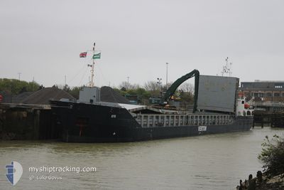
AYR
General Cargo
Current Trip
| Time Travelled | 2 days |
|---|---|
| Remaining Time | --- |
| Distance Travelled | 182.12 nm |
| Remaining Distance | 46.50 nm |
| AVG Speed | 10.8 Knots |
| MAX Speed | 14.2 Knots |
| AVG Wind | 10.4 knots |
| MAX Wind | 20 knots |
| MIN Temp | 10°C / 50°F |
| MAX Temp | 14.8°C / 58.64°F |
| Draught | 3.3 m |
| Position Received | 1 m ago |
Current Position
| Longitude | 3.34917° |
|---|---|
| Latitude | 51.76850° |
| Status | At anchor |
| Speed | 0.2 Knots |
| Course | 254° |
| Area | North Sea |
| Station | T-AIS |
| Position Received | 1 m ago |
Info
Information
The current position of AYR is in North Sea with coordinates 51.76850° / 3.34917° as reported on 2024-05-27 01:23 by AIS to our vessel tracker app. The vessel's current speed is 0.2 Knots and is heading at the port of GENT. The estimated time of arrival as calculated by vessel tracking app is 2024-05-25 15:00 LT
The vessel AYR (IMO: 9313711, MMSI: 253613000) is a General Cargo that was built in 2009 ( 15 years old ). It's sailing under the flag of [LU] Luxembourg.
In this page you can find informations about the vessels current position, last detected port calls, and current voyage information. If the vessels is not in coverage by AIS you will find the latest position.
The current position of AYR is detected by our AIS receivers and we are not responsible for the reliability of the data. The last position was recorded while the vessel was in Coverage by the Ais receivers of our vessel tracking app.
The current draught of AYR as reported by AIS is 3.3 meters
Weather
| Temperature | 13.8°C / 56.84°F |
|---|---|
| Wind Speed | 18 knots |
| Direction | 227° SW |
| Pressure | 1014.5 hPa |
| Humidity | 87.7 % |
| Cloud Coverage | 40 % |
Featured Company
Last Port Calls
| Port | Arrival | Departure | Time In Port |
|---|---|---|---|
| 2024-05-24 06:42 | 2024-05-24 21:23 | 14 h | |
| 2024-05-22 12:47 | 2024-05-23 04:11 | 15 h | |
| 2024-05-19 17:00 | 2024-05-22 12:16 | 2 d | |
| 2024-05-09 08:16 | 2024-05-14 13:30 | 5 d | |
| 2024-05-04 15:35 | 2024-05-07 18:37 | 3 d | |
| 2024-05-01 15:40 | 2024-05-01 17:02 | 1 h | |
| 2024-04-30 02:21 | 2024-05-01 15:05 | 1 d | |
| 2024-04-26 15:01 | 2024-04-30 01:56 | 3 d | |
| 2024-04-24 17:42 | 2024-04-25 18:56 | 1 d | |
| 2024-04-21 13:04 | 2024-04-23 14:09 | 2 d |
Last Trips
| Origin | Departure | Destination | Arrival | Distance | |
|---|---|---|---|---|---|
| 2024-05-23 06:11 | 2024-05-24 07:42 | 215.16 nm | |||
| 2024-05-22 14:16 | 2024-05-22 14:47 | 1.54 nm | |||
| 2024-05-14 14:30 | 2024-05-19 19:00 | 325.26 nm | |||
| 2024-05-07 19:37 | 2024-05-09 09:16 | 369.39 nm | |||
| 2024-05-01 19:02 | 2024-05-04 16:35 | 567.27 nm | |||
| 2024-05-01 17:05 | 2024-05-01 17:40 | 2.13 nm | |||
| 2024-04-30 03:56 | 2024-04-30 04:21 | 1.49 nm | |||
| 2024-04-25 19:56 | 2024-04-26 17:01 | 206.23 nm | |||
| 2024-04-23 15:09 | 2024-04-24 18:42 | 157.69 nm | |||
| 2024-04-19 01:47 | 2024-04-21 14:04 | 291.84 nm |
Events
| Time | Event | Details | Position / Dest | Info |
|---|---|---|---|---|
| 2024-05-26 10:32 | Status Changed | At anchor Default |
51.76750 / 3.34600
BEGNE
|
Speed: 0.1 kn Course: 44° |
| 2024-05-26 10:26 | Status Changed | Default At anchor |
51.76747 / 3.34621
BEGNE
|
Speed: 0.1 kn Course: 44° |
| 2024-05-26 10:20 | Status Changed | At anchor Default |
51.76750 / 3.34617
BEGNE
|
Speed: 0.1 kn Course: 47° |
| 2024-05-26 10:14 | Status Changed | Default At anchor |
51.76752 / 3.34607
BEGNE
|
Speed: Course: 45° |
| 2024-05-25 13:50 | Status Changed | At anchor Under way using engine |
51.76817 / 3.34850
BEGNE
|
Speed: 0.2 kn Course: 246° |
| 2024-05-25 13:50 | STOP Moving | 15.71 nm, North West of NEELTJE JANS |
51.76819 / 3.34845
BEGNE
|
Speed: 0.3 kn Course: 246° |
| 2024-05-25 10:52 | Change Sea Area | Dutch part of the North Sea United Kingdom part of the North Sea |
51.97367 / 2.62133
North Sea
BEGNE
|
Speed: 11.8 kn Course: 155.2° |
| 2024-05-25 10:11 | Status Changed | Under way using engine Default |
52.08302 / 2.49759
BEGNE
|
Speed: 11.8 kn Course: 144° |
| 2024-05-25 10:01 | IN Coverage |
52.08302 / 2.49759
North Sea
BEGNE
|
Speed: 11.6 kn Course: 143.3° |
|
| 2024-05-25 07:35 | OUT of Coverage |
52.53950 / 2.04550
North Sea
BEGNE
|
Speed: 12.6 kn Course: 149° |