
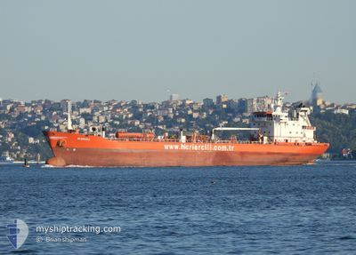
AYSENAZ
Oil/Chemical Tanker
Current Trip
| Time Travelled | 15 h, 51 mins |
|---|---|
| Remaining Time | 19 h, 28 mins |
| Distance Travelled | 55.11 nm |
| Remaining Distance | 148.13 nm |
| AVG Speed | 8.8 Knots |
| MAX Speed | 12 Knots |
| AVG Wind | 12.6 knots |
| MAX Wind | 16.5 knots |
| MIN Temp | 19.5°C / 67.1°F |
| MAX Temp | 24.7°C / 76.46°F |
| Draught | 4.4 m |
| Position Received | 14 m ago |
Current Position
| Longitude | 28.74949° |
|---|---|
| Latitude | 40.71050° |
| Status | Not under command |
| Speed | 0.6 Knots |
| Course | 125° |
| Area | Sea of Marmara |
| Station | T-AIS |
| Position Received | 14 m ago |
Info
Information
The current position of AYSENAZ is in Sea of Marmara with coordinates 40.71050° / 28.74949° as reported on 2024-06-26 10:03 by AIS to our vessel tracker app. The vessel's current speed is 0.6 Knots and is heading at the port of BURGAS. The estimated time of arrival as calculated by vessel tracking app is 2024-06-27 05:46 LT
The vessel AYSENAZ (IMO: 9034743, MMSI: 271044017) is a Oil/Chemical Tanker that was built in 1993 ( 31 years old ). It's sailing under the flag of [TR] Turkey.
In this page you can find informations about the vessels current position, last detected port calls, and current voyage information. If the vessels is not in coverage by AIS you will find the latest position.
The current position of AYSENAZ is detected by our AIS receivers and we are not responsible for the reliability of the data. The last position was recorded while the vessel was in Coverage by the Ais receivers of our vessel tracking app.
The current draught of AYSENAZ as reported by AIS is 4.4 meters
Weather
| Temperature | 24.9°C / 76.82°F |
|---|---|
| Wind Speed | 18 knots |
| Direction | 42° NE |
| Pressure | 1014.6 hPa |
| Humidity | 62.7 % |
| Cloud Coverage | --- |
Featured Company
Last Port Calls
| Port | Arrival | Departure | Time In Port |
|---|---|---|---|
| 2024-06-24 05:56 | 2024-06-25 18:27 | 1 d | |
| 2024-06-22 11:05 | 2024-06-23 08:21 | 21 h | |
| 2024-06-18 15:11 | 2024-06-21 15:09 | 2 d | |
| 2024-06-14 12:49 | 2024-06-15 12:17 | 23 h | |
| 2024-06-10 06:27 | 2024-06-12 21:39 | 2 d | |
| 2024-06-07 12:17 | 2024-06-08 12:57 | 1 d | |
| 2024-06-04 03:21 | 2024-06-06 02:06 | 1 d | |
| 2024-06-03 06:09 | 2024-06-03 20:15 | 14 h | |
| 2024-05-30 23:34 | 2024-06-01 13:53 | 1 d | |
| 2024-05-26 01:45 | 2024-05-28 14:25 | 2 d |
Last Trips
| Origin | Departure | Destination | Arrival | Distance | |
|---|---|---|---|---|---|
| 2024-06-23 11:21 | 2024-06-24 08:56 | 187.26 nm | |||
| 2024-06-21 18:09 | 2024-06-22 14:05 | 195.04 nm | |||
| 2024-06-15 15:17 | 2024-06-18 18:11 | 201.21 nm | |||
| 2024-06-13 00:39 | 2024-06-14 15:49 | 214.19 nm | |||
| 2024-06-08 15:57 | 2024-06-10 09:27 | 204.14 nm | |||
| 2024-06-06 05:06 | 2024-06-07 15:17 | 217.45 nm | |||
| 2024-06-03 23:15 | 2024-06-04 06:21 | 12.59 nm | |||
| 2024-06-01 16:53 | 2024-06-03 09:09 | 263.51 nm | |||
| 2024-05-28 17:25 | 2024-05-31 02:34 | 303.60 nm | |||
| 2024-05-24 15:41 | 2024-05-26 04:45 | 215.79 nm |
Events
| Time | Event | Details | Position / Dest | Info |
|---|---|---|---|---|
| 2024-06-26 10:09 | Status Changed | Default Not under command |
40.70967 / 28.74854
TRIZT>BGBOJ
|
Speed: 0.6 kn Course: 125° |
| 2024-06-26 09:45 | Status Changed | Not under command Default |
40.71324 / 28.75415
TRIZT>BGBOJ
|
Speed: 1 kn Course: 140° |
| 2024-06-26 09:45 | IN Coverage |
40.71324 / 28.75415
Sea of Marmara
TRIZT>BGBOJ
|
Speed: 1 kn Course: 232.3° |
|
| 2024-06-26 09:03 | Status Changed | Default Not under command |
40.71994 / 28.76778
TRIZT>BGBOJ
|
Speed: 1 kn Course: 150° |
| 2024-06-26 08:42 | Status Changed | Not under command Default |
40.72284 / 28.77520
TRIZT>BGBOJ
|
Speed: 0.9 kn Course: 153° |
| 2024-06-26 08:42 | OUT of Coverage |
40.72284 / 28.77520
Sea of Marmara
TRIZT>BGBOJ
|
Speed: 1 kn Course: 241° |
|
| 2024-06-26 08:24 | Status Changed | Default Not under command |
40.72526 / 28.78150
TRIZT>BGBOJ
|
Speed: 1 kn Course: 154° |
| 2024-06-26 08:00 | Status Changed | Not under command Default |
40.72847 / 28.79014
TRIZT>BGBOJ
|
Speed: 1.1 kn Course: 154° |
| 2024-06-26 07:42 | Status Changed | Default Not under command |
40.73168 / 28.79680
TRIZT>BGBOJ
|
Speed: 1.2 kn Course: 148° |
| 2024-06-26 07:27 | Status Changed | Not under command Default |
40.73456 / 28.80270
TRIZT>BGBOJ
|
Speed: 1.3 kn Course: 150° |