
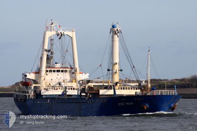
AYSHA M
General Cargo
Current Trip
| Trip Time | 4 days |
|---|---|
| Trip Distance | 84.13 nm |
| AVG Speed | 7.3 Knots |
| MAX Speed | 11.2 Knots |
| Draught | 6.4 m |
| AVG Wind | 11.5 knots |
| MAX Wind | 19.8 knots |
| MIN Temp | 18.6°C / 65.48°F |
| MAX Temp | 34°C / 93.2°F |
| Position Received | 7 d ago |
Current Position
| Longitude | 29.46425° |
|---|---|
| Latitude | 44.16187° |
| Status | Under way using engine |
| Speed | 9.3 Knots |
| Course | 29.9° |
| Area | Black Sea |
| Station | T-AIS |
| Position Received | 7 d ago |
Info
Information
The current position of AYSHA M is in Black Sea with coordinates 44.16187° / 29.46425° as reported on 2024-06-19 07:11 by AIS to our vessel tracker app. The vessel's current speed is 9.3 Knots and is currently inside the port of BRAILA.
The vessel AYSHA M (IMO: 8511146, MMSI: 620050000) is a General Cargo that was built in 1985 ( 39 years old ). It's sailing under the flag of [KM] Comoros.
In this page you can find informations about the vessels current position, last detected port calls, and current voyage information. If the vessels is not in coverage by AIS you will find the latest position.
The current position of AYSHA M is detected by our AIS receivers and we are not responsible for the reliability of the data. The last position was recorded while the vessel was in Coverage by the Ais receivers of our vessel tracking app.
The current draught of AYSHA M as reported by AIS is 6.4 meters
Weather
| Temperature | 28.4°C / 83.12°F |
|---|---|
| Wind Speed | 7 knots |
| Direction | 61° ENE |
| Pressure | 1018 hPa |
| Humidity | 36.7 % |
| Cloud Coverage | 69 % |
Featured Company
Last Port Calls
| Port | Arrival | Departure | Time In Port |
|---|---|---|---|
| 2024-06-24 13:23 | |||
| 2024-06-19 15:01 | 2024-06-20 03:05 | 12 h | |
| 2024-06-08 12:15 | 2024-06-14 05:07 | 5 d | |
| 2024-06-02 10:13 | 2024-06-02 10:42 | 29 m | |
| 2024-04-28 07:20 | 2024-04-28 08:50 | 1 h | |
| 2024-04-25 12:19 | 2024-04-26 05:54 | 17 h | |
| 2024-04-25 12:00 | 2024-04-25 12:11 | 10 m | |
| 2024-04-24 04:31 | 2024-04-25 11:50 | 1 d | |
| 2024-04-24 04:08 | 2024-04-24 04:24 | 16 m | |
| 2024-04-22 15:20 | 2024-04-24 04:04 | 1 d |
Last Trips
| Origin | Departure | Destination | Arrival | Distance | |
|---|---|---|---|---|---|
| 2024-06-20 06:05 | 2024-06-24 16:23 | 84.13 nm | |||
| 2024-06-14 08:07 | 2024-06-19 18:01 | 995.90 nm | |||
| 2024-06-02 13:42 | 2024-06-08 15:15 | 960.57 nm | |||
| 2024-04-28 11:50 | 2024-06-02 13:13 | 1445.60 nm | |||
| 2024-04-26 08:54 | 2024-04-28 10:20 | 347.99 nm | |||
| 2024-04-25 15:11 | 2024-04-25 15:19 | 1.97 nm | |||
| 2024-04-25 14:50 | 2024-04-25 15:00 | 4.88 nm | |||
| 2024-04-24 07:24 | 2024-04-24 07:31 | 0.70 nm | |||
| 2024-04-24 07:04 | 2024-04-24 07:08 | 0.45 nm | |||
| 2024-04-22 18:18 | 2024-04-22 18:20 | 1.56 nm |
Events
| Time | Event | Details | Position / Dest | Info |
|---|---|---|---|---|
| 2024-06-24 13:23 | STOP Moving |
45.28698 / 27.99158
[RO] BRAILA
|
Speed: Course: 206° |
|
| 2024-06-24 13:23 | PORT ARRIVAL |
|
45.28698 / 27.99158
[RO] BRAILA
|
Speed: 2.5 kn Course: 195° |
| 2024-06-24 12:38 | START Moving | 2.28 nm, North of BRAILA |
45.30155 / 27.99727
RO BRA
|
Speed: 4.4 kn Course: 183° |
| 2024-06-20 15:38 | STOP Moving | 2.61 nm, North of BRAILA |
45.30658 / 28.00035
RO BRA
|
Speed: 0.2 kn Course: 221° |
| 2024-06-20 03:05 | PORT DEPARTURE |
|
45.16692 / 29.58520
RO BRA
|
Speed: 7.9 kn Course: 298° |
| 2024-06-20 02:37 | START Moving |
45.15723 / 29.65429
[RO] SULINA
|
Speed: 4.3 kn Course: 278° |
|
| 2024-06-19 15:01 | STOP Moving |
45.15707 / 29.65841
[RO] SULINA
|
Speed: Course: 271° |
|
| 2024-06-19 15:01 | PORT ARRIVAL |
|
45.15707 / 29.65841
[RO] SULINA
|
Speed: 0.8 kn Course: 276° |
| 2024-06-19 13:44 | START Moving | 7.17 nm, East of SULINA |
45.12324 / 29.80968
RO BRA
|
Speed: 3.9 kn Course: 322° |
| 2024-06-19 13:37 | STOP Moving | 7.45 nm, East of SULINA |
45.12065 / 29.81541
RO BRA
|
Speed: 0.2 kn Course: 294° |