
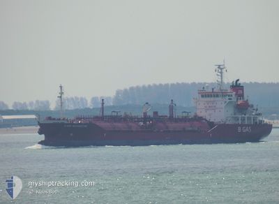
B GAS MARGRETHE
Lpg Tanker
Current Trip
| Time Travelled | 7 days |
|---|---|
| Remaining Time | 1 day |
| Distance Travelled | 227.11 nm |
| Remaining Distance | 314.08 nm |
| AVG Speed | 9.4 Knots |
| MAX Speed | 13.9 Knots |
| AVG Wind | 16.2 knots |
| MAX Wind | 34.8 knots |
| MIN Temp | 10.8°C / 51.44°F |
| MAX Temp | 14.8°C / 58.64°F |
| Draught | 4.6 m |
| Position Received | 1 m ago |
Current Position
| Longitude | -0.12083° |
|---|---|
| Latitude | 50.49146° |
| Status | Under way using engine |
| Speed | 12.4 Knots |
| Course | 256.5° |
| Area | English Channel |
| Station | T-AIS |
| Position Received | 1 m ago |
Info
Information
The current position of B GAS MARGRETHE is in English Channel with coordinates 50.49146° / -0.12083° as reported on 2024-06-13 03:52 by AIS to our vessel tracker app. The vessel's current speed is 12.4 Knots and is heading at the port of PEMBROKE. The estimated time of arrival as calculated by vessel tracking app is 2024-06-14 07:33 LT
The vessel B GAS MARGRETHE (IMO: 9346407, MMSI: 249810000) is a Lpg Tanker that was built in 2006 ( 18 years old ). It's sailing under the flag of [MT] Malta.
In this page you can find informations about the vessels current position, last detected port calls, and current voyage information. If the vessels is not in coverage by AIS you will find the latest position.
The current position of B GAS MARGRETHE is detected by our AIS receivers and we are not responsible for the reliability of the data. The last position was recorded while the vessel was in Coverage by the Ais receivers of our vessel tracking app.
The current draught of B GAS MARGRETHE as reported by AIS is 4.6 meters
Weather
| Temperature | 13.8°C / 56.84°F |
|---|---|
| Wind Speed | 9 knots |
| Direction | 226° SW |
| Pressure | 1017.8 hPa |
| Humidity | 74.9 % |
| Cloud Coverage | 68 % |
Featured Company
Last Port Calls
| Port | Arrival | Departure | Time In Port |
|---|---|---|---|
| 2024-06-04 00:49 | 2024-06-05 08:11 | 1 d | |
| 2024-05-29 12:17 | 2024-06-01 14:41 | 3 d | |
| 2024-05-27 00:08 | 2024-05-28 07:51 | 1 d | |
| 2024-05-22 20:57 | 2024-05-23 19:41 | 22 h | |
| 2024-05-21 06:18 | 2024-05-21 23:17 | 16 h | |
| 2024-05-16 01:52 | 2024-05-16 22:13 | 20 h | |
| 2024-05-13 07:18 | 2024-05-14 02:19 | 19 h | |
| 2024-05-11 04:57 | 2024-05-12 00:37 | 19 h | |
| 2024-05-08 08:37 | 2024-05-09 10:00 | 1 d | |
| 2024-05-05 08:37 | 2024-05-06 08:29 | 23 h |
Last Trips
| Origin | Departure | Destination | Arrival | Distance | |
|---|---|---|---|---|---|
| 2024-06-01 15:41 | 2024-06-04 02:49 | 522.62 nm | |||
| 2024-05-28 08:51 | 2024-05-29 13:17 | 134.42 nm | |||
| 2024-05-23 20:41 | 2024-05-27 01:08 | 725.53 nm | |||
| 2024-05-22 01:17 | 2024-05-22 21:57 | 278.46 nm | |||
| 2024-05-17 00:13 | 2024-05-21 08:18 | 558.90 nm | |||
| 2024-05-14 04:19 | 2024-05-16 03:52 | 386.00 nm | |||
| 2024-05-12 02:37 | 2024-05-13 09:18 | 381.70 nm | |||
| 2024-05-09 12:00 | 2024-05-11 06:57 | 566.73 nm | |||
| 2024-05-06 10:29 | 2024-05-08 10:37 | 574.03 nm | |||
| 2024-04-29 12:07 | 2024-05-05 10:37 | 411.73 nm |
Events
| Time | Event | Details | Position / Dest | Info |
|---|---|---|---|---|
| 2024-06-13 01:38 | Status Changed | Under way using engine Default |
50.61366 / .52567
PEMBROKE (UK)
|
Speed: 10.8 kn Course: 253° |
| 2024-06-13 01:25 | Status Changed | Default Under way using engine |
50.62648 / .58205
PEMBROKE (UK)
|
Speed: 11 kn Course: 246.9° |
| 2024-06-13 01:20 | Status Changed | Under way using engine Default |
50.63221 / .60422
PEMBROKE (UK)
|
Speed: 10.9 kn Course: 247° |
| 2024-06-13 01:01 | Status Changed | Default Under way using engine |
50.66437 / .67999
PEMBROKE (UK)
|
Speed: 11.1 kn Course: 228.8° |
| 2024-06-13 00:56 | Status Changed | Under way using engine Default |
50.67430 / .69880
PEMBROKE (UK)
|
Speed: 11.1 kn Course: 231° |
| 2024-06-13 00:41 | Status Changed | Default Under way using engine |
50.70436 / .75568
PEMBROKE (UK)
|
Speed: 11.3 kn Course: 233.1° |
| 2024-06-13 00:27 | Status Changed | Under way using engine Default |
50.73249 / .81390
PEMBROKE (UK)
|
Speed: 11.5 kn Course: 233° |
| 2024-06-13 00:21 | Status Changed | Default Under way using engine |
50.74250 / .83596
PEMBROKE (UK)
|
Speed: 11.6 kn Course: 235.3° |
| 2024-06-12 22:18 | Draught Changed | 4.6 4.7 |
51.02365 / 1.38026
PEMBROKE (UK)
|
Speed: 13.8 kn Course: 232.5° |
| 2024-06-12 21:58 | Change Sea Area | United Kingdom part of the English Channel United Kingdom part of the North Sea |
51.07023 / 1.47096
English Channel
PEMBROKE (UK)
|
Speed: 13.3 kn Course: 233.2° |