
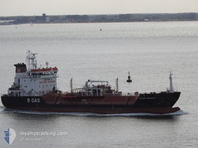
B GAS MARINER
Lpg Tanker
Current Trip
| Time Travelled | 3 days |
|---|---|
| Remaining Time | 5 h, 26 mins |
| Distance Travelled | 433.03 nm |
| Remaining Distance | 67.00 nm |
| AVG Speed | 10.2 Knots |
| MAX Speed | 12.5 Knots |
| AVG Wind | 18.8 knots |
| MAX Wind | 28.5 knots |
| MIN Temp | 9.7°C / 49.46°F |
| MAX Temp | 13.5°C / 56.3°F |
| Draught | 5.3 m |
| Position Received | Now |
Current Position
| Longitude | 9.67595° |
|---|---|
| Latitude | 57.86142° |
| Status | Under way using engine |
| Speed | 10.7 Knots |
| Course | 64.1° |
| Area | Skaggerak |
| Station | T-AIS |
| Position Received | Now |
Info
Information
The current position of B GAS MARINER is in Skaggerak with coordinates 57.86142° / 9.67595° as reported on 2024-06-09 02:10 by AIS to our vessel tracker app. The vessel's current speed is 10.7 Knots and is heading at the port of BROFJORDEN. The estimated time of arrival as calculated by vessel tracking app is 2024-06-09 07:37 LT
The vessel B GAS MARINER (IMO: 9344198, MMSI: 215064000) is a Lpg Tanker that was built in 2007 ( 17 years old ). It's sailing under the flag of [MT] Malta.
In this page you can find informations about the vessels current position, last detected port calls, and current voyage information. If the vessels is not in coverage by AIS you will find the latest position.
The current position of B GAS MARINER is detected by our AIS receivers and we are not responsible for the reliability of the data. The last position was recorded while the vessel was in Coverage by the Ais receivers of our vessel tracking app.
The current draught of B GAS MARINER as reported by AIS is 5.3 meters
Weather
| Temperature | 11.6°C / 52.88°F |
|---|---|
| Wind Speed | 29 knots |
| Direction | 252° WSW |
| Pressure | 997.6 hPa |
| Humidity | 64.7 % |
| Cloud Coverage | 81 % |
Featured Company
Last Port Calls
| Port | Arrival | Departure | Time In Port |
|---|---|---|---|
| 2024-06-04 04:55 | 2024-06-05 10:22 | 1 d | |
| 2024-05-30 15:33 | 2024-05-31 09:23 | 17 h | |
| 2024-05-27 20:10 | 2024-05-28 12:46 | 16 h | |
| 2024-05-24 18:22 | 2024-05-26 00:10 | 1 d | |
| 2024-05-19 03:15 | 2024-05-19 17:16 | 14 h | |
| 2024-05-16 13:22 | 2024-05-17 08:13 | 18 h | |
| 2024-05-12 18:59 | 2024-05-13 14:11 | 19 h | |
| 2024-05-06 09:06 | 2024-05-07 14:07 | 1 d | |
| 2024-04-27 16:43 | 2024-04-28 16:20 | 23 h | |
| 2024-04-19 13:58 | 2024-04-21 02:37 | 1 d |
Last Trips
| Origin | Departure | Destination | Arrival | Distance | |
|---|---|---|---|---|---|
| 2024-05-31 11:23 | 2024-06-04 05:55 | 502.53 nm | |||
| 2024-05-28 14:46 | 2024-05-30 17:33 | 462.72 nm | |||
| 2024-05-26 02:10 | 2024-05-27 22:10 | 466.23 nm | |||
| 2024-05-19 19:16 | 2024-05-24 20:22 | 466.73 nm | |||
| 2024-05-17 10:13 | 2024-05-19 05:15 | 467.29 nm | |||
| 2024-05-13 16:11 | 2024-05-16 15:22 | 464.23 nm | |||
| 2024-05-07 16:07 | 2024-05-12 20:59 | 467.88 nm | |||
| 2024-04-28 18:20 | 2024-05-06 11:06 | 564.59 nm | |||
| 2024-04-21 04:37 | 2024-04-27 18:43 | 575.25 nm | |||
| 2024-04-17 23:54 | 2024-04-19 15:58 | 468.19 nm |
Events
| Time | Event | Details | Position / Dest | Info |
|---|---|---|---|---|
| 2024-06-08 21:10 | Change Sea Area | Danish part of the Skaggerak Danish part of the North Sea |
57.40065 / 8.12302
Skaggerak
GB IMM > SE BRO
|
Speed: 11.5 kn Course: 62.8° |
| 2024-06-08 16:40 | Status Changed | Under way using engine Default |
57.02850 / 6.92696
GB IMM > SE BRO
|
Speed: 9.9 kn Course: 62° |
| 2024-06-08 16:32 | Status Changed | Default Under way using engine |
57.01775 / 6.89401
GB IMM > SE BRO
|
Speed: 9.6 kn Course: 59.8° |
| 2024-06-08 16:19 | Status Changed | Under way using engine Default |
56.99980 / 6.84105
GB IMM > SE BRO
|
Speed: 9.5 kn Course: 55° |
| 2024-06-08 16:02 | IN Coverage |
56.99980 / 6.84105
North Sea
GB IMM > SE BRO
|
Speed: 9.6 kn Course: 59.8° |
|
| 2024-06-08 09:29 | Status Changed | Default Under way using engine |
56.39630 / 5.23713
GB IMM > SE BRO
|
Speed: 9.4 kn Course: 50.7° |
| 2024-06-08 09:25 | OUT of Coverage |
56.39048 / 5.22293
North Sea
GB IMM > SE BRO
|
Speed: 9.4 kn Course: 50.7° |
|
| 2024-06-08 03:14 | Change Sea Area | Danish part of the North Sea German part of the North Sea |
55.84062 / 3.83483
North Sea
GB IMM > SE BRO
|
Speed: 9.1 kn Course: 51.3° |
| 2024-06-08 03:02 | Change Sea Area | German part of the North Sea United Kingdom part of the North Sea |
55.82195 / 3.79214
North Sea
GB IMM > SE BRO
|
Speed: 9 kn Course: 48.4° |
| 2024-06-08 02:59 | Status Changed | Under way using engine Default |
55.81691 / 3.78431
GB IMM > SE BRO
|
Speed: 9 kn Course: 36° |