
BABA'S
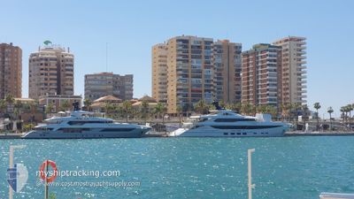
Pleasure Craft
Current Trip
| Trip Time | 2 days |
|---|---|
| Trip Distance | 503.16 nm |
| AVG Speed | 9.7 Knots |
| MAX Speed | 14.2 Knots |
| Draught | 3 m |
| AVG Wind | 11.8 knots |
| MAX Wind | 20 knots |
| MIN Temp | 20.2°C / 68.36°F |
| MAX Temp | 25.4°C / 77.72°F |
| Position Received | 2 m ago |
Current Position
| Longitude | 1.73128° |
|---|---|
| Latitude | 41.21185° |
| Status | Moored |
| Speed | |
| Course | 75° |
| Area | Balearic Sea |
| Station | T-AIS |
| Position Received | 2 m ago |
Info
Information
The current position of BABA'S is in Balearic Sea with coordinates 41.21185° / 1.73128° as reported on 2024-06-13 05:19 by AIS to our vessel tracker app. The vessel's current speed is 0 Knots and is currently inside the port of VILANOVA.
The vessel BABA'S (IMO: 9822607, MMSI: 339861000) is a Pleasure Craft It's sailing under the flag of [JM] Jamaica.
In this page you can find informations about the vessels current position, last detected port calls, and current voyage information. If the vessels is not in coverage by AIS you will find the latest position.
The current position of BABA'S is detected by our AIS receivers and we are not responsible for the reliability of the data. The last position was recorded while the vessel was in Coverage by the Ais receivers of our vessel tracking app.
The current draught of BABA'S as reported by AIS is 3 meters
Weather
| Temperature | 15.3°C / 59.54°F |
|---|---|
| Wind Speed | 4 knots |
| Direction | 333° NNW |
| Pressure | 1019.7 hPa |
| Humidity | 79.8 % |
| Cloud Coverage | 1 % |
Featured Company
Last Port Calls
| Port | Arrival | Departure | Time In Port |
|---|---|---|---|
| 2024-06-08 20:00 | |||
| 2024-06-06 08:22 | 2024-06-06 14:04 | 5 h | |
| 2024-05-13 13:50 | 2024-05-20 17:45 | 7 d | |
| 2024-05-12 15:16 | 2024-05-12 20:46 | 5 h | |
| 2024-05-05 13:06 | |||
| 2024-04-13 16:56 | 2024-04-23 15:25 | 9 d | |
| 2024-04-06 00:52 |
Most Visited Ports (Last year)
| Port | Arrivals | |
|---|---|---|
| 9 | ||
| 4 | ||
| 2 | ||
| 2 | ||
| 2 | ||
| 2 |
Last Trips
| Origin | Departure | Destination | Arrival | Distance | |
|---|---|---|---|---|---|
| 2024-06-06 16:04 | 2024-06-08 22:00 | 503.16 nm | |||
| 2024-05-20 13:45 | 2024-06-06 10:22 | 3872.65 nm | |||
| 2024-05-12 16:46 | 2024-05-13 09:50 | 176.04 nm | |||
| 2024-05-05 09:06 | 2024-05-12 11:16 | 85.81 nm | |||
| 2024-04-05 20:52 | 2024-04-13 12:56 | 210.39 nm |
Events
| Time | Event | Details | Position / Dest | Info |
|---|---|---|---|---|
| 2024-06-08 20:34 | Status Changed | Moored Under way using engine |
41.21187 / 1.73129
[ES] VILANOVA
|
Speed: Course: 70° |
| 2024-06-08 20:08 | STOP Moving |
41.21223 / 1.73241
[ES] VILANOVA
|
Speed: 0.3 kn Course: 70° |
|
| 2024-06-08 20:00 | PORT ARRIVAL |
|
41.20653 / 1.72870
[ES] VILANOVA
|
Speed: 5.7 kn Course: 44.2° |
| 2024-06-08 19:11 | ETA Changed | 2024/06/08 19:00 2024/06/08 18:00 |
41.06041 / 1.68318
VILLANOVA
|
Speed: 12.7 kn Course: 20.5° |
| 2024-06-08 18:01 | IN Coverage |
40.83022 / 1.55865
Balearic Sea
VILLANOVA
|
Speed: 12.7 kn Course: 23.8° |
|
| 2024-06-08 07:54 | OUT of Coverage |
38.89353 / .56320
Balearic Sea
VILLANOVA
|
Speed: 12 kn Course: 27° |
|
| 2024-06-08 07:25 | Detected in Sea | Spanish part of the Balearic Sea |
38.80377 / .51599
Balearic Sea
VILLANOVA
|
Speed: 11.7 kn Course: 20.3° |
| 2024-06-08 07:25 | IN Coverage |
38.80377 / .51599
Balearic Sea
VILLANOVA
|
Speed: 11.7 kn Course: 20.3° |
|
| 2024-06-08 05:55 | OUT of Coverage |
38.54454 / .31477
Mediterranean Sea - Western Basin
VILLANOVA
|
Speed: 12.5 kn Course: 44° |
|
| 2024-06-08 00:10 | ETA Changed | 2024/06/08 18:00 |
37.74521 / -.37517
VILLANOVA
|
Speed: 7.9 kn Course: 347° |