
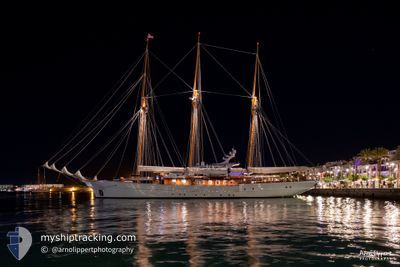
BABOON
Sailing
Current Trip
LEVANTO
Unknown Port
ETA*
2024-06-28 15:00 UTC
| Time Travelled | 2 days |
|---|---|
| Remaining Time | --- |
| Distance Travelled | 106.29 nm |
| Remaining Distance | --- |
| AVG Speed | 9.9 Knots |
| MAX Speed | 11.6 Knots |
| AVG Wind | 4.3 knots |
| MAX Wind | 9.2 knots |
| MIN Temp | 19.6°C / 67.28°F |
| MAX Temp | 25.4°C / 77.72°F |
| Draught | 0 m |
| Position Received | 9 h, 33 m ago |
Current Position
| Longitude | 9.59375° |
|---|---|
| Latitude | 44.16245° |
| Status | At anchor |
| Speed | 0.1 Knots |
| Course | 234° |
| Area | Ligurian Sea |
| Station | T-AIS |
| Position Received | 9 h, 33 m ago |
Info
info
Information
The current position of BABOON is in Ligurian Sea with coordinates 44.16245° / 9.59375° as reported on 2024-06-28 18:11 by AIS to our vessel tracker app. The vessel's current speed is 0.1 Knots
The vessel BABOON (MMSI: 378352000) is a Sailing It's sailing under the flag of [VG] British Virgin Is.
In this page you can find informations about the vessels current position, last detected port calls, and current voyage information. If the vessels is not in coverage by AIS you will find the latest position.
The current position of BABOON is detected by our AIS receivers and we are not responsible for the reliability of the data. The last position was recorded while the vessel was in Coverage by the Ais receivers of our vessel tracking app.
Weather
| Temperature | 21.9°C / 71.42°F |
|---|---|
| Wind Speed | 2 knots |
| Direction | 299° WNW |
| Pressure | 1017.2 hPa |
| Humidity | 82 % |
| Cloud Coverage | 20 % |
Featured Company
Limited time offer - Install a base station receiver to your area and list your company on Free forever!
Most Visited Ports (Last year)
| Port | Arrivals | |
|---|---|---|
| 12 |
Events
| Time | Event | Details | Position / Dest | Info |
|---|---|---|---|---|
| 2024-06-28 18:11 | OUT of Coverage |
44.16245 / 9.59375
Ligurian Sea
LEVANTO
|
Speed: 0.1 kn Course: 147.5° |
|
| 2024-06-28 16:23 | IN Coverage |
44.16262 / 9.59350
Ligurian Sea
LEVANTO
|
Speed: 0.1 kn Course: 330.8° |
|
| 2024-06-28 14:50 | OUT of Coverage |
44.16243 / 9.59347
Ligurian Sea
LEVANTO
|
Speed: Course: 300.7° |
|
| 2024-06-28 14:23 | IN Coverage |
44.16252 / 9.59353
Ligurian Sea
LEVANTO
|
Speed: Course: 267.8° |
|
| 2024-06-28 13:05 | OUT of Coverage |
44.16262 / 9.59348
Ligurian Sea
LEVANTO
|
Speed: Course: 267.8° |
|
| 2024-06-28 13:05 | Status Changed | At anchor Under way using engine |
44.16262 / 9.59348
LEVANTO
|
Speed: 0.1 kn Course: 215° |
| 2024-06-28 12:51 | IN Coverage |
44.16262 / 9.59352
Ligurian Sea
LEVANTO
|
Speed: 0.1 kn Course: 267.8° |
|
| 2024-06-28 11:07 | OUT of Coverage |
44.15825 / 9.57893
Ligurian Sea
LEVANTO
|
Speed: 4.8 kn Course: 59.1° |
|
| 2024-06-28 10:12 | Destination Changed | LEVANTO PORTOFINO |
44.21917 / 9.41525
LEVANTO
|
Speed: 10.3 kn Course: 127.2° |
| 2024-06-28 10:12 | ETA Changed | 2024/06/28 15:00 2024/06/26 16:00 |
44.21917 / 9.41525
LEVANTO
|
Speed: 10.3 kn Course: 127.2° |