
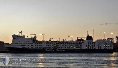
BAHIJAH
Livestock Carrier
Current Trip
| Trip Time | 7 days |
|---|---|
| Trip Distance | 708.51 nm |
| AVG Speed | 12.4 Knots |
| MAX Speed | 16.7 Knots |
| Draught | 6.6 m |
| AVG Wind | 12.3 knots |
| MAX Wind | 21.6 knots |
| MIN Temp | 15.4°C / 59.72°F |
| MAX Temp | 20°C / 68°F |
| Position Received | 5 d ago |
Current Position
| Longitude | -6.27972° |
|---|---|
| Latitude | 36.52807° |
| Status | Moored |
| Speed | |
| Course | 283° |
| Area | North Atlantic Ocean |
| Station | T-AIS |
| Position Received | 5 d ago |
Info
Information
The current position of BAHIJAH is in North Atlantic Ocean with coordinates 36.52807° / -6.27972° as reported on 2024-05-18 11:05 by AIS to our vessel tracker app. The vessel's current speed is 0 Knots and is currently inside the port of CADIZ.
The vessel BAHIJAH (IMO: 9360788, MMSI: 538007603) is a Livestock Carrier that was built in 2010 ( 14 years old ). It's sailing under the flag of [MH] Marshall Is.
In this page you can find informations about the vessels current position, last detected port calls, and current voyage information. If the vessels is not in coverage by AIS you will find the latest position.
The current position of BAHIJAH is detected by our AIS receivers and we are not responsible for the reliability of the data. The last position was recorded while the vessel was in Coverage by the Ais receivers of our vessel tracking app.
The current draught of BAHIJAH as reported by AIS is 6.6 meters
Weather
| Temperature | 19°C / 66.2°F |
|---|---|
| Wind Speed | 12 knots |
| Direction | 287° WNW |
| Pressure | 1013.7 hPa |
| Humidity | 55.8 % |
| Cloud Coverage | 1 % |
Featured Company
Last Port Calls
| Port | Arrival | Departure | Time In Port |
|---|---|---|---|
| 2024-05-18 10:15 | |||
| 2024-05-07 18:08 | 2024-05-10 16:40 | 2 d | |
| 2024-05-06 05:34 | 2024-05-07 17:43 | 1 d | |
| 2024-04-26 23:34 | 2024-04-27 01:36 | 2 h | |
| 2024-04-17 07:29 | 2024-04-19 20:45 | 2 d | |
| 2024-04-06 17:02 | |||
| 2024-03-28 19:31 | 2024-03-29 11:24 | 15 h | |
| 2024-03-03 07:58 |
Most Visited Ports (Last year)
| Port | Arrivals | |
|---|---|---|
| 9 | ||
| 5 | ||
| 4 | ||
| 3 | ||
| 3 | ||
| 1 |
Last Trips
| Origin | Departure | Destination | Arrival | Distance | |
|---|---|---|---|---|---|
| 2024-05-10 17:40 | 2024-05-18 12:15 | 708.51 nm | |||
| 2024-05-07 18:43 | 2024-05-07 19:08 | 4.08 nm | |||
| 2024-04-27 04:36 | 2024-05-06 06:34 | 2840.33 nm | |||
| 2024-04-19 21:45 | 2024-04-27 02:34 | 2434.67 nm | |||
| 2024-03-29 11:24 | 2024-04-06 20:02 | 2942.53 nm | |||
| 2024-03-03 15:58 | 2024-03-28 19:31 | 9465.37 nm |
Events
| Time | Event | Details | Position / Dest | Info |
|---|---|---|---|---|
| 2024-05-18 11:05 | OUT of Coverage |
36.52807 / -6.27972
North Atlantic Ocean
[ES] CADIZ
|
Speed: Course: 51° |
|
| 2024-05-18 10:53 | Status Changed | Moored Under way using engine |
36.52802 / -6.27978
[ES] CADIZ
|
Speed: Course: 282° |
| 2024-05-18 10:43 | STOP Moving |
36.52792 / -6.27925
[ES] CADIZ
|
Speed: 0.3 kn Course: 284° |
|
| 2024-05-18 10:15 | PORT ARRIVAL |
|
36.53750 / -6.26712
[ES] CADIZ
|
Speed: 4.7 kn Course: 160° |
| 2024-05-18 09:07 | Status Changed | Under way using engine Default |
36.55032 / -6.34293
ESCAD
|
Speed: 1.1 kn Course: 355° |
| 2024-05-18 09:06 | Status Changed | Default Under way using engine |
36.55008 / -6.34318
ESCAD
|
Speed: 1.2 kn Course: 7° |
| 2024-05-18 07:16 | Draught Changed | 6.6 7.4 |
36.20615 / -6.38835
ESCAD
|
Speed: 14.8 kn Course: 351° |
| 2024-05-18 07:16 | ETA Changed | 2024/05/18 09:30 2024/05/12 15:00 |
36.20615 / -6.38835
ESCAD
|
Speed: 14.8 kn Course: 351° |
| 2024-05-18 07:03 | Status Changed | Under way using engine Default |
36.15910 / -6.36817
ESCAD
|
Speed: 13.4 kn Course: 327° |
| 2024-05-18 07:02 | Status Changed | Default Under way using engine |
36.15365 / -6.36438
ESCAD
|
Speed: 11 kn Course: 323° |