
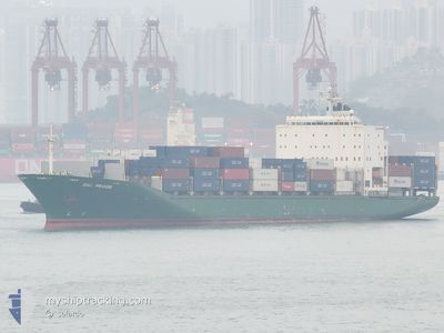
BAL PEACE
Container Ship
Current Trip
| Time Travelled | 4 days |
|---|---|
| Remaining Time | 20 h, 46 mins |
| Distance Travelled | 1079.94 nm |
| Remaining Distance | 347.13 nm |
| AVG Speed | 11.5 Knots |
| MAX Speed | 16.7 Knots |
| AVG Wind | 8.9 knots |
| MAX Wind | 19.6 knots |
| MIN Temp | 24.6°C / 76.28°F |
| MAX Temp | 30.3°C / 86.54°F |
| Draught | 7.8 m |
| Position Received | 1 d ago |
Current Position
| Longitude | 106.87455° |
|---|---|
| Latitude | 20.63747° |
| Status | Under way using engine |
| Speed | 10.5 Knots |
| Course | 124° |
| Area | South China Sea |
| Station | T-AIS |
| Position Received | 1 d ago |
Info
Information
The current position of BAL PEACE is in South China Sea with coordinates 20.63747° / 106.87455° as reported on 2024-05-21 12:23 by AIS to our vessel tracker app. The vessel's current speed is 10.5 Knots and is heading at the port of KAOHSIUNG. The estimated time of arrival as calculated by vessel tracking app is 2024-05-23 18:06 LT
The vessel BAL PEACE (IMO: 9249207, MMSI: 354194000) is a Container Ship that was built in 2002 ( 22 years old ). It's sailing under the flag of [PA] Panama.
In this page you can find informations about the vessels current position, last detected port calls, and current voyage information. If the vessels is not in coverage by AIS you will find the latest position.
The current position of BAL PEACE is detected by our AIS receivers and we are not responsible for the reliability of the data. The last position was recorded while the vessel was in Coverage by the Ais receivers of our vessel tracking app.
The current draught of BAL PEACE as reported by AIS is 7.8 meters
Weather
| Temperature | 26.6°C / 79.88°F |
|---|---|
| Wind Speed | 5 knots |
| Direction | 186° S |
| Pressure | 1007 hPa |
| Humidity | 85.8 % |
| Cloud Coverage | 100 % |
Featured Company
Last Port Calls
| Port | Arrival | Departure | Time In Port |
|---|---|---|---|
| 2024-05-17 01:51 | 2024-05-18 02:25 | 1 d | |
| 2024-05-09 16:31 | 2024-05-10 15:17 | 22 h | |
| 2024-05-02 03:11 | 2024-05-03 01:16 | 22 h | |
| 2024-04-25 00:06 | 2024-04-26 02:34 | 1 d | |
| 2024-04-18 02:19 | 2024-04-18 21:52 | 19 h | |
| 2024-04-10 14:18 | 2024-04-11 18:36 | 1 d | |
| 2024-04-03 06:53 | 2024-04-04 02:55 | 20 h | |
| 2024-03-26 14:57 | 2024-03-27 19:54 | 1 d | |
| 2024-03-19 02:08 | 2024-03-20 02:50 | 1 d | |
| 2024-03-11 11:20 | 2024-03-12 11:17 | 23 h |
Last Trips
| Origin | Departure | Destination | Arrival | Distance | |
|---|---|---|---|---|---|
| 2024-05-10 23:17 | 2024-05-17 09:51 | 1605.96 nm | |||
| 2024-05-03 09:16 | 2024-05-10 00:31 | 1611.37 nm | |||
| 2024-04-26 10:34 | 2024-05-02 11:11 | 1611.49 nm | |||
| 2024-04-19 05:52 | 2024-04-25 08:06 | 1607.51 nm | |||
| 2024-04-12 02:36 | 2024-04-18 10:19 | 1606.14 nm | |||
| 2024-04-04 10:55 | 2024-04-10 22:18 | 1607.67 nm | |||
| 2024-03-28 03:54 | 2024-04-03 14:53 | 1606.44 nm | |||
| 2024-03-20 10:50 | 2024-03-26 22:57 | 1622.58 nm | |||
| 2024-03-12 19:17 | 2024-03-19 10:08 | 1578.70 nm | |||
| 2024-03-05 01:33 | 2024-03-11 19:20 | 1589.64 nm |
Events
| Time | Event | Details | Position / Dest | Info |
|---|---|---|---|---|
| 2024-05-21 12:27 | Status Changed | Default Under way using engine |
20.62987 / 106.88890
TWKSG
|
Speed: 10.5 kn Course: 124° |
| 2024-05-21 12:23 | OUT of Coverage |
20.63747 / 106.87455
South China Sea
TWKSG
|
Speed: 10.5 kn Course: 124° |
|
| 2024-05-21 11:39 | Status Changed | Under way using engine Default |
20.65737 / 106.98377
TWKSG
|
Speed: 13.6 kn Course: 279° |
| 2024-05-21 11:25 | Status Changed | Default Under way using engine |
20.67490 / 107.00543
TWKSG
|
Speed: 12.8 kn Course: 144° |
| 2024-05-21 11:16 | Status Changed | Under way using engine Default |
20.69898 / 106.98652
TWKSG
|
Speed: 13.1 kn Course: 145° |
| 2024-05-21 11:03 | Status Changed | Default Under way using engine |
20.73805 / 106.95664
TWKSG
|
Speed: 12.6 kn Course: 144° |
| 2024-05-21 09:37 | Status Changed | Under way using engine Moored |
20.83048 / 106.79178
TWKSG
|
Speed: 3.8 kn Course: 82° |
| 2024-05-21 09:36 | START Moving | 3.45 nm, South East of HAI PHONG |
20.83032 / 106.79070
TWKSG
|
Speed: 3.5 kn Course: 82° |
| 2024-05-21 09:05 | Draught Changed | 7.8 7.9 |
20.82958 / 106.78877
TWKSG
|
Speed: Course: 124° |
| 2024-05-21 09:05 | Destination Changed | TWKSG VNHPG |
20.82958 / 106.78877
TWKSG
|
Speed: Course: 124° |