
BALAT
General Cargo
Current Trip
| Time Travelled | 11 days |
|---|---|
| Remaining Time | 7 h, 27 mins |
| Distance Travelled | 623.17 nm |
| Remaining Distance | 59.13 nm |
| AVG Speed | 9.5 Knots |
| MAX Speed | 9.5 Knots |
| AVG Wind | 9.1 knots |
| MAX Wind | 19.9 knots |
| MIN Temp | 17.6°C / 63.68°F |
| MAX Temp | 33°C / 91.4°F |
| Draught | 5 m |
| Position Received | 1 m ago |
Current Position
| Longitude | 25.76233° |
|---|---|
| Latitude | 38.99539° |
| Status | Under way using engine |
| Speed | 8.1 Knots |
| Course | 106.2° |
| Area | Aegean Sea |
| Station | T-AIS |
| Position Received | 1 m ago |
Info
Information
The current position of BALAT is in Aegean Sea with coordinates 38.99539° / 25.76233° as reported on 2024-06-15 22:54 by AIS to our vessel tracker app. The vessel's current speed is 8.1 Knots and is heading at the port of NEMRUT. The estimated time of arrival as calculated by vessel tracking app is 2024-06-16 06:22 LT
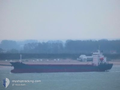
The vessel BALAT (IMO: 9383730, MMSI: 374761000) is a General Cargo that was built in 2006 ( 18 years old ). It's sailing under the flag of [PA] Panama.
In this page you can find informations about the vessels current position, last detected port calls, and current voyage information. If the vessels is not in coverage by AIS you will find the latest position.
The current position of BALAT is detected by our AIS receivers and we are not responsible for the reliability of the data. The last position was recorded while the vessel was in Coverage by the Ais receivers of our vessel tracking app.
The current draught of BALAT as reported by AIS is 5 meters
Weather
| Temperature | 23°C / 73.4°F |
|---|---|
| Wind Speed | 10 knots |
| Direction | 19° NNE |
| Pressure | 1009.9 hPa |
| Humidity | 73.7 % |
| Cloud Coverage | --- |
Featured Company
Last Port Calls
| Port | Arrival | Departure | Time In Port |
|---|---|---|---|
| 2024-06-03 09:14 | 2024-06-04 04:23 | 19 h | |
| 2024-05-21 13:21 | 2024-05-23 02:45 | 1 d | |
| 2024-05-07 16:29 | 2024-05-09 08:34 | 1 d | |
| 2024-04-24 15:24 | |||
| 2024-04-11 07:18 | 2024-04-12 16:01 | 1 d | |
| 2024-04-09 15:28 |
Most Visited Ports (Last year)
| Port | Arrivals | |
|---|---|---|
| 2 | ||
| 2 | ||
| 2 | ||
| 2 | ||
| 1 | ||
| 1 |
Last Trips
| Origin | Departure | Destination | Arrival | Distance | |
|---|---|---|---|---|---|
| 2024-05-23 03:45 | 2024-06-03 12:14 | 2370.52 nm | |||
| 2024-05-09 09:34 | 2024-05-21 14:21 | 502.04 nm | |||
| 2024-04-24 18:24 | 2024-05-07 17:29 | 2245.08 nm | |||
| 2024-04-09 18:28 | 2024-04-11 10:18 | 355.03 nm |
Events
| Time | Event | Details | Position / Dest | Info |
|---|---|---|---|---|
| 2024-06-15 16:35 | Change Sea Area | Greek part of the Aegean Sea Turkish part of the Aegean Sea |
39.86263 / 25.85280
Aegean Sea
TR NEM
|
Speed: 9.4 kn Course: 188.6° |
| 2024-06-15 16:32 | Status Changed | Under way using engine Default |
39.87000 / 25.85424
TR NEM
|
Speed: 9.5 kn Course: 193° |
| 2024-06-15 16:24 | Status Changed | Default Under way using engine |
39.89115 / 25.85908
TR NEM
|
Speed: 9.5 kn Course: 197° |
| 2024-06-15 15:56 | Status Changed | Under way using engine Default |
39.96027 / 25.88596
TR NEM
|
Speed: 10 kn Course: 237° |
| 2024-06-15 15:15 | Status Changed | Default Under way using engine |
40.00980 / 26.02008
TR NEM
|
Speed: 10.2 kn Course: 261.5° |
| 2024-06-15 14:59 | Status Changed | Under way using engine Default |
40.01589 / 26.07401
TR NEM
|
Speed: 10.9 kn Course: 262° |
| 2024-06-15 14:56 | Status Changed | Default Under way using engine |
40.01746 / 26.08828
TR NEM
|
Speed: 10.9 kn Course: 262.2° |
| 2024-06-15 14:34 | Change Sea Area | Turkish part of the Aegean Sea Turkish part of the Sea of Marmara |
40.02837 / 26.17317
Aegean Sea
TR NEM
|
Speed: 11.6 kn Course: 255.1° |
| 2024-06-15 12:02 | Status Changed | Under way using engine Default |
40.36274 / 26.64846
TR NEM
|
Speed: 11.5 kn Course: 231° |
| 2024-06-15 12:02 | IN Coverage |
40.35716 / 26.64402
Sea of Marmara
TR NEM
|
Speed: 11.8 kn Course: 211.3° |