
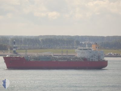
BALEARIC GAS
Tanker D
Current Trip
KR USN OPL
| Time Travelled | 7 days |
|---|---|
| Remaining Time | --- |
| Distance Travelled | 490.05 nm |
| Remaining Distance | --- |
| AVG Speed | 7.7 Knots |
| MAX Speed | 14.2 Knots |
| AVG Wind | 10 knots |
| MAX Wind | 34.3 knots |
| MIN Temp | 20.1°C / 68.18°F |
| MAX Temp | 24.1°C / 75.38°F |
| Draught | 6.9 m |
| Position Received | 1 d ago |
Current Position
| Longitude | 129.70643° |
|---|---|
| Latitude | 35.39202° |
| Status | Under way using engine |
| Speed | 1.1 Knots |
| Course | 267° |
| Area | Japan Sea |
| Station | T-AIS |
| Position Received | 1 d ago |
Info
Information
The current position of BALEARIC GAS is in Japan Sea with coordinates 35.39202° / 129.70643° as reported on 2024-06-27 07:37 by AIS to our vessel tracker app. The vessel's current speed is 1.1 Knots
The vessel BALEARIC GAS (IMO: 9682253, MMSI: 219674000) is a Tanker D It's sailing under the flag of [DK] Denmark.
In this page you can find informations about the vessels current position, last detected port calls, and current voyage information. If the vessels is not in coverage by AIS you will find the latest position.
The current position of BALEARIC GAS is detected by our AIS receivers and we are not responsible for the reliability of the data. The last position was recorded while the vessel was in Coverage by the Ais receivers of our vessel tracking app.
The current draught of BALEARIC GAS as reported by AIS is 6.9 meters
Weather
| Temperature | 22.6°C / 72.68°F |
|---|---|
| Wind Speed | 17 knots |
| Direction | 217° SW |
| Pressure | 1008.8 hPa |
| Humidity | 95 % |
| Cloud Coverage | 100 % |
Featured Company
Last Port Calls
| Port | Arrival | Departure | Time In Port |
|---|---|---|---|
| 2024-06-21 00:35 | 2024-06-21 23:43 | 23 h | |
| 2024-06-18 09:57 | 2024-06-20 00:13 | 1 d | |
| 2024-06-14 12:17 | 2024-06-15 07:31 | 19 h | |
| 2024-06-12 10:33 | 2024-06-14 09:13 | 1 d | |
| 2024-04-26 07:19 | 2024-05-01 22:43 | 5 d | |
| 2024-04-20 22:09 | 2024-04-24 11:06 | 3 d |
Most Visited Ports (Last year)
| Port | Arrivals | |
|---|---|---|
| 5 | ||
| 2 | ||
| 2 | ||
| 1 | ||
| 1 | ||
| 1 |
Last Trips
| Origin | Departure | Destination | Arrival | Distance | |
|---|---|---|---|---|---|
| 2024-06-20 09:13 | 2024-06-21 09:35 | 90.70 nm | |||
| 2024-06-15 15:31 | 2024-06-18 18:57 | 1046.96 nm | |||
| 2024-06-14 17:13 | 2024-06-14 20:17 | 33.92 nm | |||
| 2024-05-02 00:43 | 2024-06-12 18:33 | 13713.19 nm | |||
| 2024-04-24 13:06 | 2024-04-26 09:19 | 93.62 nm | |||
| 2024-02-06 07:00 | 2024-04-21 00:09 | 6679.57 nm |
Events
| Time | Event | Details | Position / Dest | Info |
|---|---|---|---|---|
| 2024-06-27 18:38 | START Moving | 13.7 nm, East of ULSAN |
35.50160 / 129.67270
KR USN OPL
|
Speed: 4.7 kn Course: 132° |
| 2024-06-27 09:26 | STOP Moving | 16 nm, East of ULSAN |
35.41695 / 129.71164
KR USN OPL
|
Speed: 0.3 kn Course: 280° |
| 2024-06-27 07:37 | Status Changed | Default Under way using engine |
35.39223 / 129.70647
KR USN OPL
|
Speed: 1.1 kn Course: 267° |
| 2024-06-27 07:37 | OUT of Coverage |
35.39202 / 129.70643
Japan Sea
|
Speed: 1.1 kn Course: 7.2° |
|
| 2024-06-27 07:36 | Status Changed | Under way using engine Default |
35.39193 / 129.70641
KR USN OPL
|
Speed: 0.9 kn Course: 275° |
| 2024-06-27 07:30 | Status Changed | Default Under way using engine |
35.39000 / 129.70605
KR USN OPL
|
Speed: 0.8 kn Course: 275° |
| 2024-06-27 07:25 | Status Changed | Under way using engine Default |
35.38865 / 129.70577
KR USN OPL
|
Speed: 0.8 kn Course: 281° |
| 2024-06-27 07:20 | Status Changed | Default Under way using engine |
35.38730 / 129.70544
KR USN OPL
|
Speed: 1 kn Course: 281° |
| 2024-06-27 07:05 | Status Changed | Under way using engine Default |
35.38290 / 129.70437
KR USN OPL
|
Speed: 1.1 kn Course: 273° |
| 2024-06-27 06:53 | Status Changed | Default Under way using engine |
35.37922 / 129.70363
KR USN OPL
|
Speed: 1.2 kn Course: 273° |