
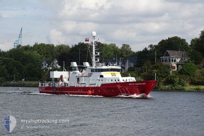
BALTIC SURVEYOR
Research/Survey Vessel
Current Trip
SURVEY TOW 0.5 NM
| Time Travelled | 31 days |
|---|---|
| Remaining Time | --- |
| Distance Travelled | 2275.38 nm |
| Remaining Distance | --- |
| AVG Speed | 4.8 Knots |
| MAX Speed | 10.2 Knots |
| AVG Wind | 10.3 knots |
| MAX Wind | 22.9 knots |
| MIN Temp | 8.6°C / 47.48°F |
| MAX Temp | 16.5°C / 61.7°F |
| Draught | 2.3 m |
| Position Received | Now |
Current Position
| Longitude | 1.65904° |
|---|---|
| Latitude | 51.67844° |
| Status | Restricted manoeuverability |
| Speed | 4.4 Knots |
| Course | 341° |
| Area | North Sea |
| Station | T-AIS |
| Position Received | Now |
Info
Information
The current position of BALTIC SURVEYOR is in North Sea with coordinates 51.67844° / 1.65904° as reported on 2024-06-08 22:56 by AIS to our vessel tracker app. The vessel's current speed is 4.4 Knots
The vessel BALTIC SURVEYOR (IMO: 8747109, MMSI: 261002065) is a Research/Survey Vessel that was built in 1983 ( 41 years old ). It's sailing under the flag of [PL] Poland.
In this page you can find informations about the vessels current position, last detected port calls, and current voyage information. If the vessels is not in coverage by AIS you will find the latest position.
The current position of BALTIC SURVEYOR is detected by our AIS receivers and we are not responsible for the reliability of the data. The last position was recorded while the vessel was in Coverage by the Ais receivers of our vessel tracking app.
The current draught of BALTIC SURVEYOR as reported by AIS is 2.3 meters
Weather
| Temperature | 13.7°C / 56.66°F |
|---|---|
| Wind Speed | 15 knots |
| Direction | 314° NW |
| Pressure | 1014.6 hPa |
| Humidity | 73 % |
| Cloud Coverage | 4 % |
Featured Company
Last Port Calls
| Port | Arrival | Departure | Time In Port |
|---|---|---|---|
| 2024-05-07 19:24 | 2024-05-08 17:24 | 22 h | |
| 2024-05-01 13:00 | 2024-05-04 09:40 | 2 d | |
| 2024-04-27 13:44 | 2024-04-30 07:11 | 2 d | |
| 2024-04-26 12:13 | 2024-04-26 17:15 | 5 h | |
| 2024-04-23 16:00 | 2024-04-25 10:19 | 1 d | |
| 2024-04-18 19:40 | 2024-04-22 06:29 | 3 d | |
| 2024-04-14 18:50 | 2024-04-17 12:12 | 2 d | |
| 2024-04-13 18:52 | 2024-04-14 07:08 | 12 h | |
| 2024-04-12 14:29 | 2024-04-13 06:53 | 16 h | |
| 2024-04-08 20:58 | 2024-04-12 07:49 | 3 d |
Most Visited Ports (Last year)
| Port | Arrivals | |
|---|---|---|
| 30 | ||
| 10 | ||
| 3 | ||
| 1 |
Last Trips
| Origin | Departure | Destination | Arrival | Distance | |
|---|---|---|---|---|---|
| 2024-05-04 10:40 | 2024-05-07 20:24 | 338.83 nm | |||
| 2024-04-30 08:11 | 2024-05-01 14:00 | 131.24 nm | |||
| 2024-04-26 18:15 | 2024-04-27 14:44 | 90.12 nm | |||
| 2024-04-25 11:19 | 2024-04-26 13:13 | 135.69 nm | |||
| 2024-04-22 07:29 | 2024-04-23 17:00 | 132.98 nm | |||
| 2024-04-17 13:12 | 2024-04-18 20:40 | 138.88 nm | |||
| 2024-04-14 08:08 | 2024-04-14 19:50 | 54.12 nm | |||
| 2024-04-13 07:53 | 2024-04-13 19:52 | 51.08 nm | |||
| 2024-04-12 08:49 | 2024-04-12 15:29 | 50.74 nm | |||
| 2024-04-07 17:13 | 2024-04-08 21:58 | 294.09 nm |
Events
| Time | Event | Details | Position / Dest | Info |
|---|---|---|---|---|
| 2024-06-08 22:55 | START Moving | 17.53 nm, South East of F HALLS COMPANY BOAT |
51.67698 / 1.66059
SURVEY TOW 0.5 NM
|
Speed: 3.1 kn Course: 348° |
| 2024-06-08 22:28 | STOP Moving | 17.41 nm, South East of F HALLS COMPANY BOAT |
51.68511 / 1.66584
SURVEY TOW 0.5 NM
|
Speed: 0.3 kn Course: 7° |
| 2024-06-08 21:46 | START Moving | 16.75 nm, South East of F HALLS COMPANY BOAT |
51.68373 / 1.64262
SURVEY TOW 0.5 NM
|
Speed: 4 kn Course: 44° |
| 2024-06-08 21:44 | STOP Moving | 16.7 nm, South East of F HALLS COMPANY BOAT |
51.68284 / 1.63999
SURVEY TOW 0.5 NM
|
Speed: 0.3 kn Course: 44° |
| 2024-06-08 17:40 | START Moving | 9.81 nm, East of F HALLS COMPANY BOAT |
51.79367 / 1.52597
SURVEY TOW 0.5 NM
|
Speed: 3.3 kn Course: 281° |
| 2024-06-08 17:38 | Status Changed | Restricted manoeuverability Under way using engine |
51.79345 / 1.52593
SURVEY TOW 0.5 NM
|
Speed: 1.5 kn Course: 214° |
| 2024-06-08 17:27 | STOP Moving | 9.65 nm, East of F HALLS COMPANY BOAT |
51.79263 / 1.52097
SURVEY TOW 0.5 NM
|
Speed: 0.3 kn Course: 229° |
| 2024-06-08 14:52 | Status Changed | Under way using engine Default |
51.73748 / 1.86409
SURVEY TOW 0.5 NM
|
Speed: 7.3 kn Course: 294° |
| 2024-06-08 14:42 | Status Changed | Default Under way using engine |
51.72930 / 1.89414
SURVEY TOW 0.5 NM
|
Speed: 7.6 kn Course: 295.6° |
| 2024-06-08 14:41 | Status Changed | Under way using engine Default |
51.72866 / 1.89632
SURVEY TOW 0.5 NM
|
Speed: 6.7 kn Course: 275° |