
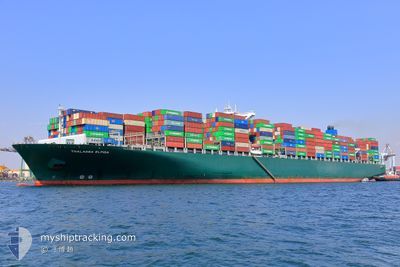
BALTIMORE EXPRESS
Container Ship
Current Trip
SGSIN-LKCMB
| Time Travelled | 3 days |
|---|---|
| Remaining Time | --- |
| Distance Travelled | 1557.50 nm |
| Remaining Distance | --- |
| AVG Speed | 18.3 Knots |
| MAX Speed | 20.4 Knots |
| AVG Wind | 10.2 knots |
| MAX Wind | 20.3 knots |
| MIN Temp | 26.7°C / 80.06°F |
| MAX Temp | 30.3°C / 86.54°F |
| Draught | 15 m |
| Position Received | 11 d ago |
Current Position
| Longitude | 103.46024° |
|---|---|
| Latitude | 1.20897° |
| Status | Under way using engine |
| Speed | 16.7 Knots |
| Course | 280.4° |
| Area | Singapore Strait |
| Station | T-AIS |
| Position Received | 11 d ago |
Info
Information
The current position of BALTIMORE EXPRESS is in Singapore Strait with coordinates 1.20897° / 103.46024° as reported on 2024-05-05 04:48 by AIS to our vessel tracker app. The vessel's current speed is 16.7 Knots
The vessel BALTIMORE EXPRESS (IMO: 9665621, MMSI: 636021036) is a Container Ship that was built in 2014 ( 10 years old ). It's sailing under the flag of [LR] Liberia.
In this page you can find informations about the vessels current position, last detected port calls, and current voyage information. If the vessels is not in coverage by AIS you will find the latest position.
The current position of BALTIMORE EXPRESS is detected by our AIS receivers and we are not responsible for the reliability of the data. The last position was recorded while the vessel was in Coverage by the Ais receivers of our vessel tracking app.
The current draught of BALTIMORE EXPRESS as reported by AIS is 15 meters
Weather
| Temperature | 28°C / 82.4°F |
|---|---|
| Wind Speed | 11 knots |
| Direction | 92° E |
| Pressure | 1011.7 hPa |
| Humidity | 77.3 % |
| Cloud Coverage | 22 % |
Featured Company
Last Port Calls
| Port | Arrival | Departure | Time In Port |
|---|---|---|---|
| 2024-05-12 03:08 | 2024-05-13 08:00 | 1 d | |
| 2024-05-03 21:26 | 2024-05-05 02:44 | 1 d | |
| 2024-04-29 02:06 | 2024-04-30 02:05 | 23 h | |
| 2024-04-25 10:32 | 2024-04-26 01:20 | 14 h | |
| 2024-04-24 02:20 | 2024-04-24 09:52 | 7 h | |
| 2024-04-22 06:28 | 2024-04-22 14:30 | 8 h | |
| 2024-03-03 19:03 | 2024-03-08 06:28 | 4 d |
Most Visited Ports (Last year)
| Port | Arrivals | |
|---|---|---|
| 5 | ||
| 4 | ||
| 4 | ||
| 4 | ||
| 4 | ||
| 4 |
Last Trips
| Origin | Departure | Destination | Arrival | Distance | |
|---|---|---|---|---|---|
| 2024-05-05 10:44 | 2024-05-12 08:38 | 1631.85 nm | |||
| 2024-04-30 09:05 | 2024-05-04 05:26 | 651.16 nm | |||
| 2024-04-26 09:20 | 2024-04-29 09:06 | 995.46 nm | |||
| 2024-04-24 17:52 | 2024-04-25 18:32 | 140.09 nm | |||
| 2024-04-22 22:30 | 2024-04-24 10:20 | 467.31 nm | |||
| 2024-03-08 14:28 | 2024-04-22 14:28 | 732.34 nm | |||
| 2024-02-13 18:53 | 2024-03-04 03:03 | 7729.85 nm |
Events
| Time | Event | Details | Position / Dest | Info |
|---|---|---|---|---|
| 2024-05-13 08:00 | PORT DEPARTURE |
|
6.97154 / 79.83416
SGSIN-LKCMB
|
Speed: 6.2 kn Course: 9° |
| 2024-05-13 07:52 | START Moving |
6.95697 / 79.83350
[LK] COLOMBO
|
Speed: 4.2 kn Course: 15° |
|
| 2024-05-12 03:56 | STOP Moving |
6.94684 / 79.82909
[LK] COLOMBO
|
Speed: 0.2 kn Course: 259° |
|
| 2024-05-12 03:08 | PORT ARRIVAL |
|
6.96456 / 79.83449
[LK] COLOMBO
|
Speed: 6.4 kn Course: 169° |
| 2024-05-12 00:29 | START Moving | 14.99 nm, North West of COLOMBO |
7.08825 / 79.62305
SGSIN-LKCMB
|
Speed: 3.1 kn Course: 107° |
| 2024-05-11 14:16 | STOP Moving | 15.32 nm, West of COLOMBO |
7.02373 / 79.58925
SGSIN-LKCMB
|
Speed: 0.1 kn Course: 221° |
| 2024-05-11 12:44 | START Moving | 13.46 nm, North West of COLOMBO |
7.04389 / 79.62904
SGSIN-LKCMB
|
Speed: 3.4 kn Course: 146° |
| 2024-05-11 01:13 | STOP Moving | 17.28 nm, West of COLOMBO |
6.99119 / 79.54944
SGSIN-LKCMB
|
Speed: 0.3 kn Course: 109° |
| 2024-05-10 23:40 | START Moving | 19.88 nm, West of COLOMBO |
7.01228 / 79.50851
SGSIN-LKCMB
|
Speed: 3.1 kn Course: 114° |
| 2024-05-10 20:17 | STOP Moving | 19.65 nm, West of COLOMBO |
7.00424 / 79.51105
SGSIN-LKCMB
|
Speed: 0.3 kn Course: 192° |