
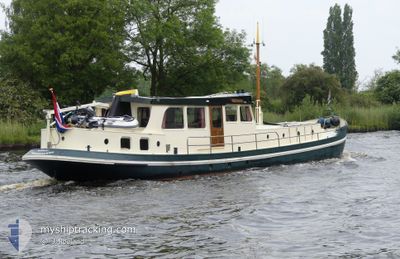
BANJAARD
Pleasure Craft
Current Trip
,ROERMOND
| Trip Time | 4 h, 42 mins |
|---|---|
| Trip Distance | 42.24 nm |
| AVG Speed | 8.6 Knots |
| MAX Speed | 10.3 Knots |
| Draught | 1.4 m |
| AVG Wind | 13.1 knots |
| MAX Wind | 15.9 knots |
| MIN Temp | 15.8°C / 60.44°F |
| MAX Temp | 17.2°C / 62.96°F |
| Position Received | 9 m ago |
Current Position
| Longitude | 4.25156° |
|---|---|
| Latitude | 51.92281° |
| Status | Moored |
| Speed | |
| Course | --- |
| Area | North Sea |
| Station | T-AIS |
| Position Received | 9 m ago |
Info
Information
The current position of BANJAARD is in North Sea with coordinates 51.92281° / 4.25156° as reported on 2024-06-01 09:58 by AIS to our vessel tracker app. The vessel's current speed is 0 Knots and is currently inside the port of MAASSLUIS.
The vessel BANJAARD (MMSI: 244780254) is a Pleasure Craft It's sailing under the flag of [NL] Netherlands.
In this page you can find informations about the vessels current position, last detected port calls, and current voyage information. If the vessels is not in coverage by AIS you will find the latest position.
The current position of BANJAARD is detected by our AIS receivers and we are not responsible for the reliability of the data. The last position was recorded while the vessel was in Coverage by the Ais receivers of our vessel tracking app.
The current draught of BANJAARD as reported by AIS is 1.4 meters
Weather
| Temperature | 15.2°C / 59.36°F |
|---|---|
| Wind Speed | 14 knots |
| Direction | --- N |
| Pressure | 1018.5 hPa |
| Humidity | 83.2 % |
| Cloud Coverage | 100 % |
Featured Company
Last Port Calls
| Port | Arrival | Departure | Time In Port |
|---|---|---|---|
| 2024-05-29 14:11 | |||
| 2024-05-29 09:29 | |||
| 2024-05-24 16:17 | 2024-05-26 08:18 | 1 d | |
| 2024-05-11 12:03 | 2024-05-11 12:36 | 32 m | |
| 2024-05-09 14:15 | 2024-05-11 09:35 | 1 d | |
| 2024-05-08 16:57 | 2024-05-09 08:52 | 15 h | |
| 2024-05-08 11:37 |
Most Visited Ports (Last year)
| Port | Arrivals | |
|---|---|---|
| 8 | ||
| 6 | ||
| 3 | ||
| 2 | ||
| 2 | ||
| 2 |
Last Trips
| Origin | Departure | Destination | Arrival | Distance | |
|---|---|---|---|---|---|
| 2024-05-29 11:29 | 2024-05-29 16:11 | 42.24 nm | |||
| 2024-05-11 14:36 | 2024-05-24 18:17 | 317.30 nm | |||
| 2024-05-11 11:35 | 2024-05-11 14:03 | 5.65 nm | |||
| 2024-05-09 10:52 | 2024-05-09 16:15 | 14.59 nm | |||
| 2024-05-08 13:37 | 2024-05-08 18:57 | 33.05 nm |
Events
| Time | Event | Details | Position / Dest | Info |
|---|---|---|---|---|
| 2024-05-30 10:39 | Destination Changed | ,ROERMOND MAASSLUIS |
51.92279 / 4.25154
[NL] MAASSLUIS
|
Speed: Course: 511° |
| 2024-05-29 14:31 | STOP Moving |
51.92303 / 4.25080
[NL] MAASSLUIS
|
Speed: 0.1 kn Course: 511° |
|
| 2024-05-29 14:11 | PORT ARRIVAL |
|
51.91400 / 4.24848
[NL] MAASSLUIS
|
Speed: 9.2 kn Course: 302° |
| 2024-05-29 09:30 | IN Coverage |
51.81619 / 5.24017
North Sea
|
Speed: 9.9 kn Course: 263.6° |
|
| 2024-05-29 09:29 | PORT DEPARTURE |
|
51.81619 / 5.24017
MAASSLUIS
|
Speed: Course: 511° |
| 2024-05-29 05:03 | OUT of Coverage |
51.81368 / 5.24476
North Sea
[NL] ZALTBOMMEL
|
Speed: Course: 511° |
|
| 2024-05-29 05:03 | IN Coverage |
51.81368 / 5.24476
North Sea
[NL] ZALTBOMMEL
|
Speed: Course: 511° |
|
| 2024-05-29 03:02 | OUT of Coverage |
51.81372 / 5.24471
North Sea
[NL] ZALTBOMMEL
|
Speed: Course: 511° |
|
| 2024-05-29 00:08 | IN Coverage |
51.81370 / 5.24476
North Sea
[NL] ZALTBOMMEL
|
Speed: Course: 511° |
|
| 2024-05-28 11:01 | OUT of Coverage |
51.80454 / 5.35451
North Sea
|
Speed: 10.5 kn Course: 259.4° |