
BAR :
Cargo
Current Trip
| Time Travelled | 9 days |
|---|---|
| Remaining Time | --- |
| Distance Travelled | 2335.39 nm |
| Remaining Distance | --- |
| AVG Speed | 10.2 Knots |
| MAX Speed | 14.1 Knots |
| AVG Wind | 12.2 knots |
| MAX Wind | 20 knots |
| MIN Temp | 11°C / 51.8°F |
| MAX Temp | 25.8°C / 78.44°F |
| Draught | 8.3 m |
| Position Received | 4 m ago |
Current Position
| Longitude | 17.18021° |
|---|---|
| Latitude | 36.50264° |
| Status | Under way using engine |
| Speed | 11.9 Knots |
| Course | 86.2° |
| Area | Mediterranean Sea - Eastern Basin |
| Station | T-AIS |
| Position Received | 4 m ago |
Info
Information
The current position of BAR : is in Mediterranean Sea - Eastern Basin with coordinates 36.50264° / 17.18021° as reported on 2024-06-25 06:09 by AIS to our vessel tracker app. The vessel's current speed is 11.9 Knots and is heading at the port of DILISKELESI. The estimated time of arrival as calculated by vessel tracking app is 2024-06-28 09:00 LT
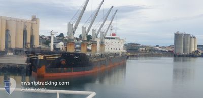
The vessel BAR : (IMO: 9693496, MMSI: 262007000) is a Cargo It's sailing under the flag of [ME] Montenegro.
In this page you can find informations about the vessels current position, last detected port calls, and current voyage information. If the vessels is not in coverage by AIS you will find the latest position.
The current position of BAR : is detected by our AIS receivers and we are not responsible for the reliability of the data. The last position was recorded while the vessel was in Coverage by the Ais receivers of our vessel tracking app.
The current draught of BAR : as reported by AIS is 8.3 meters
Weather
| Temperature | 25.7°C / 78.26°F |
|---|---|
| Wind Speed | 12 knots |
| Direction | 109° ESE |
| Pressure | 1011.7 hPa |
| Humidity | 74.6 % |
| Cloud Coverage | 70 % |
Featured Company
Most Visited Ports (Last year)
| Port | Arrivals | |
|---|---|---|
| 2 | ||
| 1 | ||
| 1 | ||
| 1 | ||
| 1 | ||
| 1 |
Events
| Time | Event | Details | Position / Dest | Info |
|---|---|---|---|---|
| 2024-06-25 05:55 | Status Changed | Under way using engine Default |
36.49965 / 17.12078
DILISKELESI
|
Speed: 11.7 kn Course: 92° |
| 2024-06-25 05:55 | IN Coverage |
36.49965 / 17.12078
Mediterranean Sea - Eastern Basin
DILISKELESI
|
Speed: 11.6 kn Course: 87.4° |
|
| 2024-06-25 01:41 | Status Changed | Default Under way using engine |
36.52575 / 16.10520
DILISKELESI
|
Speed: 11.2 kn Course: 91.4° |
| 2024-06-25 01:39 | OUT of Coverage |
36.52591 / 16.09670
Mediterranean Sea - Eastern Basin
DILISKELESI
|
Speed: 11.2 kn Course: 91.4° |
|
| 2024-06-25 00:57 | Status Changed | Under way using engine Default |
36.53010 / 15.93742
DILISKELESI
|
Speed: 10.4 kn Course: 92° |
| 2024-06-25 00:45 | Status Changed | Default Under way using engine |
36.53048 / 15.89371
DILISKELESI
|
Speed: 10.2 kn Course: 89.6° |
| 2024-06-25 00:05 | Status Changed | Under way using engine Default |
36.52645 / 15.74746
DILISKELESI
|
Speed: 11 kn Course: 85° |
| 2024-06-25 00:01 | Status Changed | Default Under way using engine |
36.52542 / 15.73296
DILISKELESI
|
Speed: 11.1 kn Course: 85.1° |
| 2024-06-24 23:56 | Status Changed | Under way using engine Default |
36.52409 / 15.71375
DILISKELESI
|
Speed: 11.1 kn Course: 86° |
| 2024-06-24 23:53 | Status Changed | Default Under way using engine |
36.52336 / 15.70212
DILISKELESI
|
Speed: 11.1 kn Course: 85.8° |