
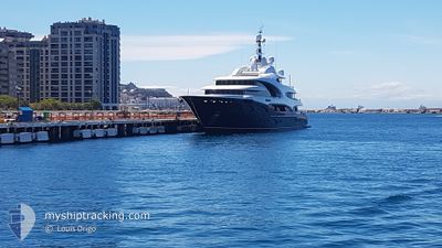
BARBARA
Pleasure Craft
Current Trip
| Time Travelled | 1 day |
|---|---|
| Remaining Time | 17 h, 18 mins |
| Distance Travelled | 724.91 nm |
| Remaining Distance | 288.74 nm |
| AVG Speed | 16.1 Knots |
| MAX Speed | 19.1 Knots |
| AVG Wind | 6.8 knots |
| MAX Wind | 20.1 knots |
| MIN Temp | 17.4°C / 63.32°F |
| MAX Temp | 22.5°C / 72.5°F |
| Draught | 4 m |
| Position Received | 1 h, 14 m ago |
Current Position
| Longitude | 19.88462° |
|---|---|
| Latitude | 36.94868° |
| Status | Under way using engine |
| Speed | 15.6 Knots |
| Course | 106.3° |
| Area | Ionian Sea |
| Station | T-AIS |
| Position Received | 1 h, 14 m ago |
Info
Information
The current position of BARBARA is in Ionian Sea with coordinates 36.94868° / 19.88462° as reported on 2024-06-06 11:02 by AIS to our vessel tracker app. The vessel's current speed is 15.6 Knots and is heading at the port of MYKONOS. The estimated time of arrival as calculated by vessel tracking app is 2024-06-07 05:35 LT
The vessel BARBARA (IMO: 1012725, MMSI: 319104200) is a Pleasure Craft It's sailing under the flag of [KY] Cayman Is.
In this page you can find informations about the vessels current position, last detected port calls, and current voyage information. If the vessels is not in coverage by AIS you will find the latest position.
The current position of BARBARA is detected by our AIS receivers and we are not responsible for the reliability of the data. The last position was recorded while the vessel was in Coverage by the Ais receivers of our vessel tracking app.
The current draught of BARBARA as reported by AIS is 4 meters
Weather
| Temperature | 22.5°C / 72.5°F |
|---|---|
| Wind Speed | 16 knots |
| Direction | 350° N |
| Pressure | 1013 hPa |
| Humidity | 85.4 % |
| Cloud Coverage | --- |
Featured Company
Last Port Calls
| Port | Arrival | Departure | Time In Port |
|---|---|---|---|
| 2024-05-17 06:23 | 2024-06-04 12:48 | 18 d | |
| 2024-05-14 06:18 | 2024-05-14 14:22 | 8 h | |
| 2024-04-30 15:33 | |||
| 2024-04-23 16:01 | 2024-04-25 14:35 | 1 d | |
| 2024-04-12 15:59 | 2024-04-12 16:26 | 26 m |
Last Trips
| Origin | Departure | Destination | Arrival | Distance | |
|---|---|---|---|---|---|
| 2024-05-14 16:22 | 2024-05-17 08:23 | 863.66 nm | |||
| 2024-04-25 10:35 | 2024-04-30 11:33 | 696.29 nm | |||
| 2024-04-12 12:26 | 2024-04-23 12:01 | 964.37 nm | |||
| 2024-03-29 23:30 | 2024-04-12 11:59 | 351.11 nm |
Events
| Time | Event | Details | Position / Dest | Info |
|---|---|---|---|---|
| 2024-06-06 11:02 | OUT of Coverage |
36.94868 / 19.88462
Ionian Sea
MYKONOS GR
|
Speed: 15.6 kn Course: 106.3° |
|
| 2024-06-06 08:55 | IN Coverage |
37.09953 / 19.22922
Ionian Sea
MYKONOS GR
|
Speed: 15.1 kn Course: 105.2° |
|
| 2024-06-06 07:26 | OUT of Coverage |
37.20463 / 18.77212
Ionian Sea
MYKONOS GR
|
Speed: 15.6 kn Course: 107.1° |
|
| 2024-06-06 07:20 | Detected in Sea | Greek part of the Ionian Sea |
37.21153 / 18.74233
Ionian Sea
MYKONOS GR
|
Speed: 15.3 kn Course: 106.2° |
| 2024-06-06 07:19 | IN Coverage |
37.21153 / 18.74233
Ionian Sea
MYKONOS GR
|
Speed: 15.3 kn Course: 106.2° |
|
| 2024-06-06 05:20 | OUT of Coverage |
37.35143 / 18.13212
Ionian Sea
MYKONOS GR
|
Speed: 15.7 kn Course: 106.9° |
|
| 2024-06-06 05:20 | IN Coverage |
37.35143 / 18.13212
Ionian Sea
MYKONOS GR
|
Speed: 15.7 kn Course: 106.9° |
|
| 2024-06-06 01:16 | OUT of Coverage |
37.64613 / 16.84392
Ionian Sea
MYKONOS GR
|
Speed: 15.5 kn Course: 104.1° |
|
| 2024-06-06 00:45 | IN Coverage |
37.68307 / 16.68232
Ionian Sea
MYKONOS GR
|
Speed: 15.4 kn Course: 106.5° |
|
| 2024-06-05 22:20 | OUT of Coverage |
37.85730 / 15.91725
Ionian Sea
MYKONOS GR
|
Speed: 15.8 kn Course: 105.8° |