
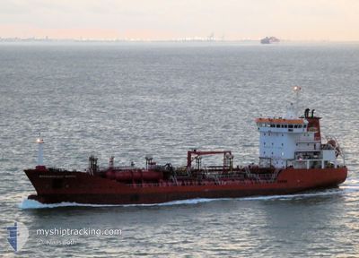
BARBAROS ULUC VARDAL
Oil/Chemical Tanker
Current Trip
IT NAP
| Time Travelled | 1 day |
|---|---|
| Remaining Time | --- |
| Distance Travelled | 503.66 nm |
| Remaining Distance | --- |
| AVG Speed | 12.2 Knots |
| MAX Speed | 13.2 Knots |
| AVG Wind | 8 knots |
| MAX Wind | 17.3 knots |
| MIN Temp | 17.7°C / 63.86°F |
| MAX Temp | 22.5°C / 72.5°F |
| Draught | 5.9 m |
| Position Received | Now |
Current Position
| Longitude | 14.27664° |
|---|---|
| Latitude | 40.76083° |
| Status | Under way using engine |
| Speed | 10.5 Knots |
| Course | 43° |
| Area | Tyrrhenian Sea |
| Station | T-AIS |
| Position Received | Now |
Info
Information
The current position of BARBAROS ULUC VARDAL is in Tyrrhenian Sea with coordinates 40.76083° / 14.27664° as reported on 2024-06-03 08:53 by AIS to our vessel tracker app. The vessel's current speed is 10.5 Knots
The vessel BARBAROS ULUC VARDAL (IMO: 9291602, MMSI: 352001852) is a Oil/Chemical Tanker that was built in 2004 ( 20 years old ). It's sailing under the flag of [PA] Panama.
In this page you can find informations about the vessels current position, last detected port calls, and current voyage information. If the vessels is not in coverage by AIS you will find the latest position.
The current position of BARBAROS ULUC VARDAL is detected by our AIS receivers and we are not responsible for the reliability of the data. The last position was recorded while the vessel was in Coverage by the Ais receivers of our vessel tracking app.
The current draught of BARBAROS ULUC VARDAL as reported by AIS is 5.9 meters
Weather
| Temperature | 20.2°C / 68.36°F |
|---|---|
| Wind Speed | 6 knots |
| Direction | 251° WSW |
| Pressure | 1014.8 hPa |
| Humidity | 73.2 % |
| Cloud Coverage | --- |
Featured Company
Last Port Calls
| Port | Arrival | Departure | Time In Port |
|---|---|---|---|
| 2024-06-01 00:02 | 2024-06-01 16:14 | 16 h | |
| 2024-05-26 18:27 | 2024-05-28 18:00 | 1 d | |
| 2024-05-15 08:09 | 2024-05-16 16:36 | 1 d | |
| 2024-05-04 06:14 | 2024-05-06 17:14 | 2 d | |
| 2024-04-23 14:14 | 2024-04-25 04:05 | 1 d | |
| 2024-04-10 05:57 | |||
| 2024-04-01 03:23 |
Last Trips
| Origin | Departure | Destination | Arrival | Distance | |
|---|---|---|---|---|---|
| 2024-05-28 20:00 | 2024-06-01 02:02 | 877.05 nm | |||
| 2024-05-16 19:36 | 2024-05-26 20:27 | 2335.60 nm | |||
| 2024-05-06 19:14 | 2024-05-15 11:09 | 2052.04 nm | |||
| 2024-04-25 07:05 | 2024-05-04 08:14 | 2012.06 nm | |||
| 2024-04-10 08:57 | 2024-04-23 17:14 | 2468.81 nm |
Events
| Time | Event | Details | Position / Dest | Info |
|---|---|---|---|---|
| 2024-06-03 04:29 | Status Changed | Under way using engine Default |
40.73734 / 13.14148
IT NAP
|
Speed: 12 kn Course: 113° |
| 2024-06-03 04:29 | IN Coverage |
40.73629 / 13.15441
Tyrrhenian Sea
|
Speed: 12.6 kn Course: 96° |
|
| 2024-06-03 01:57 | Status Changed | Default Under way using engine |
40.94833 / 12.52500
IT NAP
|
Speed: 12.7 kn Course: 124° |
| 2024-06-03 01:45 | OUT of Coverage |
40.97246 / 12.47987
Tyrrhenian Sea
|
Speed: 12.7 kn Course: 124° |
|
| 2024-06-03 01:29 | Status Changed | Under way using engine Default |
41.00392 / 12.41786
IT NAP
|
Speed: 12 kn Course: 123° |
| 2024-06-03 01:29 | IN Coverage |
41.00362 / 12.41845
Tyrrhenian Sea
|
Speed: 12.8 kn Course: 124° |
|
| 2024-06-02 23:42 | Status Changed | Default Under way using engine |
41.20661 / 11.99166
IT NAP
|
Speed: 12.7 kn Course: 122° |
| 2024-06-02 23:34 | Status Changed | Under way using engine Default |
41.22100 / 11.96108
IT NAP
|
Speed: 12.7 kn Course: 122° |
| 2024-06-02 23:34 | OUT of Coverage |
41.22100 / 11.96108
Tyrrhenian Sea
|
Speed: 12.7 kn Course: 122° |
|
| 2024-06-02 23:27 | IN Coverage |
41.22100 / 11.96108
Tyrrhenian Sea
|
Speed: 12.7 kn Course: 122° |