
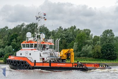
BARNEY
Tug
Current Trip
RIVER MEDWAY
| Time Travelled | 12 days |
|---|---|
| Remaining Time | --- |
| Distance Travelled | 38.10 nm |
| Remaining Distance | --- |
| AVG Speed | 6.7 Knots |
| MAX Speed | 10.5 Knots |
| AVG Wind | 11.3 knots |
| MAX Wind | 18.1 knots |
| MIN Temp | 9.8°C / 49.64°F |
| MAX Temp | 18.5°C / 65.3°F |
| Draught | 2.4 m |
| Position Received | Now |
Current Position
| Longitude | 0.62278° |
|---|---|
| Latitude | 51.41103° |
| Status | Restricted manoeuverability |
| Speed | |
| Course | 175° |
| Area | North Sea |
| Station | T-AIS |
| Position Received | Now |
Info
Information
The current position of BARNEY is in North Sea with coordinates 51.41103° / 0.62278° as reported on 2024-06-03 17:01 by AIS to our vessel tracker app. The vessel's current speed is 0 Knots
The vessel BARNEY (IMO: 9740938, MMSI: 244850156) is a Tug It's sailing under the flag of [NL] Netherlands.
In this page you can find informations about the vessels current position, last detected port calls, and current voyage information. If the vessels is not in coverage by AIS you will find the latest position.
The current position of BARNEY is detected by our AIS receivers and we are not responsible for the reliability of the data. The last position was recorded while the vessel was in Coverage by the Ais receivers of our vessel tracking app.
The current draught of BARNEY as reported by AIS is 2.4 meters
Weather
| Temperature | 18.3°C / 64.94°F |
|---|---|
| Wind Speed | 5 knots |
| Direction | 326° NW |
| Pressure | 1019 hPa |
| Humidity | 73.4 % |
| Cloud Coverage | 100 % |
Featured Company
Last Port Calls
| Port | Arrival | Departure | Time In Port |
|---|---|---|---|
| 2024-05-22 10:33 | 2024-05-22 10:40 | 7 m | |
| 2024-05-20 16:32 | 2024-05-21 08:59 | 16 h | |
| 2024-05-13 03:23 | 2024-05-14 15:13 | 1 d | |
| 2024-05-11 12:40 | 2024-05-12 14:08 | 1 d | |
| 2024-05-09 19:19 | 2024-05-10 12:54 | 17 h | |
| 2024-05-09 12:09 | 2024-05-09 12:56 | 46 m | |
| 2024-05-09 10:45 | 2024-05-09 10:49 | 4 m | |
| 2024-05-08 04:59 | 2024-05-08 10:36 | 5 h | |
| 2024-05-08 04:15 | 2024-05-08 04:47 | 31 m | |
| 2024-05-05 02:54 | 2024-05-07 15:24 | 2 d |
Most Visited Ports (Last year)
| Port | Arrivals | |
|---|---|---|
| 82 | ||
| 50 | ||
| 17 | ||
| 15 | ||
| 11 | ||
| 10 |
Last Trips
| Origin | Departure | Destination | Arrival | Distance | |
|---|---|---|---|---|---|
| 2024-05-21 09:59 | 2024-05-22 11:33 | 115.43 nm | |||
| 2024-05-14 16:13 | 2024-05-20 17:32 | 191.64 nm | |||
| 2024-05-12 15:08 | 2024-05-13 04:23 | 92.80 nm | |||
| 2024-05-10 14:54 | 2024-05-11 13:40 | 128.69 nm | |||
| 2024-05-09 14:56 | 2024-05-09 21:19 | 37.08 nm | |||
| 2024-05-09 12:49 | 2024-05-09 14:09 | 11.46 nm | |||
| 2024-05-08 12:36 | 2024-05-09 12:45 | 118.59 nm | |||
| 2024-05-08 06:47 | 2024-05-08 06:59 | 1.00 nm | |||
| 2024-05-07 17:24 | 2024-05-08 06:15 | 63.11 nm | |||
| 2024-05-04 10:17 | 2024-05-05 04:54 | 134.67 nm |
Events
| Time | Event | Details | Position / Dest | Info |
|---|---|---|---|---|
| 2024-06-02 15:13 | STOP Moving | 2.35 nm, East of HOO |
51.41161 / .62267
RIVER MEDWAY
|
Speed: 0.2 kn Course: 350° |
| 2024-06-02 15:09 | START Moving | 2.43 nm, East of HOO |
51.41113 / .62491
RIVER MEDWAY
|
Speed: 4.7 kn Course: 210° |
| 2024-06-02 13:17 | STOP Moving | 2.32 nm, East of HOO |
51.41092 / .62185
RIVER MEDWAY
|
Speed: 0.3 kn Course: 254° |
| 2024-06-02 13:11 | START Moving | 1.91 nm, East of HOO |
51.41107 / .61104
RIVER MEDWAY
|
Speed: 7.1 kn Course: 86.9° |
| 2024-06-02 12:58 | STOP Moving | 1.81 nm, East of HOO |
51.41161 / .60820
RIVER MEDWAY
|
Speed: 0.3 kn Course: 263° |
| 2024-06-02 12:53 | START Moving | 2.21 nm, East of HOO |
51.41083 / .61906
RIVER MEDWAY
|
Speed: 7.3 kn Course: 272.3° |
| 2024-06-02 12:32 | STOP Moving | 2.33 nm, East of HOO |
51.41094 / .62202
RIVER MEDWAY
|
Speed: 0.3 kn Course: 273° |
| 2024-06-02 12:27 | START Moving | 1.93 nm, East of HOO |
51.41095 / .61149
RIVER MEDWAY
|
Speed: 9.8 kn Course: 85.5° |
| 2024-06-02 12:12 | STOP Moving | 1.8 nm, East of HOO |
51.41168 / .60807
RIVER MEDWAY
|
Speed: 0.2 kn Course: 259° |
| 2024-06-02 12:08 | START Moving | 2.05 nm, East of HOO |
51.41199 / .61461
RIVER MEDWAY
|
Speed: 3.3 kn Course: 271° |