
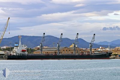
BARRA
Bulk Carrier
Current Trip
| Time Travelled | 11 days |
|---|---|
| Remaining Time | --- |
| Distance Travelled | 1280.71 nm |
| Remaining Distance | --- |
| AVG Speed | 8.4 Knots |
| MAX Speed | 8.4 Knots |
| AVG Wind | 8.6 knots |
| MAX Wind | 22.9 knots |
| MIN Temp | 11.4°C / 52.52°F |
| MAX Temp | 23.7°C / 74.66°F |
| Draught | 6.2 m |
| Position Received | 4 d ago |
Current Position
| Longitude | 29.55120° |
|---|---|
| Latitude | 41.32913° |
| Status | Under way using engine |
| Speed | 8.9 Knots |
| Course | 71° |
| Area | Black Sea |
| Station | T-AIS |
| Position Received | 4 d ago |
Info
Information
The current position of BARRA is in Black Sea with coordinates 41.32913° / 29.55120° as reported on 2024-05-24 19:35 by AIS to our vessel tracker app. The vessel's current speed is 8.9 Knots
The vessel BARRA (IMO: 9142992, MMSI: 620752000) is a Bulk Carrier that was built in 1998 ( 26 years old ). It's sailing under the flag of [KM] Comoros.
In this page you can find informations about the vessels current position, last detected port calls, and current voyage information. If the vessels is not in coverage by AIS you will find the latest position.
The current position of BARRA is detected by our AIS receivers and we are not responsible for the reliability of the data. The last position was recorded while the vessel was in Coverage by the Ais receivers of our vessel tracking app.
The current draught of BARRA as reported by AIS is 6.2 meters
Weather
| Temperature | 18.1°C / 64.58°F |
|---|---|
| Wind Speed | 11 knots |
| Direction | 157° SSE |
| Pressure | 1012.9 hPa |
| Humidity | 94.2 % |
| Cloud Coverage | 100 % |
Featured Company
Last Port Calls
| Port | Arrival | Departure | Time In Port |
|---|---|---|---|
| 2024-05-12 13:50 | 2024-05-17 22:56 | 5 d | |
| 2024-04-23 00:28 | 2024-04-23 14:28 | 13 h | |
| 2024-03-15 14:18 | 2024-03-21 05:32 | 5 d |
Most Visited Ports (Last year)
| Port | Arrivals | |
|---|---|---|
| 5 | ||
| 3 | ||
| 1 | ||
| 1 | ||
| 1 | ||
| 1 |
Last Trips
| Origin | Departure | Destination | Arrival | Distance | |
|---|---|---|---|---|---|
| 2024-04-23 16:28 | 2024-05-12 15:50 | 143.27 nm | |||
| 2024-03-21 07:32 | 2024-04-23 02:28 | 3222.45 nm | |||
| 2024-01-14 17:31 | 2024-03-15 16:18 | 2238.74 nm |
Events
| Time | Event | Details | Position / Dest | Info |
|---|---|---|---|---|
| 2024-05-24 19:40 | Status Changed | Default Under way using engine |
41.33167 / 29.56667
RU TUA
|
Speed: 8.9 kn Course: 71° |
| 2024-05-24 19:35 | Status Changed | Under way using engine Default |
41.32913 / 29.55120
RU TUA
|
Speed: 8.8 kn Course: 71° |
| 2024-05-24 19:35 | OUT of Coverage |
41.32913 / 29.55120
Black Sea
RU TUA
|
Speed: 8.9 kn Course: 71° |
|
| 2024-05-24 19:23 | Status Changed | Default Under way using engine |
41.31985 / 29.51297
RU TUA
|
Speed: 8.9 kn Course: 72° |
| 2024-05-24 17:52 | Change Sea Area | Turkish part of the Black Sea Turkish part of the Sea of Marmara |
41.23353 / 29.15048
Black Sea
RU TUA
|
Speed: 10.6 kn Course: 60° |
| 2024-05-24 17:48 | Destination Changed | RU TUA RU NVS |
41.22475 / 29.13720
RU TUA
|
Speed: 10.1 kn Course: 40° |
| 2024-05-24 13:05 | START Moving | 10.6 nm, West of YALOVA |
40.72480 / 29.05818
RU NVS
|
Speed: 3.2 kn Course: 80° |
| 2024-05-24 13:01 | Status Changed | Under way using engine Not under command |
40.72570 / 29.05555
RU NVS
|
Speed: 0.5 kn Course: 129° |
| 2024-05-24 09:02 | ETA Changed | 2024/05/26 13:00 2024/05/26 01:00 |
40.69633 / 28.97480
RU NVS
|
Speed: 1.1 kn Course: 124° |
| 2024-05-24 08:44 | ETA Changed | 2024/05/26 01:00 2024/05/24 08:00 |
40.69392 / 28.96780
RU NVS
|
Speed: 1.1 kn Course: 125° |