
BARRINGTON ISLAND
Reefer
Current Trip
MQFDF
| Time Travelled | 3 days |
|---|---|
| Remaining Time | --- |
| Distance Travelled | 1351.98 nm |
| Remaining Distance | --- |
| AVG Speed | 16.2 Knots |
| MAX Speed | 20 Knots |
| AVG Wind | 7.6 knots |
| MAX Wind | 21 knots |
| MIN Temp | 17.6°C / 63.68°F |
| MAX Temp | 30.2°C / 86.36°F |
| Draught | 7.5 m |
| Position Received | 1 d ago |
Current Position
| Longitude | -79.57939° |
|---|---|
| Latitude | 9.89116° |
| Status | Under way using engine |
| Speed | 17 Knots |
| Course | 28° |
| Area | Caribbean Sea |
| Station | T-AIS |
| Position Received | 1 d ago |
Info
Information
The current position of BARRINGTON ISLAND is in Caribbean Sea with coordinates 9.89116° / -79.57939° as reported on 2024-06-26 10:09 by AIS to our vessel tracker app. The vessel's current speed is 17 Knots
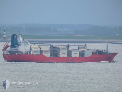
The vessel BARRINGTON ISLAND (IMO: 9059614, MMSI: 308701000) is a Reefer that was built in 1993 ( 31 years old ). It's sailing under the flag of [BS] Bahamas.
In this page you can find informations about the vessels current position, last detected port calls, and current voyage information. If the vessels is not in coverage by AIS you will find the latest position.
The current position of BARRINGTON ISLAND is detected by our AIS receivers and we are not responsible for the reliability of the data. The last position was recorded while the vessel was in Coverage by the Ais receivers of our vessel tracking app.
The current draught of BARRINGTON ISLAND as reported by AIS is 7.5 meters
Weather
| Temperature | 28.2°C / 82.76°F |
|---|---|
| Wind Speed | 21 knots |
| Direction | 106° ESE |
| Pressure | 1011.3 hPa |
| Humidity | 84.6 % |
| Cloud Coverage | 100 % |
Featured Company
Last Port Calls
| Port | Arrival | Departure | Time In Port |
|---|---|---|---|
| 2024-06-23 02:37 | 2024-06-23 14:41 | 12 h | |
| 2024-06-18 12:45 | 2024-06-21 08:46 | 2 d | |
| 2024-06-08 23:53 | 2024-06-09 23:55 | 1 d | |
| 2024-06-08 07:15 | |||
| 2024-06-04 09:21 | 2024-06-04 19:10 | 9 h | |
| 2024-06-03 09:35 | 2024-06-03 18:35 | 9 h | |
| 2024-05-24 09:09 | 2024-05-24 20:32 | 11 h | |
| 2024-05-20 23:31 | 2024-05-23 15:45 | 2 d | |
| 2024-05-20 05:21 | 2024-05-20 17:19 | 11 h | |
| 2024-05-05 02:52 | 2024-05-05 12:33 | 9 h |
Most Visited Ports (Last year)
| Port | Arrivals | |
|---|---|---|
| 8 | ||
| 7 | ||
| 7 | ||
| 7 | ||
| 7 | ||
| 7 |
Last Trips
| Origin | Departure | Destination | Arrival | Distance | |
|---|---|---|---|---|---|
| 2024-06-21 03:46 | 2024-06-22 21:37 | 329.02 nm | |||
| 2024-06-09 19:55 | 2024-06-18 07:45 | 2360.69 nm | |||
| 2024-06-08 04:15 | 2024-06-08 19:53 | 217.22 nm | |||
| 2024-06-03 14:35 | 2024-06-04 05:21 | 116.33 nm | |||
| 2024-05-24 22:32 | 2024-06-03 05:35 | 3669.93 nm | |||
| 2024-05-23 17:45 | 2024-05-24 11:09 | 256.04 nm | |||
| 2024-05-20 18:19 | 2024-05-21 01:31 | 97.62 nm | |||
| 2024-05-05 07:33 | 2024-05-20 06:21 | 5627.68 nm | |||
| 2024-05-03 01:01 | 2024-05-04 21:52 | 328.96 nm | |||
| 2024-04-22 04:46 | 2024-04-30 07:51 | 2336.03 nm |
Events
| Time | Event | Details | Position / Dest | Info |
|---|---|---|---|---|
| 2024-06-26 10:11 | Status Changed | Default Under way using engine |
9.90084 / -79.57410
MQFDF
|
Speed: 17 kn Course: 28° |
| 2024-06-26 10:09 | OUT of Coverage |
9.89116 / -79.57939
Caribbean Sea
|
Speed: 17 kn Course: 28° |
|
| 2024-06-26 07:59 | Change Sea Area | Panamanian part of the Caribbean Sea Panamanian part of the North Pacific Ocean |
9.37341 / -79.91822
Caribbean Sea
|
Speed: 8.5 kn Course: 2.5° |
| 2024-06-26 07:12 | Status Changed | Under way using engine Default |
9.28863 / -79.92079
MQFDF
|
Speed: 2 kn Course: 7° |
| 2024-06-26 07:12 | Status Changed | Default Under way using engine |
9.28820 / -79.92083
MQFDF
|
Speed: 3.1 kn Course: 7° |
| 2024-06-26 07:02 | START Moving | 3.97 nm, South of CRISTOBAL |
9.28090 / -79.92156
MQFDF
|
Speed: 3.4 kn Course: 5° |
| 2024-06-26 06:13 | Status Changed | Under way using engine Default |
9.27271 / -79.92284
MQFDF
|
Speed: 1.6 kn Course: 8° |
| 2024-06-26 06:12 | Status Changed | Default Under way using engine |
9.27185 / -79.92296
MQFDF
|
Speed: 1.6 kn Course: 8° |
| 2024-06-26 05:49 | STOP Moving | 4.64 nm, South of CRISTOBAL |
9.26980 / -79.92327
MQFDF
|
Speed: 0.1 kn Course: 8° |
| 2024-06-26 03:23 | Status Changed | Under way using engine Default |
9.05630 / -79.65719
MQFDF
|
Speed: 12.5 kn Course: 324° |